• Welcome to TalkWeather!
    We see you lurking around TalkWeather! Take the extra step and join us today to view attachments, see less ads and maybe even join the discussion.
    CLICK TO JOIN TALKWEATHER

Severe Weather Thread - 7/18 - 7/21/2026

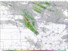
0Z HRRR is a bit nondescript for Monday. Develops a similar volatile environment over northeast IA as other models, but fires little convection within it through 0Z Tuesday in the wake of the MCS that moves through southern Wisconsin.
 
Yep.
0Z HRRR is a bit nondescript for Monday. Develops a similar volatile environment over northeast IA as other models, but fires little convection within it through 0Z Tuesday in the wake of the MCS that moves through southern Wisconsin.
Still interesting that it still manages to fire a 30 DBZ storm in there. But low level shear isn't exactly strong. Seems to me more like a day with conditional long lived supercells, with a low end tornado threat. But any supercell that could get going would be quite the all sorts of hazards. Can see why SPC went conservative but surely the parameter space warrants a mention at minimum. It's only the first run though so I'm nto gonna shut the door on the ceiling. This will be a complex day to sort out.
 
Yep.

Still interesting that it still manages to fire a 30 DBZ storm in there. But low level shear isn't exactly strong. Seems to me more like a day with conditional long lived supercells, with a low end tornado threat. But any supercell that could get going would be quite the all sorts of hazards. Can see why SPC went conservative but surely the parameter space warrants a mention at minimum. It's only the first run though so I'm nto gonna shut the door on the ceiling. This will be a complex day to sort out.

Kind of interesting to see them going with a wind-producing MCS as the primary threat when the 3K NAM, of all models, portrays a more discrete mode.
 
Likely to see a wind driven MCS now, as CAMs get in good range. 70-90 mph winds perhaps but not expecting a extremely organized bow echo of sorts. There will be a low end tornado threat though along with such.
 
Never mind. 12z HRRR says nope and has a supercell in Central WI in a volatile environment capable of all hazards. Storm mode gonna be uncertain for Monday. As for today, I'm eying central SD for a "mesoscale accident" that I mentioned in my surprise tornado environment thread. Large, rapid LI change leading to explosive vertical instability is known for such events.
 
Jewell mentioned Vorticity Generation Parameter in that discussion. Extremely interesting to see that incorporated into forecasts.
I'm not sure I'm there with the CIG1 yet. I know, i know, conservative but these events tend to be finicky. I just don't think low level shear is strong enough. Instability can compensate but it's more often shear compensates than instability. We will see.
 
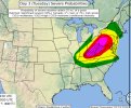
New day 2 adds a cig 1 from the northeast corner of IA to northeast WI:
View attachment 54194

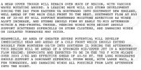
INITIAL STORMS SHOULD PRIMARILY BE SUPERCELLS GIVEN SUCH STRONG
SHEAR. A CORRIDOR OF TORNADO RISK IS EVIDENT EAST OF THE INSTABILITY
AXIS FROM IA ACROSS WI AND INTO UPPER MI, AND EFFECTIVE SRH MAY
EXCEED 300 M2/S2. SURFACE WINDS MAY VEER WITH TIME, BUT ANY
RIGHTWARD MOVEMENT OFF THE HODOGRAPH MAY LEAD TO A LARGE INCREASE OF
EFFECTIVE SRH FOR SOME OF THE LARGER SUPERCELLS.

A CONDITIONAL RISK OF A STRONG TORNADO ALSO EXISTS FROM FAR
NORTHEAST IA ACROSS MUCH OF WI. HERE, 0-3 KM SHEAR WILL BE STRONG,
WITH 50 KT WINDS AT 700 MB. SEVERAL MODELS INDICATE A VGP AT OR
ABOVE 0.4.
 
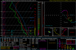
Yep. I'm on board now for a conditional strong tornado or two tomorrow in areas of E WI. 18z HRRR lets off with 3-4 supercells and the environment is pretty decent (300+ 0-1km SRH, 3K SBCAPE almost) questions are if SE moving storm mode can maintain itself long enough and not blob out
 
Back
Top