SmokeEater
Member
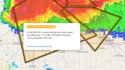
Meso out for Central IA also, tornado watch likely there, also 95%.
Follow along with the video below to see how to install our site as a web app on your home screen.
Note: This feature may not be available in some browsers.

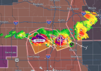
NAM NST thinks they'll be the main players, HRRR thinks they fall apart before new cells form to the NE at 00Z. Very different solutions from both models. NAM NST looks like the more intense scenario based purely on UD helicity swaths.I think the cells in Iowa are the drifters from MN. Doubt those will be the main players but they look quite strange on reflectivity.
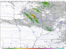
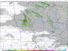
Interesting, I still think the main show will be in Wisconsin but yeah, these guys look healthy enough to be able to do stuff before that.NAM NST thinks they'll be the main players, HRRR thinks they fall apart before new cells form to the NE at 00Z. Very different solutions from both models. NAM NST looks like the more intense scenario based purely on UD helicity swaths.
View attachment 54219View attachment 54220
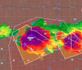
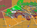

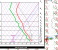
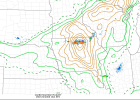
TBF they're extremely bizarre and windbaggy right now so they will have to change quite a bit before they'll be able to do anything.To summarize the current situation. Isolated supercell with 70k ft cloud top. An eroded cap. 60 kts eff sheer. 238 m2/s2 Eff SRH. An EHI of 9. And 6000 CAPE. Very very volatile situation unfolding here. Only thing that could (and hopefully does) hold it back is very meager low level sheer and 0-1km SRH.

They are increasingly beginning to cluster. Let's see but don't get too ahead of yourself here.To summarize the current situation. Isolated supercell with 70k ft cloud top. An eroded cap. 60 kts eff sheer. 238 m2/s2 Eff SRH. An EHI of 9. And 6000 CAPE. Very very volatile situation unfolding here. Only thing that could (and hopefully does) hold it back is very meager low level sheer and 0-1km SRH.