jiharris0220
Member
Supercells in central WI are a little more sustained now, but their updrafts are still very much anemic, they have another 4 hours at most to do something.
Follow along with the video below to see how to install our site as a web app on your home screen.
Note: This feature may not be available in some browsers.
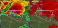
I mean, these storms are very much capable of producing.Not sure what is up with all these tornado warnings on these teensy a** storms that barely have a reflectivity signature let alone velocity. To be fair, central Wisconsin is a pretty terrible radar hole, but KGRB is hitting the storms southeast of Antigo and near Weston at about 4-6K' up (not ridiculous) and...yeah.
Edit: This is radar confirmed?! OK...
View attachment 54239

I mean, these storms are very much capable of producing.

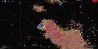

read that as "neopet" because I'm a child of the 90sDebris signature by Neopit, Wisconsin.
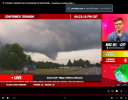

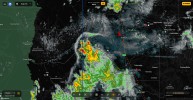
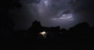


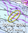
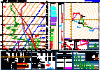
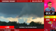
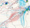
Also adding onto this: the fact that we got a few tornadoes out of the cells that did form in central Wisconsin, AND virtually every cell no matter how poor it looked on radar was rotating to boot even as they were dying, shows that if we had the air mass that was modeled that a significant outbreak of strong/intense tornadoes would have occurred.Yesterday did underperform. But there were signs that we dodged a bullet with supercells in Central Wisconsin given strong low level shear at play. I mentioned meteorologist Chris Jakub's research on the 300mb jet and how its orientation helps sniffs out storm mode and the real events. Yesterday, we had a very impressive 300mb jet diving into the region. This was expected to bring the potential for a couple supercells capable of a significant tornado of two. I had questions regarding low level stability which would verify due to different reasons like anvil shading from the Iowa MCS that all models had at 00z but dropped off on it. This is courtesy of Stephen Cross on X. This is the VOC nose at 300mb yesterday and this is when mini supercells have launched across Central Wisconsin, dropping photogenic tornadoes.
View attachment 54249
As the 300mb jet with 100+ kt began to approach the region, supercells took off however they were severely affected by 800-300mb dry air, evident by this observed sounding. Low level shear is absolutely significantly higher than models forecasted up here, 380 0-1km, easily supportive of intense tornadoes. View attachment 54250
Seeing that amount of dry air will make a storm cut its EL by many bits. As storms were not tall enough (meaning they had access to less instability, which would limit how this low level shear is being used), tornadoes were at times more weak but one or two mightve been strong yesterday. All in all, while yesterday underperformed, i think it's reasonable to say that the VOC works, but it's all dependant on how your thermodynamics work out and if your thermodynamics are good, you're set. Yesterday, there was too much dry air and that's a good thing. This could've been a nasty situation had we sustained multiple discrete supercells across Central WI. We got a sneak peek of what these storms could do with 25kft cloud tops minimum, and it got hectic for a bit.
Hope you enjoyed this breakdown, I will be using the VOC for more of these significant ceiling events. While I was conservative ans was right judging the parameter space, i failed to put emphasis on failure modes that really caught my eyes like low level stability and dry profiles. We appear to have a break after today (which should result in a isolated tornado threat in areas preciously in that 5 hatch in the Mid Atlantic
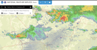
Tornado warningWatch for these two supercells, they’re in directional shear vectors but the thermos especially in the lowest 3km is very high. “IF” they can generate a sufficient amount of inflow, then it’ll be off to the races.
View attachment 54256