
Sawmaster
Member
WFAA Aerial footage of Runaway Bay damage on YouTube- HEADPHONE ALERT!!!!!
Follow along with the video below to see how to install our site as a web app on your home screen.
Note: This feature may not be available in some browsers.
Also the hailstorm on the south side looks nuclear. Actually very pretty on Scholl's stream.Meanwhile, tornado-warned bowing segment approaching Lyndon, KS. Seems like even the overnight (06Z) HRRR run did not pick up on this convection being that strong, although it did show messy convection around that area at this time. Wasn't until the later runs that started showing UH swaths with this convection.
I'm not up to date with what's the threat here in NTX. Could someone explain which possibillities theee are especially here in North TX?2% TOR risk in NTX. Hope the weather doesn't have surprises like last night
The Texas probabilities are probably precautionary but I doubt we see any convection south of the TX OK border. Albeit HRRR does show a supercell but way south of Fort Worth.I'm not up to date with what's the threat here in NTX. Could someone explain which possibillities theee are especially here in North TX?
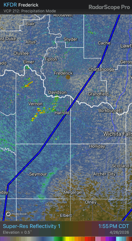
Think that's just the dryline, saw the same on the Enid day.Do I spot an outflow boundary in Southern Oklahoma on the KFDR radar?
Looks like some blips might've just initiated there.
Yea that's the dryline.Think that's just the dryline, saw the same on the Enid day.
Cap holding strong. Crazy how quickly they went up and then disappeared just as quick.So far no go on those Wichita Falls blips.
Is the cap set to erode? If they issued a watch they must believe that'd happen.Cap holding strong. Crazy how quickly they went up and then disappeared just as quick.