• Welcome to TalkWeather!
    We see you lurking around TalkWeather! Take the extra step and join us today to view attachments, see less ads and maybe even join the discussion.
    CLICK TO JOIN TALKWEATHER

Severe Weather 2026

Doesn’t surprise me that this year has been fairly active in terms of total tornadoes, but it’s definitely lacking from a strong/violent standpoint. Enid and Kouts are the two that stick out to me, but nothing much else.
It’s been an average year I would say for chasing prospects and memorable tornadoes. Not too bad like 2018, 2020. But also not like 2024, 2025.

It was unique in the fact that the season had highly active focal points like Illinois. Yet you had several days spanning from March to June that were conditionally and locally intense in several regions, and at weird times–like Mississippi in May.

I think 2025 was a far more versatile, memorable, and intense tornado season.
 
Time to write a discussion.

TODAY

So, initially, i wasn't really interested in today but today will hold opportunities for isolated tornadoes and one target catches my eye a lot.

Saskatchewan/W Manitoba

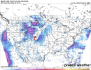
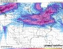
A supercell or two may be able to develop amidst a incomplete airmass that fails to fully destabilise today as the result of the ongoing severe-warmed complex in the area. 500 mb flow is rather meager in nature over the area but it's enough. 700 mb temps up there should be cool enough for storms to not have any issue. Low level shear will not be particularly strong but neither will instability. A brief tornado or two isn't ruled out. What's the target i mentioned? Take a look at that subtle impulse feeding into W Central Montana. That's your answer.
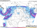
500wh.conus.png
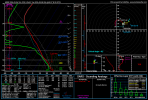
Supercells should fire off this regime and while moisture is slightly meager, it's worth noting that this area is higher in terrain so a dew point of 56F would actually likely be 60+F in nature. I don't expect a multitude of supercells but rather one singular cluster that manages to survive amidst increasing low level stability. A strong LLJ will coincide with this cluster if it manages to tap in the higher moisture and so you get this.
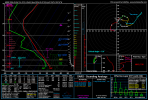
hrrr_2026090612_015_47.26--109.76.png
Strong low level shear, humps in the lowest 1km tell me any tornado would be cyclic and deviant at times if a supercell manages to become tornadic. It's not a high guarantee but i never ignore these High Plains setups.

TOMORROW

I've had some concerns over tomorrow's setups but it will work out. Just not in the areas we originally discussed. But it isn't far off E ND, and it's the ND/Canada border.
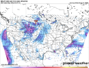
sfcwind_mslp.conus.png
A low pressure sets up in W ND, and within this feature with strong height falls and the 500 mb jet hitting this area, supercells wrap around the low. Profiles are very classic for supercells to use low level vorticity and low level shear to spam brief spinup tornadoes, at times, even photogenic.
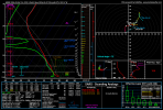
hrrr_2026090612_032_48.30--102.14.png
Curved, small low level hodographs combined with this type of vorticity usually does it and these supercells are in that right quadrant close to the low.

These supercells continue to interact as this low level jet strengthens where hodographs rapidly increase, and, a heightened tornado threat continues at 00z. This sounding is from NE SD.
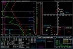
hrrr_2026090612_036_48.36--99.63.png


Wednesday, despite the trough has downtrended and is no longer a svr weather threat to actually watch. That is all. This trough could deliver picturesque supercells, and the occasional sporadic tornadoes here. Don't sleep on it.
 
Updates on tmrw. HRRR trended stronger with that low which means a slightly stronger LLJ response by 00z.sfcwind_mslp.conus (1).pnghrrr_2026090618_030_48.51--99.99.png
As evident I the sounding, you get some stronger humps in the lowest 1km. I know backing and venting isn't exactly particularly brilliant but I pay less attention to these features and just stick to the basics. Most environments can get it done if timed right. I will note that the impulse in the jet doesn't directly hit the warm sector compared to the stronger jet just down south that drives that conditional secondary target in SE SD.

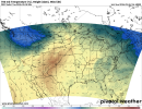
A isolated supercell or two may fire in SE SD despite warm 700s and with the jet barely scraping the area with enough lift, a supercell with a tornado or two is possible. A strengthened LLJ is also down here. Notice those more cooler temps tucked in under that low for the northern target and the southern target is plagued.

700th.conus (1).png

And Wednesday has kinda crept back up but it's not necessarily significant. That impulse has shifted south on recent global runs, compared to some of my more recent discussions where the trough was mainly centered on Central NY. 700 mb temps have also cooled quite a bit in this area too, combined with strong low level shear at times. Thermodynamics are still paltry and so are height falls. Pretty low end setup that I'm not interested in much. If anything fires, a rather low end threat for a spinup exists but I wouldn't be concerned significantly at all with this one. It's very conditional 500wh.conus (1).png
 
Back
Top