• Welcome to TalkWeather!
    We see you lurking around TalkWeather! Take the extra step and join us today to view attachments, see less ads and maybe even join the discussion.
    CLICK TO JOIN TALKWEATHER

Severe Weather 2026

Right now the line that started in Michigan and now is approaching northern West Virginia is below what would be considered Derecho criteria with the current batch of Severe Thunderstorm Warnings. I’m sure the experts will re-examine the wind reports in the coming days to see if this complex turns out to be a Derecho or a run of the mill MCS.
 
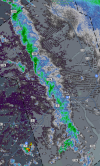
theres just a bunch of very weak supercells with broad rotation stuck in one place in atlantic canada.

1788549258025.png
very strange to look at , ive seen these on the great lake over water before but first time ive seen them form and stay on land.
 
Next week could be interesting. GFS noting strong low level shear again in the Northeast with a unusually persistent NW flow pattern. Global models have underestimated instability a few times recently I've noticed so watch out on the 9th. 250+ 0-1km SRH at times. Not a guaranteed and models could very well be estimating instability well this time but I'd err on the side of caution. Let's see.
 
little discussion/write-up on the potential for two rather synoptically evident svr weather events this following week.

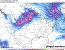
Monday: A synoptically evident 500 mb trough ejects into portions of the Northern Plains, containing 50+ kt flow. While this day is close to high res CAM support, models have serious caveats. Let's dive into those.

500wh.conus (2).png

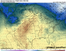
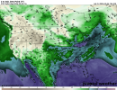
While we do have decent flow aloft at play, the devil is always in the details. There's alright height falls that would support lift but then you look at your 700 mb temperatures and you see this...

700th.conus.png

Yep. Nearly 10C-15C 700s across the majority of where that warm sector is breached, hence why not many globals have QPF signals at all. This will make it tough for any supercellular development to take place. So while the main synoptic picture DOES favor severe storms across the Northern Plains, these two major caveats will make it tough to discern if supercells will fire. Will CAMs help us any more on this highly uncertain day? I would hope so but knowing them this year, it might make it harder (and that isn't anyone's fault but a certain 4 word that starts with c and ends with s...had to say it, sorry)

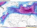
Wednesday: flow is actually a bit more zonalish honestly rather than a true NW flow regime for the NE but regardless it has characteristics of both. The right exit region of the jet directly impinges robust 60F+ dewpoints across portions of W NY/C NY.

500wh.conus (3).pngsfctd-imp.conus.png

Taking a look at our height falls, they're pretty decent. The strongest just to the west but given the forcing at play, I'd say convection in this environment wouldn't be a problem. QPF signals reflect this as convection, a bit more cellular in nature does end up firing in portions of W NY.

So what's the issue that prevents any further wording on this threat so far if the synoptics have something going for it? 700 mb temps again, but this time, it's not necessarily in the way you think it would affect it. All of our mid level moisture is pretty lackluster and combined with 10C temps across W NY, instability is severely limited in the area despite near 70F dewpoints.

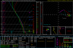
Should this issue lessen, attention will be needed for this one. Strong low level shear will be in combination, sounding taken from W NY in the vicinity of a cell in the environment modeled here. Notice how those temperature lines as you go up slightly push out and limit the parcel from rising? Combine that with saturated mid levels too at times and you just don't get instability. But given this system should be able to pull in good moisture, I'd watch for thermodynamics mainly over the next few days on this one. If they improve, it's another "watch out" day for areas previously affected by yesterday's severe weather outbreak. Those mid level lapse rates are pretty horrific too. But it's a threat that can pose something isolated if things work out.

2026090418_GFS_123_43.29,-74.37_severe_ml.png

One last note is that better thermodynamics DO exist but that's within NE OH/NW PA. And that area is plagued by 700s as well as a lack of decent lift with the height falls just off to the north. Updates will be probably tomorrow morning with the latest model guidance. I'll try be consistent with these short, easy to digest breakdowns later on in the future.
 
Back
Top