• Welcome to TalkWeather!
    We see you lurking around TalkWeather! Take the extra step and join us today to view attachments, see less ads and maybe even join the discussion.
    CLICK TO JOIN TALKWEATHER

Severe Weather 2026

Day 3


..NORTHWEST PA TO THE MID-ATLANTIC COASTLINE


SCATTERED THUNDERSTORMS (PERHAPS STRONG) WILL BE ONGOING ACROSS PA
AND POINTS SOUTHEAST AT THE START OF THE PERIOD (12Z WEDNESDAY).
THROUGH THE EARLY AFTERNOON HOURS, SHOWERS AND THUNDERSTORMS WILL
GIVE WAY TO AT LEAST MODEST INSOLATION, RESULTING IN BOUNDARY LAYER
DESTABILIZATION. SURFACE HEATING OF A MOIST BOUNDARY LAYER (E.G. LOW
70S F SURFACE DEWPOINTS) WILL RESULT IN 2000-3000 J/KG MLCAPE GIVEN
MID-LEVEL LAPSE RATES APPROACHING 7 C/KM. THE AFOREMENTIONED
MID-LEVEL IMPULSE OVERSPREADING EASTERN LOWER MICHIGAN TO THE
DELMARVA WILL RESULT IN STRONG NORTHWESTERLY FLOW ALOFT AND 35-45
KTS OF EFFECTIVE BULK SHEAR. FURTHERMORE, FORECAST SOUNDINGS ALSO
DEPICT APPRECIABLY LARGE AND CURVED HODOGRAPHS, WITH OVER 200 M2/S2
0-3 KM SRH. SUPERCELLS AND BOWING SEGMENTS WILL BE THE MOST LIKELY
STORM MODE, WITH SEVERE WIND AND HAIL THE MAIN THREATS, THOUGH A
COUPLE OF TORNADOES ARE ALSO POSSIBLE.
 
Sneaky potential for a tornadic supercell in S SD today. May lean more cold and outflowy but there's been a subtle uptrend with the parameter space in latest runs.
 
the third looks overall interesting, especially for SW WI, and a torrential flood risk for parts of central/north-central wisconsin. i am noticing a few cells popping up just north of i-80, with a pretty good hodograph and environment... thoughts?
 

Attachments

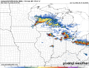
  • rrfs-refcmp_uh001h-us_mw-2026090106-64.png
    rrfs-refcmp_uh001h-us_mw-2026090106-64.png
    335.3 KB · Views: 22
  • soundings-[41.68,-88.26]-rrfs-refcmp_uh001h-us_mw-2026090106-63.png
    soundings-[41.68,-88.26]-rrfs-refcmp_uh001h-us_mw-2026090106-63.png
    253.6 KB · Views: 22
the third looks overall interesting, especially for SW WI, and a torrential flood risk for parts of central/north-central wisconsin. i am noticing a few cells popping up just north of i-80, with a pretty good hodograph and environment... thoughts?
This would favor elevated storms. Notice how the profile is all wonky of sorts? Your parcel is cut off from the surface too.
 
Well, it's definitely not common for my area to have a robust enough severe threat that it makes TV news with the threat of tornadoes mentioned...but it's super rare for this to happen in September. Depending on how things come together tomorrow I might actually go out and chase. I'm not working until Friday anyway lol.
 
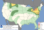
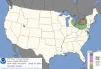
Looks like we've got ourselves a 5# today, and validly so IMO, if things pan out correctly for these storms.View attachment 54810View attachment 54811
Gotta watch those 2026 5% hatched days…

SUFFICIENT LOW-LEVEL
SHEAR SHOULD ALSO BE PRESENT TO SUPPORT A FEW TORNADOES, WITH SOME
CHANCE FOR A STRONG TORNADO THIS EVENING IF A SUPERCELL MODE CAN BE
MAINTAINED ACROSS WESTERN NY AND VICINITY. CONFIDENCE HAS INCREASED
IN A CORRIDOR OF GREATER SEVERE/DAMAGING WIND POTENTIAL LATE THIS
AFTERNOON/EVENING ACROSS PARTS OF WESTERN NY, WHERE AN ENHANCED RISK
HAS BEEN INTRODUCED.
 

A MORE CONDITIONAL HAIL/TORNADO THREAT MAY DEVELOP IF MORE DISCRETE
STORM MODE CAN BE MAINTAINED. THE EARLY CONVECTIVE DEVELOPMENT
ACROSS ONTARIO DOES LEAD TO MORE UNCERTAINTY IN THE MAINTENANCE OF
SUPERCELL MODE. THE STORMS MAY CONGEAL INTO ONE OR MORE LINEAR
STRUCTURES BEFORE ENTERING WESTERN NEW YORK. HOWEVER, IF A MORE
DISCRETE MODE CAN BE MAINTAINED AFTER 23Z, WHEN THE LOW LEVEL JET IS
FORECAST TO STRENGTHEN, A GREATER TORNADO THREAT MAY EXIST.
THEREFORE, A TORNADO WATCH MAY NEED TO BE ISSUED, ESPECIALLY IF
DISCRETE SUPERCELL MODE APPEARS POSSIBLE THIS EVENING AS LOW-LEVEL
SHEAR INCREASES.

..BENTLEY/GLEASON.. 09/02/2026
 
Aaand I'm not going chasing today because I woke up with a badly swollen sore ankle, went to the doctor's office, got diagnosed with cellulitis and put on oral antibiotics for 5 days, and apparently one of the side effects is that it really sharts some stuff with your tummy.

1788380838582.png
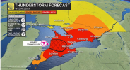
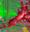
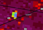
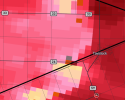
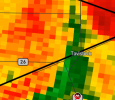
Anywho, while it's outside of the SPC's jurisdiction, I feel like if SW Ontario was in the US then a small 10% risk would be warranted. The storms we've been having through here have been staying pretty discrete so far and the one currently NE of Toronto is showing some broad rotation.

Edit: I meant to say "starts" there but "sharts" is at least as accurate so I'm keeping it lol.
 
1788383661050.png
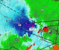
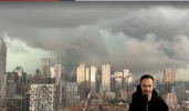
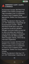
Live stream from Toronto. This is a fast-moving storm and it's going to be packing some really strong straight-line winds. Not sure how many people here are from the Toronto/Mississauga/Brampton area, but anyone who is really should be taking shelter right now.

As an aside, I have to say while this year hasn't been super active for tornadoes so far (although fall season isn't too far off), we've been getting some absolutely gorgeous cells.
 
Back
Top