Navigation
Install the app
How to install the app on iOS
Follow along with the video below to see how to install our site as a web app on your home screen.
Note: This feature may not be available in some browsers.
More options
-
Welcome to TalkWeather! We see you lurking around TalkWeather! Take the extra step and join us today to view attachments, see less ads and maybe even join the discussion. CLICK TO JOIN TALKWEATHER
You are using an out of date browser. It may not display this or other websites correctly.
You should upgrade or use an alternative browser.
You should upgrade or use an alternative browser.
Severe Weather 2026
- Thread starter KevinH
- Start date
I used to really get into the seasonal forecasting and almost take them as gospel, but I’ve really gotten away from it. There are just way too many small and individual factors to try and judge how an entire season will go. Specifically on if it will be active or less active or most like x year. I feel like it’s all just prognostication that combines some variables that may impact severe weather activity, although in other years it may not impact it at all.I don't really get into seasonal forecasting because last year, the Plains was set to be below average or barely average and something changed rapidly l late April that caused a favorable pattern for around two weeks that May for our sig outbreaks. And nuclear EML/warm nose events can be defeated (eg June 20th) but it can play a portion into the season and we'll see if it does. Hopefully less destruction this year...
I remember 2024 was predicted to be below average in total count. While that was true starting out, that was flipped on its head starting 4/26/24 with what seemed like an outbreak/tornado event every single day running through the end of May.
I don’t think there’s a good signal that you can discern total year activity from. Other than the TNI, which I do believe correlates well with active periods and higher end outbreaks. There’s still a lot of good research being done on that front.
Ozonelayer
Member
Yeah, GFS has not let go of that setup for next Thursday and now the Euro is on board as well. Now looks to be quite a bit further west/southwest than depicted by the GFS a few days ago (NE/KS rather than IA), so the question is is my SDS (storm/supercell deprivation syndrome) bad enough to make a Plains run in FEBRUARY?
Forecast hodographs on the 12Z GFS look great. Moisture is seasonably modest but doable given the forecast depth and LCL. Hmmmm...
Definitely has my eye. Solid kinematic profile and okay moisture. The main problem with the setup though is the fact that there is barely any cape on the 12z GFS and the surface backing could be a bit better but southerly is still very much suitable.


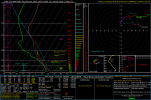
(2 separate 12z GFS Soundings in SSE Kansas, in the Wichita and El Dorado vicinity)
As you can see, the cape profile is remarkably slim despite the dew point spread being manageable and the lapse rates being okay. They will likely go up as we get closer but I think I've found the reasoning behind to little cape:

As you can see, there are a crap ton of clouds covering the area. This likely is the reason behind the less-than-mediocre cape values. If it had slightly stronger SSE pull and less cloud cover on this run, there would likely be atleast a somewhat decent tornadic setup from north Texas to southern Kansas.
Of course it's subject to change as it gets closer but taking the 12z at face value, the only apparent limiting factor (to me and my limited knowledge of soundings) is the almost nonexistent cape and okay lapse rates
Kds86z
Member
Kds86z
Member
N
Not here anymore
Guest


What’s interesting is that it’s not just a positive TNI. A strongly negative TNI is also correlated with higher frequency of activity + outbreaks (May 2003 for example). It’s when TNI is “neutral” that activity can slow down.
Although, worth pointing out the caveat that the original TNI study was specifically focused on April/May.
tennessee storm chaser
Member
- Messages
- 1,876
- Reaction score
- 4,283
- Location
- jackson tennessee
- Special Affiliations
- SKYWARN® Volunteer
Yeah think we are still going have wait another month or so before things really start ramping up.What’s interesting is that it’s not just a positive TNI. A strongly negative TNI is also correlated with higher frequency of activity + outbreaks (May 2003 for example). It’s when TNI is “neutral” that activity can slow down.
Although, worth pointing out the caveat that the original TNI study was specifically focused on April/May.
CheeselandSkies
Member
Looks like the GFS has finally caved for the later this coming week timeframe, over the last 36 hours or so it has lost that nice, digging trough it had for Thursday for at least the previous 100 hours of runs and trended toward more broad, nondescript southwest to westerly flow over the central and eastern CONUS while the main trough hangs way back to the west (and remains positively tilted), similar to what the ECMWF was portraying.
You still have strong deep layer shear overtopping upper 50s/low 60s dewpoints into the Ohio Valley, it's just lacking a synoptic scale focus for lift. Any severe weather event would have to rely on more subtle mechanisms, the placement/timing of which is not really apparent at this range.
You still have strong deep layer shear overtopping upper 50s/low 60s dewpoints into the Ohio Valley, it's just lacking a synoptic scale focus for lift. Any severe weather event would have to rely on more subtle mechanisms, the placement/timing of which is not really apparent at this range.
- Thread starter
- #391
KevinH
Member
Watch it flip flop back and forth….Looks like the GFS has finally caved for the later this coming week timeframe, over the last 36 hours or so it has lost that nice, digging trough it had for Thursday for at least the previous 100 hours of runs and trended toward more broad, nondescript southwest to westerly flow over the central and eastern CONUS while the main trough hangs way back to the west (and remains positively tilted), similar to what the ECMWF was portraying.
You still have strong deep layer shear overtopping upper 50s/low 60s dewpoints into the Ohio Valley, it's just lacking a synoptic scale focus for lift. Any severe weather event would have to rely on more subtle mechanisms, the placement/timing of which is not really apparent at this range.
I swear these models are like watching a tennis match.
Kds86z
Member
joshoctober16
Member
just going to share this insane radar signature happening right now.

N
Not here anymore
Guest
00Z GFS; Possible trouble on the horizon next Saturday with CAPE near 1800-2000 j/kg and these EHI's near 3.4


Last edited by a moderator:
Kds86z
Member
Kds86z
Member
CheeselandSkies
Member
Was not expecting that after the GFS appeared to cave toward the Euro's earlier, tamer solution for this time frame. Chase back on? We shall see...
Edit: SPC is on board, with a 15% Day 4 contour for Thursday. Looks like the setup has pulled the old "Tease at long range, appear to gradually downtrend with time, only to suddenly uptrend again once inside of 100 hours." I should be used to this by now.
Last edited:
WeathermanLeprechaun
Member
00z GFS pulled 2k SBCAPE into Alabama along with decently strong kinematics. That for February would be quite the event. I took a quick look at shear vectors and that would suggest more of a linear event, but with that amount of CAPE at hand, a long lasting windbag too? And then even prefrontals out in front, all in all, that'd be some scenario. 06z downtrended big but Saturday has got something going for it. The magnitude we don't really know just yet.
WeathermanLeprechaun
Member
Regarding Thursday, GFS has a few caveats. Storm mode will be discrete but there's a slight warm nose plus weaker lapsw rates aloft. A discrete storm sustaining would be hard to get. I feel like a low level shear uptrend will take place with this. Pretty potent dynamics at play.
WeathermanLeprechaun
Member
The NAM is in range for Thursday, and i wouldn't exactly say it's a great environment for CI. But thermodynamics are at least there plus the shear. Some sort of severe threat albeit conditional does exist. Strong low level shear plus discrete shear vectors