Navigation
Install the app
How to install the app on iOS
Follow along with the video below to see how to install our site as a web app on your home screen.
Note: This feature may not be available in some browsers.
More options
-
Welcome to TalkWeather! We see you lurking around TalkWeather! Take the extra step and join us today to view attachments, see less ads and maybe even join the discussion. CLICK TO JOIN TALKWEATHER
You are using an out of date browser. It may not display this or other websites correctly.
You should upgrade or use an alternative browser.
You should upgrade or use an alternative browser.
Severe Weather 2026
- Thread starter KevinH
- Start date


Kds86z
Member
Attachments
Last edited:

slenker
Member
If Reed actually caught this, he's an absolute legend. Dude's the GOAT despite his antics.Oh Reed, you son of a gun.

jiharris0220
Member
It’s a good thing the LLJ is below 30knots, and that there’s no inversion layer, the storms have been and will likely continue to be outflow dominant despite the insane vertical instability and favorable vertical wind profile.
The supercell that produced the Intense tornado did so via storm interaction with the MCS which helped in increasing its inflow just enough to briefly put one down.
EDIT: it seems another mesoscale interaction is occurring with the lead supercell, looks like it may soon drop a tornado of its own.
The supercell that produced the Intense tornado did so via storm interaction with the MCS which helped in increasing its inflow just enough to briefly put one down.
EDIT: it seems another mesoscale interaction is occurring with the lead supercell, looks like it may soon drop a tornado of its own.
And happened to do it at quite literally the worst or 2nd worst time possible. If it dropped a bit earlier it would've hit more of the town.It’s a good thing the LLJ is below 30knots, and that there’s no inversion layer, the storms have been and will likely continue to be outflow dominant despite the insane vertical instability and favorable vertical wind profile.
The supercell that produced the Intense tornado did so via storm interaction with the MCS which helped in increasing its inflow just enough to briefly put one down.
Kds86z
Member

WeathermanLeprechaun
Member
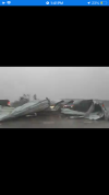
So, via scanned feeds. This fire station is completely destroyed in Appleton. 

TornadoFan
Member
DanLarsen34
Member
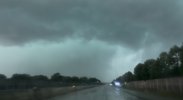
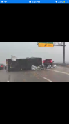
Lots of cars struck on the highway too unfortunately. They really never saw it coming.
Yeah, this might be really bad. Let’s hope the tornado was weaker than what radar suggested or else I fear what we’re going to hear in the coming hours.
jiharris0220
Member
Leading supercell as expected became outflow dominant, unfortunately, the outflow in question contains 60 to 80knot velocities.
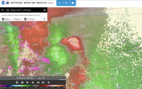
It was without a doubt at least EF3. There's a solid shot it wasn't EF4 or higher because of the relatively low TDS height but an EF3 striking a large, dense population center is enough for a major disaster.Yeah, this might be really bad. Let’s hope the tornado was weaker than what radar suggested or else I fear what we’re going to hear in the coming hours.
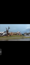
Tree damage on the coast of Lake Winnebago. Some structural damage but it doesn't appear too severe. I believe this is on the north end of the lake, so it was either on the outskirts of the tornado or it had significantly weakened by this point.
Kds86z
Member
WeathermanLeprechaun
Member
Tree damage on the coast of Lake Winnebago. Some structural damage but it doesn't appear too severe. I believe this is on the north end of the lake, so it was either on the outskirts of the tornado or it had significantly weakened by this point.
Great minds think alike to lighten up the mood in here lol. I'll delete my post.

Tanner
Member
Not looking good... in Menasha... looks like a fair amount of this tornado would've been over the lake but looks like significant damage.
The damage already looks more intense than what we saw in St. Louis last year on May 15.
WeathermanLeprechaun
Member
Widespread major damage but I think that radar overestimated intensity thankfully. Despite that, this is still very bad.
DanLarsen34
Member
Think it might have pushed at least EF-3. I grabbed this in the video above and it appears to be a house that was leveled.Widespread major damage but I think that radar overestimated intensity thankfully. Despite that, this is still very bad.