
Navigation
Install the app
How to install the app on iOS
Follow along with the video below to see how to install our site as a web app on your home screen.
Note: This feature may not be available in some browsers.
More options
-
Welcome to TalkWeather! We see you lurking around TalkWeather! Take the extra step and join us today to view attachments, see less ads and maybe even join the discussion. CLICK TO JOIN TALKWEATHER
You are using an out of date browser. It may not display this or other websites correctly.
You should upgrade or use an alternative browser.
You should upgrade or use an alternative browser.
Severe Weather 2026
- Thread starter KevinH
- Start date
Kds86z
Member
FYI, June has the most significant tornadoes of any month this year. 5 Ef3 and 20 EF2.
Kds86z
Member
Who’s making a thread for the last severe weather threat before death ridge lol ? Day 3 hatched and mentioning tornadoes and threat into couple days after.
tennessee storm chaser
Member
- Messages
- 1,875
- Reaction score
- 4,283
- Location
- jackson tennessee
- Special Affiliations
- SKYWARN® Volunteer
Who’s making a thread for the last severe weather threat before death ridge lol ? Day 3 hatched and mentioning tornadoes and threat into couple days after.
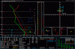
Wow. Now that’s a serious looking ridge there … time
Who’s making a thread for the last severe weather threat before death ridge lol ? Day 3 hatched and mentioning tornadoes and threat into couple days after.
wow! What a ridge … time to sweat for awhile untill fall severe weather season kicks in …
As soon as I made my comment about how active things are going to be I just KNEW a huge ridge was going to pop up out of nowhere. Forecasting is so funWow. Now that’s a serious looking ridge there … time
wow! What a ridge … time to sweat for awhile untill fall severe weather season kicks in …

Kds86z
Member
Been a fun and unfortunately deadly June. May be the most active of the spring months. Confirmed are around 240 for tornadoes. Looks like one more hurrah to end the month. What a ride..As soon as I made my comment about how active things are going to be I just KNEW a huge ridge was going to pop up out of nowhere. Forecasting is so fun
Kds86z
Member
slenker
Member
This year was quite well forecast from Trey in terms of tornado season predictions, in my opinion. Trey predicted that March would be active, April would be middle of the road, May would be inactive or even "dead," and June would be fairly active. Pretty impressed with how well the analog years lined up. It wasn't 100% accurate of course (April went fairly differently then predicted), but from a large scale standpoint, it was pretty damn good.
Last edited:
Kds86z
Member
Last edited:
atrainguy
Member
Looks like things might get stormy for me soon. Tornadoes or not, it'll be nice to have at least some nice summer t storms rolling through.
Yes while there's some more tornadoes to be surveyed which will push the number up, 234 was actually the average during the 1989-2013 period.
People have gotten so used to inactive Junes they've forgotten what a historically normal one looks like and don't remember that up till recently it was usually more active than April.
Kds86z
Member
Yeah I agree. June usually on average is 200 plus.Yes while there's some more tornadoes to be surveyed which will push the number up, 234 was actually the average during the 1989-2013 period.
People have gotten so used to inactive Junes they've forgotten what a historically normal one looks like and don't remember that up till recently it was usually more active than April.
Kds86z
Member
Can’t wait….
Can’t wait….
take it back, take it backkkkkkk
akt1985
Member
Did Ireland wind up getting an MCS Thursday?MCS potential for Dublin tonight (it's the next day here, timezone differences)
WeathermanLeprechaun
Member
In
the NW part, yeah. Not enough forcing down here sadly.Did Ireland wind up getting an MCS Thursday?
akt1985
Member
It looks like a Ring of Fire scenario is playing out over Western Europe right now with brutal heat in London and Paris.In
the NW part, yeah. Not enough forcing down here sadly.
WeathermanLeprechaun
Member
Irishman zero meters the weak tornado in Oranmore, County Galway from Friday. The extended video has a football goal flying past. I know this fits in the SigTor global thread but not many will see it there
TornadoFan
Member
I don't like this. First time I've ever seen a PDS warning for my area. The wildfire down by the Colorado/Utah stateline blew smoke right over our town and killed three firefighters yesterday.

I didn't know there were such a thing as PDS Red Flag Warnings until a couple years ago.I don't like this. First time I've ever seen a PDS warning for my area. The wildfire down by the Colorado/Utah stateline blew smoke right over our town and killed three firefighters yesterday.
View attachment 53967