• Welcome to TalkWeather!
    We see you lurking around TalkWeather! Take the extra step and join us today to view attachments, see less ads and maybe even join the discussion.
    CLICK TO JOIN TALKWEATHER

Severe Weather 2025

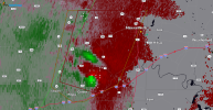
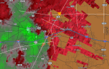
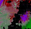
Tornado threat is increasing with this prefrontal supercell and is now tornado warned. Screenshot was a second before it was issued, i might be about to eat my words about tonight... Robust surface inversion in place but this cell may have a shot at a strong tornado with the environment it has.
 

Attachments

  • Screenshot_2025-10-24-23-55-34-924.jpeg
    Screenshot_2025-10-24-23-55-34-924.jpeg
    166.9 KB · Views: 0
  • Screenshot_2025-10-24-23-56-18-777.jpeg
    Screenshot_2025-10-24-23-56-18-777.jpeg
    100.3 KB · Views: 0
My bad for underplaying the tor threat
View attachment 47680
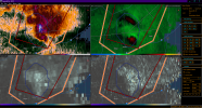
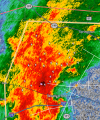
Tornado Warning for areas near Mineral Wells, Texas tor prob is at a 25% looks p good too
Cell is notably fighting a surface inversion, i wasn't even aware a potent environment existed up there near the Metroplex today.
 
Trey's thoughts on tomorrow regarding how potent it could be: thinking a thread COULD be needed for this in the morning if models trend concerning
 

Attachments

  • Screenshot_2025-10-25-00-58-20-820.jpeg
    Screenshot_2025-10-25-00-58-20-820.jpeg
    30 KB · Views: 0
Making my eyes hurt lol
My Eyes Pain GIF
 
, IT IS LIKELY THIS ACTIVITY CONTINUES OVER
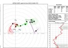
THE NEXT COUPLE OF HOURS AND APPROACHES THE DFW METRO. THE KFWS VAD
CONTINUES TO SHOW ENLARGED LOW-LEVEL HODOGRAPHS AS WELL AS AN
IMPROVING MID-LEVEL WIND PROFILE. DAMAGING/SEVERE GUSTS AS WELL AS
QLCS CIRCULATIONS/TORNADOES WILL BE POSSIBLE INTO MID EVENING.

..WENDT.. 10/25/2025

..PLEASE SEE WWW.SPC.NOAA.GOV FOR GRAPHIC PRODUCT
 
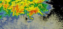
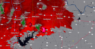
What a supercell the terminal has near Tioga
 

Attachments

  • Screenshot_2025-10-25-01-30-01-149.jpeg
    Screenshot_2025-10-25-01-30-01-149.jpeg
    341.7 KB · Views: 0
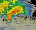
The northern terminal suggests this severe warned supercell is cranking. A tornado warning soon wouldn't shock me as it is likely rotating.
 

Attachments

  • Screenshot_2025-10-25-01-44-32-886.jpeg
    Screenshot_2025-10-25-01-44-32-886.jpeg
    135.7 KB · Views: 0
, IT IS LIKELY THIS ACTIVITY CONTINUES OVER
THE NEXT COUPLE OF HOURS AND APPROACHES THE DFW METRO. THE KFWS VAD
CONTINUES TO SHOW ENLARGED LOW-LEVEL HODOGRAPHS AS WELL AS AN
IMPROVING MID-LEVEL WIND PROFILE. DAMAGING/SEVERE GUSTS AS WELL AS
QLCS CIRCULATIONS/TORNADOES WILL BE POSSIBLE INTO MID EVENING.

..WENDT.. 10/25/2025

..PLEASE SEE WWW.SPC.NOAA.GOV FOR GRAPHIC PRODUCT
This makes me think we could see qcls tornadoes well into the night.
 
This makes me think we could see qcls tornadoes well into the night.
This tornado threat is all night. Occasional prefrontal tor threat is possible too as we've already seen. Long night with several spinups and possibly a strong one ahead.
 
Back
Top