joshoctober16
Member
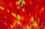
This is a bit more convincing then last scan. Unsure but safe place now


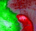
this is now clearly a unwarn tornado , debris ball seems to be getting deeper, and they are all align now, its nothing but homes were it was and where it is and where its going.