
joshoctober16
Member
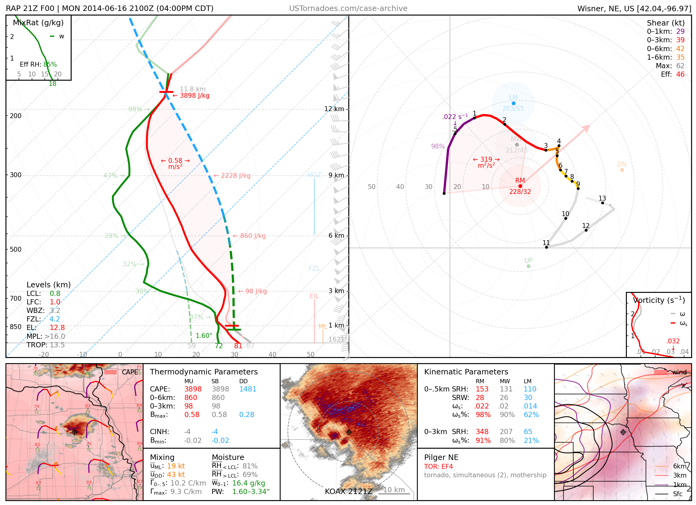
im starting to wonder if there should be a thread about parameters where we share are ideas on stuff like this.I found this really cool resource with soundings from basically every major severe weather event of the last 25 years. Some (probably obvious) trends I'm noticing are dry air aloft in the 700-500 mb range and high CAPE makes SRH less important. Likewise, CAPE is less important when helicity and sheer are really high (3-14/15 comes to mind). Strong tornadoes also seem to be pretty rare when effective sheer is outside the 40-80kt range.
[Retired] Case Archive - ustornadoes.com
Soundings, hodographs, and much more. Case synopses on some of the most well known U.S. tornadoes of the 2000s. Over 200 events examined.www.ustornadoes.com
we could find some bust issues and surprise boom moments from looking at parameters that others haven't look into before.
recently I've been noticing hybrid tornadoes tend to form in a type of environment.
also notice that a lot of the high risk bust Oklahoma events have the same mlcape vs dcape issues.
if there is 2 things I'm noticing for tornado research is.
1:they seem to completely ignore moister / wet / dry part of the environment.
2: Dcape seems to be completely ignored however base on the nudger theory it would seem like this would be very important.


