I’m on mobile, but https://tornadoarchive.com/home/ will let you run a re-analysis of the 500 MB pattern for that day.Was 5/31/1985 a large longwave, or was that a different setup entirely? That one seems to stand out to me as a strange mega outbreak that occurred really late in the season, unusually displaced well into the northeast.
My guess is it was a huge long wave through as it advected a pretty significant EML over top of the warm sector area. It was just an anomalous event. I would expect something like that in early to mid spring, not late May for that area.
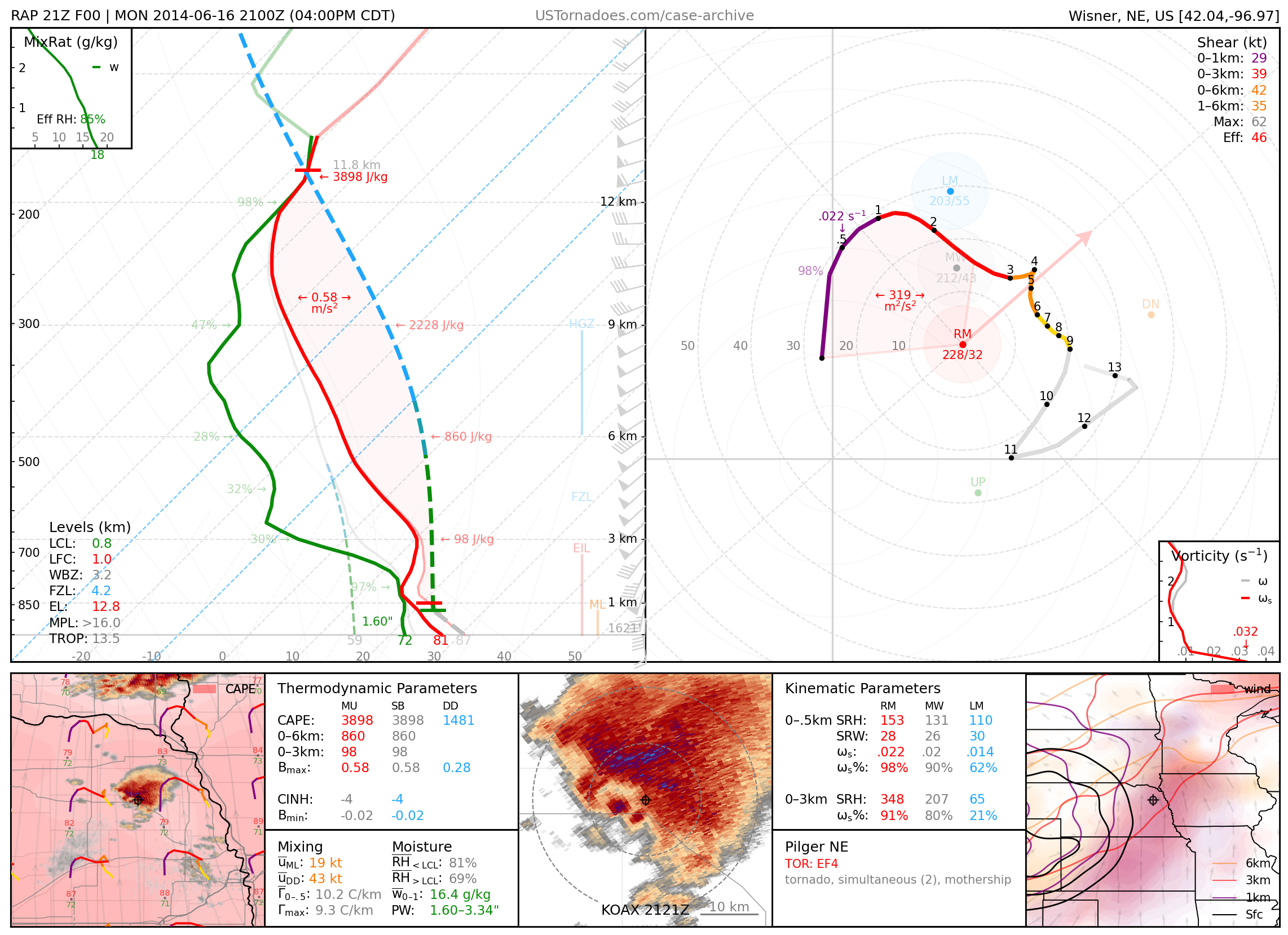
You can read more about the set up here: