• Welcome to TalkWeather!
    We see you lurking around TalkWeather! Take the extra step and join us today to view attachments, see less ads and maybe even join the discussion.
    CLICK TO JOIN TALKWEATHER

Severe Weather 2025

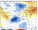
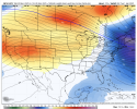
I'm not that impressed with the upcoming pattern, at least for anything that might entice me to travel for a chase. General ridging after the day 4 front (yawn), then ridging. Some possibilities could emerge towards the end of the month, but there is no real sign of a western trough pattern that I can discern.
 
Don't think we'll have too many problems this far east, but could definitely see a few surprises in MS and TN, where shear will be strongest in the evening and overnight hours.
1742478966229.png1742479025299.png1742479048344.png
 
Just waiting for the next big mjo wave .
Which is why I actually wrote out that post. It was basically piggybacking off of the excellent research and groundwork Fred & Matt both did for this season. Especially with that background pattern possibly poised to swing back through Mid-Late April. You could have a situation where you have the optimal background state, similar to what produced Friday & Saturday, with an extremely moist gulf with rich moisture just sitting there waiting all of the rest of March and possibly early April. That sort of thing has usually yielded your larger outbreaks in the southeast.
 
That massive longwave trough that is displayed on the Euro for the end of March into the beginning of April is really quite something... Obviously a lot can and will change, but right now it looks very impressive. GFS doesn't see it though.
Are you talking about This one? That really is quite the look. This is the operational Euro 0Z run.


1742491871559.png
 
Are you talking about This one? That really is quite the look. This is the operational Euro 0Z run.


View attachment 36816
Yes, that's what I was referring to. Edited this comment because I was wrong with what I stated originally - I definitely did look at the same run. The run before had a far more meridional flow regime to it, but this completely switched up and looks way nastier.
 
Last edited:
MASSIVE difference between the 12z OP Euro and the GFS and GEFS in the 10-15 day range. The latter shows two deep troughs in the West/Plains, while the former two show ridging. In other words, we have no real clue right now.
 

Attachments

  • Screenshot 2025-03-20 at 2.04.55 PM.png
    Screenshot 2025-03-20 at 2.04.55 PM.png
    1.6 MB · Views: 0
  • Screenshot 2025-03-20 at 2.05.10 PM.png
    Screenshot 2025-03-20 at 2.05.10 PM.png
    1.7 MB · Views: 0
  • Screenshot 2025-03-20 at 2.05.23 PM.png
    Screenshot 2025-03-20 at 2.05.23 PM.png
    1.3 MB · Views: 0
View attachment 36834
Got the all clear to chase, but debating if this will be a system worth chasing. Might hold off due to the models showing an possible impressive severe weather outbreak toward the end of this month into early April.
Trust me. Go to the MS delta if you do. You'll eat some good food, meet even better people, and it's the best sightlines you'll have in Dixie for chasing. Very similar terrain to the plains.

You'll also see some eye-opening things, though.
 
Trust me. Go to the MS delta if you do. You'll eat some good food, meet even better people, and it's the best sightlines you'll have in Dixie if you go. Very similar terrain to the plains.

You'll also see some eye-opening poverty, though.
I was actually thinking of visiting Rolling Fork to see how everyone’s been doing and the progress the town is making.
 
MASSIVE difference between the 12z OP Euro and the GFS and GEFS in the 10-15 day range. The latter shows two deep troughs in the West/Plains, while the former two show ridging. In other words, we have no real clue right now.
The 12Z Euro ensembles are also in more agreement with the GEFS. Like you so perfectly said, we have no clue right now how the rest of March will trend.
 
Back
Top