
Some good-looking troughs, but yeah, not much in the way of moisture return.The upcoming days out to about next week look like they would be real nasty if they occurred in the spring. However, since it's winter, the severe threat looks to be marginal at best, at least from what I can see.
Navigation
Install the app
How to install the app on iOS
Follow along with the video below to see how to install our site as a web app on your home screen.
Note: This feature may not be available in some browsers.
More options
-
Welcome to TalkWeather! We see you lurking around TalkWeather! Take the extra step and join us today to view attachments, see less ads and maybe even join the discussion. CLICK TO JOIN TALKWEATHER
You are using an out of date browser. It may not display this or other websites correctly.
You should upgrade or use an alternative browser.
You should upgrade or use an alternative browser.
Severe Weather 2024
- Thread starter KevinH
- Start date
Austin Dawg
Member
If it does like mother nature usually does it will happen when we're at least expecting it.
Yep. You know it. I'm just sitting here waiting for my next close call because I know it'll happen. Lee and Monroe Counties have the highest percentage of tornadoes (4.5%) in all of North MS with both counties seeing 54 total tornadoes. Got all this from NWS Memphis Tornado database which goes from 1800 thru 2023. I don't find that surprising at all especially how the last few years have been. Lowest total is 15 tornadoes in Benton County as well as the lowest percentage at 1.3%. Prentiss and DeSoto Counties have the 2nd highest percentage at 3.33% (or 40 tornadoes). I have all this in a spreadsheet.If it does like mother nature usually does it will happen when we're at least expecting it.
CheeselandSkies
Member
Yep. You know it. I'm just sitting here waiting for my next close call because I know it'll happen. Lee and Monroe Counties have the highest percentage of tornadoes (4.5%) in all of North MS with both counties seeing 54 total tornadoes. Got all this from NWS Memphis Tornado database which goes from 1800 thru 2023. I don't find that surprising at all especially how the last few years have been. Lowest total is 15 tornadoes in Benton County as well as the lowest percentage at 1.3%. Prentiss and DeSoto Counties have the 2nd highest percentage at 3.33% (or 40 tornadoes). I have all this in a spreadsheet.
Man it was nuts watching that monster couplet and debris ball roll right up on Amory/Smithville that night in March of last year; fortunately it was not quite as bad as that infamous day in 2011 but I have a feeling it was not too far off from being so.

Yeah. It was astounding how fast it spun up again because after it left Winona, the storm pretty much decreased in intensity, but right after it hit the county line, it absolutely went nuts. Some of the same people who had moved out of Smithville after 4/27 and rebuilt outside the city limits were hit by this one as well. Missed my new house by a quarter mile to the south. Amory is much bigger than Smithville and has a larger population so the fact that more people weren't killed is a miracle. My previous EMA director texted me that afternoon because her family was planning to go out of town and wanted to know if she should stay. I texted her back and said to stay around. That was the best decision I could have told her. What's ironic is our new EMA director was working for MEMA when the Smithville tornado happened on 4/27/11 and so I got to meet her then. I also met my past EMA director too few days after April 27th. A lot of good came from that day because I've been able to work closely with our county EMA ever since.Man it was nuts watching that monster couplet and debris ball roll right up on Amory/Smithville that night in March of last year; fortunately it was not quite as bad as that infamous day in 2011 but I have a feeling it was not too far off from being so.
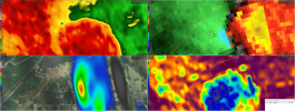
View attachment 31734
The white circle is where my new house is and where the tornadic supercell storm that hit Amory tracked. The actual track of the tornado was a quarter mile south of me, but the storm itself/debris fallout was right in my backyard literally.
Attachments
Austin Dawg
Member
I remember that storm. I still believe that the Amory storm spared lives because the tornado was not entirely on the ground like when that storm hit Smithville. It's weird how they traveled almost the same path across the country, and it's strange to me that subsequent storms follow such a similar path each time they form.
Right. It's also very interesting how the only 2 F5/EF5 tornadoes in North MS have occurred in Monroe County with each one occurring during both Super Outbreaks. That blew my mind when I saw that.I remember that storm. I still believe that the Amory storm spared lives because the tornado was not entirely on the ground like when that storm hit Smithville. It's weird how they traveled almost the same path across the country, and it's strange to me that subsequent storms follow such a similar path each time they form.
Ledian
Member
San Francisco was under a Tornado Warning earlier, couldn't believe it when i first saw on WeatherNation. I think that's the first they've ever had to my knowledge
This is the first one they have had in December. Going back to 1989 on IEM (Iowa Environmental Mesonet) site, San Francisco has had 1 in September 1989, 3 in January 2010, 1 in March 2011, and 3 in March 2024. 3 is the most San Francisco has had.San Francisco was under a Tornado Warning earlier, couldn't believe it when i first saw on WeatherNation. I think that's the first they've ever had to my knowledge
83 mph wind gust at SFO airport is the second-strongest wind gust measured at SFO since records began in 1945. The strongest wind gust in that area was 84 mph on June 15, 1977.
Here's the latest Climate Prediction Center (CPC) forecasts for the next week or so:
6-10 day temperature:

6-10 day precipitation:

8-14 day temperature:

8-14 day precipitation:

Much of the eastern CONUS can expect cooler and dryer conditions, thus implicitly limiting the chances of a severe weather outbreak over the next week or so. However, do be aware that these are climatological forecasts, so we'll still have to keep an eye on the weather patterns to see whether at least one severe system will try to sneak through...
6-10 day temperature:
6-10 day precipitation:
8-14 day temperature:
8-14 day precipitation:
Much of the eastern CONUS can expect cooler and dryer conditions, thus implicitly limiting the chances of a severe weather outbreak over the next week or so. However, do be aware that these are climatological forecasts, so we'll still have to keep an eye on the weather patterns to see whether at least one severe system will try to sneak through...
If these systems weren't moving through so quickly, it would be a different story for severe weather. Since these storm systems have been moving through quickly instead of slower, you end up with very limited severe threats. Which I'm not complaining. I, for one, am thankful for the slower pace. However, something has gotta give to flip the pattern from Fall to Winter which usually takes a big severe weather threat.
TH2002
Member
- Messages
- 4,974
- Reaction score
- 11,116
- Location
- California, United States
- Special Affiliations
- SKYWARN® Volunteer
Storms in NorCal resulted in the issuance of the first Tornado Warning on record for downtown San Francisco, and further south spawned a tornado in the city of Scotts Valley. At least five people including a firefighter were injured as the tornado flipped vehicles and damaged a shopping center.


Damage in San Francisco from Saturday morning was result of 80mph+ winds. Damage investigations still ongoing for Scott Village.
Scotts Valley, CA tornado information

- Moderator
- #3,137
Here's the latest Climate Prediction Center (CPC) forecasts for the next week or so:
I see a strong signal that I haven’t seen in a very long time from the GFS, GEFS, EURO, and CFSv2 for a severe threat post-Christmas (28th-29th).
ashtonlemleywx
Member
Hey Buddy. I just ran over here to post 18z GFS when I saw it. First PDS tor sounding I've seen in Dixie Alley since the Spring. This sounding is near Hamilton/Hackleburg Alabama. Gonna get nasty if this holds.I see a strong signal that I haven’t seen in a very long time from the GFS, GEFS, EURO, and CFSv2 for a severe threat post-Christmas (28th-29th).


Before anyone asks when the last end of the year severe weather event was, it was December 31st, 2010. That was the first thing that came to mind when I saw your post @Taylor Campbell
ashtonlemleywx
Member
Whats up JP. I have a feeling if anything happens I'll end up somewhere close to Monroe county like always haha.Before anyone asks when the last end of the year severe weather event was, it was December 31st, 2010. That was the first thing that came to mind when I saw your post @Taylor Campbell