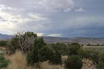
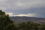
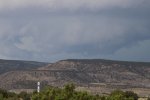
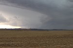
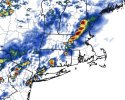
• Welcome to TalkWeather!
    We see you lurking around TalkWeather! Take the extra step and join us today to view attachments, see less ads and maybe even join the discussion.
    CLICK TO JOIN TALKWEATHER

Severe Weather 2024

Models have vacillated a bit on tomorrow's ceiling around my neck of the woods, but the 00Z HRRR came in pretty hot. Winds quite strong across all levels especially for late June, with decent directional shear as well. Sim reflectivity has supercells in Iowa congealing into an MCS as it reaches WI (typical), but if the shear is anything like this it could remain pretty intense.

hrrr_2024062200_023_42.75--89.55.png
 

I called this a few days ago on this thread with the incompetent SPC was still holding onto a Marginal Risk.

Anyway, tomorrow looks very interesting from NYC to Boston and Central New England. CAMs fire discreet cells over New Jersey and move them towards the NYC area by the late evening hours. I actually think the Central Mass / Connecticut / Albany area have the best parameters. Should be an interesting day. Definitely watching it.
 
15Z SREF has a bullseye roughly ovr Adams, MA tomorrow evening. Could certainly be an active day for New England.
1719085502996.pngfloop-hrrr-2024062218.refcmp_uh001h.us_ne.gif
 
View attachment 28777
I called this a few days ago on this thread with the incompetent SPC was still holding onto a Marginal Risk.

Anyway, tomorrow looks very interesting from NYC to Boston and Central New England. CAMs fire discreet cells over New Jersey and move them towards the NYC area by the late evening hours. I actually think the Central Mass / Connecticut / Albany area have the best parameters. Should be an interesting day. Definitely watching it.
You did call it! I forgot who pointed this out
 
Cherry picked a few PDR TOR soundings from the 18Z NAM for tomorrow in Southern NH / Northern MA. Bullseye right around Manchester.
They don't appear to be contaminated.

Although the NAM tends to be more bullish on PDS TOR soundings, it is quite remarkable to see that in this part of the country.

Edit: NYC metro would definitely be in the TOR risk area tomorrow if the most recent cams are correct. NAM depicts a line of discrete/semi-discrete rotating supercells from Philadelphia to Bridgeport, CT tomorrow evening.
 
Last edited:
The biggest issue with tomorrow's severe weather setup in the Northeast is the lack of better mid level lapse rates (better EML), which is a strong delineator between higher end severe events there and run-of-the-mill days.
 
Back
Top