
Navigation
Install the app
How to install the app on iOS
Follow along with the video below to see how to install our site as a web app on your home screen.
Note: This feature may not be available in some browsers.
More options
-
Welcome to TalkWeather! We see you lurking around TalkWeather! Take the extra step and join us today to view attachments, see less ads and maybe even join the discussion. CLICK TO JOIN TALKWEATHER
You are using an out of date browser. It may not display this or other websites correctly.
You should upgrade or use an alternative browser.
You should upgrade or use an alternative browser.
Severe Weather 2024
- Thread starter KevinH
- Start date


Gail
Member
We can’t forget the nova explosion added in too - maybe not that day but I’m sure all this somehow triggers it in movie world!Movie Title: Total Solar Tornado Eclipse Earthquake
Synopsis: a scientist uncovers historical artifacts that point to a rare Tornado Solar Eclipse occurring during a massive earthquake. They find that chemtrails work to weaken the Solar Tornado and stabilize the earthquake
Austin Dawg
Member
It probably won't happen, but having that many people in rule areas that aren't used to paying attention to different warning signs could be the recipe for big problems.To me at least, that sounds like the setup to a B-grade disaster movie...
Yep plus I figure you'll have people from other continents there as well.It probably won't happen, but having that many people in rule areas that aren't used to paying attention to different warning signs could be the recipe for big problems.
SPC watching the end of medium range very closely.
.DISCUSSION...
The potential for severe thunderstorms across the CONUS appears low
from Day 4/Friday into at least Day 5/Saturday. An upper trough/low
should dig southward along/near the West Coast in this time frame.
Low-level moisture is forecast to gradually return northward across
the southern/central Plains, lower/mid MS Valley, and OH Valley
through the upcoming weekend. Medium-range guidance is starting to
come into better agreement regarding the evolution and eventual
ejection of this upper trough/low across the western and central
states, with a more positively tilted solution somewhat more
probable based on latest ensemble guidance. Regardless, it seems
likely that a substantial warm sector will be in place across much
of the southern Plains into the lower/mid MS Valley, and perhaps
even the OH Valley by Day 6/Sunday and Day 7/Monday.
If a northern-stream upper trough over central Canada can phase with
the ejecting lower-latitude trough over the western CONUS, as some
guidance suggests, then a more organized severe threat may exist,
focused on Day 7/Monday and Day 8/Tuesday. At this point, the
regions of interest include locations along/east of a surface
dryline over the southern/central Plains, and along/south of a warm
front draped across the OH Valley. Both instability and deep-layer
shear appear strong enough for severe convection. But, there are
still some substantial differences in the location of greatest
severe risk next Monday and Tuesday. Trends in guidance will be
closely monitored. If deterministic and ensemble guidance can come
into better agreement regarding the evolution of the upper trough,
along with related surface features, then a broad 15% severe area
may be needed for next Monday and/or Tuesday in later outlooks.
..Gleason.. 03/26/2024
tennessee storm chaser
Member
- Messages
- 1,877
- Reaction score
- 4,288
- Location
- jackson tennessee
- Special Affiliations
- SKYWARN® Volunteer
I know this will not be a popular post, but as a storm chaser and the love for severe weather I have , I am tired of these Mickey Mouse systems … hoping for a nice active April . First week of April already looking interesting .
Last edited:
Justin Hindman Hindy
Member
Believe me, usually I've already used 2 personal days from work to storm chase by now lolI know this will not be a popular post, but as a storm chaser and the love for severe weather I have , I am tired of these Mickey Mouse systems … hoping for a nice active April . First week of April already looking interesting .
MattW
Member
- Messages
- 388
- Reaction score
- 382
- Location
- Decatur, GA
- HAM Callsign
- KG4GUF
- Special Affiliations
- SKYWARN® Volunteer
It's definitely a paradox. Aside from it not being full time jobs for most of us, it's not too different from doctors, police, insurance adjusters, etc. No one in those jobs want bad things to happen, but they all need a certain excitement about doing their jobs otherwise they won't do them well, and most of the roles in those jobs involve responding when bad things happen to people.I know this will not be a popular post, but as a storm chaser and the love for severe weather I have , I am tired of these Mickey Mouse systems … hoping for a nice active April . First week of April already looking interesting .
It's definitely a paradox. Aside from it not being full time jobs for most of us, it's not too different from doctors, police, insurance adjusters, etc. No one in those jobs want bad things to happen, but they all need a certain excitement about doing their jobs otherwise they won't do them well, and most of the roles in those jobs involve responding when bad things happen to people.
Pioneering severe weather forecaster Robert C. Miller wrote about that in his unpublished memoir The Unfriendly Sky:
The close knit world of the tornado and severe thunderstorm forecaster often seems somewhat demented to those not knowledgeable in this discipline. This apparent derangement is based on our seemingly ghoulish expressions of joy and satisfaction displayed whenever we verify a tornado forecast. This aberration is not vicious; tornadoes in open fields make us happier than damaging storms and count just as much for or against us. We beg your indulgence, but point out the sad truism that we rise and fall by the blessed verification numbers. There is a fantastic feeling of accomplishment when a tornado forecast is successful. We are really nice people but odd.
MMWX
Member
- Messages
- 751
- Reaction score
- 2,465
- Location
- Mississippi State University
- Special Affiliations
- SKYWARN® Volunteer
There is always the debate over whether or not its okay to root for severe weather, and I'm on the side of it being okay to root for severe weather. I obviously don't root for the potential harm to human life it brings, but severe weather fuels my passion for meteorology.I know this will not be a popular post, but as a storm chaser and the love for severe weather I have , I am tired of these Mickey Mouse systems … hoping for a nice active April . First week of April already looking interesting .
Justin Hindman Hindy
Member
let's not lie, we all wish for wedges that hit nothing but trees but with a good view lolThere is always the debate over whether or not its okay to root for severe weather, and I'm on the side of it being okay to root for severe weather. I obviously don't root for the potential harm to human life it brings, but severe weather fuels my passion for meteorology.
Ryan Walsh
Member
Did this guy ever write a treatise on philosophy? Seems like he could've had a pen namePioneering severe weather forecaster Robert C. Miller wrote about that in his unpublished memoir The Unfriendly Sky:
Today's model runs have decent widespread dewpoints early next week.
Regardless of what the next runs have, we're gonna have some type of threat next week and probably beyond that.
I've already given my County Emergency manager a heads up
Regardless of what the next runs have, we're gonna have some type of threat next week and probably beyond that.
I've already given my County Emergency manager a heads up
Attachments
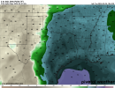
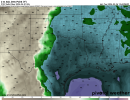
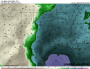
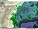
Yeah, the dews are very impressive, and would likely give ample moisture for a multi-day threat, not to mention flooding issues.Today's model runs have decent widespread dewpoints early next week.
Regardless of what the next runs have, we're gonna have some type of threat next week and probably beyond that.
I've already given my County Emergency manager a heads up
atrainguy
Member
NorthGaWeather
Member
If my math is correct, today is the 30th anniversary of the Palm Sunday tornado outbreak in 1994. This event is what ultimately shaped my interest in weather as a kid, and I'm sure others on this board as well.
- Thread starter
- #1,018
KevinH
Member
Oops… did I just start a new thread out loud? ")
Not saying the potential event next week is going to produce, but I think it could/(should?) be an interesting discussion…
 talkweather.com
Not saying the potential event next week is going to produce, but I think it could/(should?) be an interesting discussion…
Severe weather threat 3/31(?)-4/2/2024
I almost hate to do this BUT here we are. While it is too early to say how this potential event will perform, we can still have fun discussing it :) The SPC isn’t QUITE ready to pull the trigger on highlighting an area, but I would not be surprised if they did for the time frame indicated. The...
TileDude
Member
Correct today is the anniversary. James Spann had a complete story on his FB page this morning recapping the event.If my math is correct, today is the 30th anniversary of the Palm Sunday tornado outbreak in 1994. This event is what ultimately shaped my interest in weather as a kid, and I'm sure others on this board as well.
Why is wx Twitter so insufferable.
And all these people making hypothetical tornado outbreak situations that kills a lot of people. Makes me wonder do some of the people have there head screwed on right...
And all these people making hypothetical tornado outbreak situations that kills a lot of people. Makes me wonder do some of the people have there head screwed on right...