- Moderator
- #301
So glad we have a basement now. We're hosting a watch party Saturday night for WWE Royal Rumble and I'm glad we have a place to go just in case, but man, the guys are going to be MAD if they miss any of it. Lol
Follow along with the video below to see how to install our site as a web app on your home screen.
Note: This feature may not be available in some browsers.


Wait…. You are MARRIED?!Gunna try and go chasing or atleast setup at a area where I can see a long distance if there's anything on Saturday since I'm off work for once on a potential severe event lol. I really wanna see a tornado for once lol it's on my bucket list now my wife does as well.
Seems like the low pressure is slowly getting deeper each day of new runs
March 13th is my 3 year anniversary lol I've been married the entire time. I've been on this forum lolWait…. You are MARRIED?!
I was today years old lol
I didn’t know HA!March 13th is my 3 year anniversary lol I've been married the entire time. I've been on this forum lol
I do not, I only have a TwitterI would like to chase, but not looking to promising. Uncle Ju Ju you got a fb?

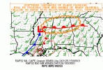
...THERE IS A MARGINAL RISK OF SEVERE THUNDERSTORMS FOR PARTS OF
LA/MS/AL...EXTREME SOUTHERN TN...WESTERN GA...FL PANHANDLE...
...SUMMARY...
A few strong to severe thunderstorms are possible across parts of
the Southeast on Thursday.
...Southeast...
A mid/upper-level shortwave trough is forecast to move from the
ArkLaTex region toward the Ohio Valley on Thursday. This shortwave
will likely be accompanied by a weak surface low, as a trailing
outflow-reinforced cold front sags southeastward across parts of
LA/MS/AL. Extensive convection will likely be ongoing Thursday
morning near the front, with scattered morning storms also possible
farther east into parts of AL/TN, as rich low-level moisture
continues to advance gradually northward across the region.
Details remain unclear regarding convective evolution on Thursday,
but guidance generally suggests potential for an MCS to develop
overnight during the D1/Wednesday period, and then propagate
east-northeastward into Thursday morning. While there may be a
tendency for the cold front to undercut convection to some extent,
favorable low-level and deep-layer shear may support some organized
storm structures capable of producing locally damaging wind and/or a
brief tornado across parts of LA/MS into western AL.
With time, the ejecting shortwave will become increasingly displaced
from the effective warm sector, so the maintenance of organized
convection into Thursday afternoon remains uncertain. However, a few
stronger storms could persist into north AL and perhaps northwest
GA, with a continued threat of locally damaging wind and/or a brief
tornado. A nonzero severe threat could also accompany any stronger
pre-frontal convection, though the extent and favored location of
any such threat remains uncertain.
Late Thursday night, some redevelopment of convection will be
possible near the LA Gulf Coast. Any such development would likely
be somewhat elevated, but a few stronger storms cannot be ruled out
near the end of the forecast period near or just off of the LA
coast.
..Dean.. 01/24/2024

...THERE IS A SLIGHT RISK OF SEVERE THUNDERSTORMS ACROSS PARTS OF
MISSISSIPPI AND ALABAMA...
...SUMMARY...
Severe thunderstorms are possible across the central Gulf Coast
States and Tennessee Valley today, especially across parts of
southern/eastern Mississippi and southeast Louisiana into Alabama.
...Central Gulf Coast States/Tennessee Valley...
A linearly organized band of thunderstorms is ongoing late this
morning across south-central/southeast Mississippi and southeast
Louisiana, with some showers/thunderstorms also ongoing across the
preceding warm sector across Alabama and eastern Mississippi. Cloud
cover remains semi-prevalent in the warm sector, and this may tend
to somewhat hinder parcel accelerations including the vigor of
line-preceding storms, although additional low-level moistening will
continue to occur during the day and be somewhat of an offsetting
thermodynamic factor.
Overall severe-conducive scenario is kinematically/dynamically
supported by the steady northeastward ejection of a shortwave trough
over the Ozarks toward the Ohio/Tennessee Valleys through tonight,
with a similar northeastward transition of strong 850 mb/700 mb
winds (50+ kt in both cases) across Mississippi/Alabama toward
eastern Tennessee and the southern Appalachians. This will allow for
the continuation of well-organized storms as additional heating
destabilization occurs and some additional updraft intensification
potentially materializes. Isolated damaging winds are expected
today, particularly across southeast/east-central Mississippi into
western Alabama, with tornadoes a possibility as well given the
degree of shear/SRH within the lowest 1-2 km AGL. At least some
severe risk, likely on a more isolated/marginal basis, could move
into additional parts of the Tennessee Valley/southern Appalachians
by late afternoon and evening.
..Guyer/Lyons.. 01/25/2024