
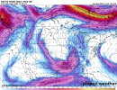
Southern tip of Florida is going to be rocking tonight.
Navigation
Install the app
How to install the app on iOS
Follow along with the video below to see how to install our site as a web app on your home screen.
Note: This feature may not be available in some browsers.
More options
-
Welcome to TalkWeather! We see you lurking around TalkWeather! Take the extra step and join us today to view attachments, see less ads and maybe even join the discussion. CLICK TO JOIN TALKWEATHER
You are using an out of date browser. It may not display this or other websites correctly.
You should upgrade or use an alternative browser.
You should upgrade or use an alternative browser.
Severe Weather 2023
- Thread starter KevinH
- Start date
Let's name it before TWC does.....
The Miami area looks like a hotzone early tommorow morning for some potential spin ups.
SPC says Tornado Watch possible tonight.
Storm Prediction Center Mesoscale Discussion 2331
Severe weather, tornado, thunderstorm, fire weather, storm report, tornado watch, severe thunderstorm watch, mesoscale discussion, convective outlook products from the Storm Prediction Center.
www.spc.noaa.gov
SUMMARY...Strong to potentially severe thunderstorms may move ashore
from the Gulf of Mexico over the next several hours. Isolated
tornadoes and damaging gusts are the main threats. The need for a
Tornado Watch issuance depends on how much instability can precede
the approaching line of thunderstorms.
DISCUSSION...A surface low continues to deepen across the eastern
Gulf of Mexico and approach the FL Peninsula as an upper-level
trough continues to amplify over the MS Valley. A confluence band
preceding the aforementioned surface low is comprised of convection
that has percolated in intensity over the last few hours, and is
poised to move ashore sometime before Midnight EST. Widespread rain
and convection have been overspreading the Peninsula for much of the
day, with 00Z soundings over TBW and MFL depicting low/mid-level
lapse rates barely exceeding 5 C/km. Despite low 70s F dewpoints,
buoyancy has been meager so far, though gradual increases in
instability are possible across southern FL tonight.
Shear profiles are impressive ahead of the rapidly deepening surface
low, with the same aforementioned observed soundings showing very
large, curved hodographs in the 0-3 km layer. As such, it is not out
of the question for a few damaging gusts or tornadoes to occur if a
persistent updraft can develop and ingest any available
surface-based, unstable parcels. As such, conditions are being
monitored for the need of a Tornado Watch issuance.
TH2002
Member
- Messages
- 4,973
- Reaction score
- 11,113
- Location
- California, United States
- Special Affiliations
- SKYWARN® Volunteer
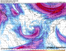
A small but stout supercell (currently Special Marine-warned) could cause problems on land if it holds together and makes landfall somewhere west of Tampa in the next 1-2 hours.
CheeselandSkies
Member
No reports...lack of instability killed this setup (in FL).
Definitely was the thermos dragging on this one, the wind fields got pretty gnarly in some areas given the proximity of the low, so glad the Florida portion was a sleeper.No reports...lack of instability killed this setup (in FL).
TH2002
Member
- Messages
- 4,973
- Reaction score
- 11,113
- Location
- California, United States
- Special Affiliations
- SKYWARN® Volunteer
TOG near Myrtle Beach

TH2002
Member
- Messages
- 4,973
- Reaction score
- 11,113
- Location
- California, United States
- Special Affiliations
- SKYWARN® Volunteer
Seems it was a rather brief spin-up, as the TDS only lasted for one or two scans. Storm still has a hook and couplet though, so could produce again at any time.
TH2002
Member
- Messages
- 4,973
- Reaction score
- 11,113
- Location
- California, United States
- Special Affiliations
- SKYWARN® Volunteer
Healthy squall line now moving along the Carolina Coast.
southmdwatcher
Member
Flash Flood Emergency in eastern Georgetown County SC, right behind that embedded tornadic supercell, a train of heavy showers and storms continue into the Myrtle Beach area.
warneagle
Member
13" of rain and it's still just surging in. Really bad situation.
southmdwatcher
Member
Just north of McClellanville SC up to Georgetown SC now has 12 plus inches of rain with an onshore wind blocking the tide, this still is not showing any signs of deviating. LSR report 7 miles northeast of McClellanville has 12.21 inches of rain since Midnight and continues as of 15 minutes ago.
- Admin
- #1,937
- Messages
- 3,618
- Reaction score
- 3,431
- Location
- Fayetteville, AR
- Special Affiliations
- SKYWARN® Volunteer
respect the poly-cone-tri-gon

When you're trying to draw a dog using the straight line tool in MSPaint but you've had too much to drink...

- Moderator
- #1,940
So what's the thoughts on potential for severe weather Sunday into Monday?
I hope not. We don't need reindeers identifying as cows.