OHWX97
Member
This is insane. The supercell has been producing tornadoes for at least 50 miles now and I doubt it's done yet.
Follow along with the video below to see how to install our site as a web app on your home screen.
Note: This feature may not be available in some browsers.
I doubt we'll hear much of anything until daylight. Other than South Salem, which is a tiny village of about 200 residence, population has been very sparse thus far, however Lancaster is in the path of this thing.Any word on damage yet? Haven't heard anything yet on social media.
Tarlton may have gotten hit. Hard to tell, but it looks like there was a tiny debris signature for a few frames as it moved through.Yet another likely tornado approaching the northern edge of Tarlton. This thing just won't quit.
Seems like everyone was expecting a big uptick last spring in severe wx. Which it was to some degree, but really more I’m looking at teleconnections and other factors , just think things will really amp up this winter into next spring with the latest Niña actually getting stronger than forecasted .
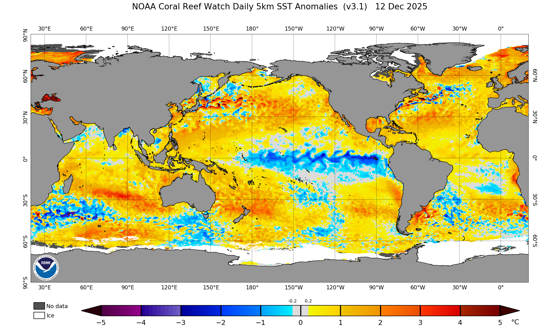
We've had a lot of subtropical jet influence the last few years and I think it has to do with how anomalously warm the EPAC is between 10N and 30N. We shall see if that gets eroded over the coming weeks, but this is very unusual in a -ENSO...and thinking back it seems like the EPAC in this region has been like this since the 2015-2016 super El Nino.Agreed, 3/17 in particular was not as significant as I anticipated. 3/25 was much closer but still could have been much worse. There seems to be "something" keeping a lid on realized vs. potential ceiling of severe weather events over the last several years, even for ones that look very ominous right up to the 11th hour (most notably 5/20/19, but others as well). Obviously a good thing from a (relative lack of) death and destruction perspective, but a bit frustrating from an enthusiast/chaser perspective. Also, the flip side of this is that the higher end/higher impact events have been happening on more subtle/harder to forecast setups, which is not good for all concerned.

That makesNew Salem, OH tornado has been rated EF2.

Gonna need the -NAO/east coast cut off troughing to resolve first before the SE U.S. gets anything of substance in my opinion. The -NAO in particular looks to hang around into early November at least...Potent system on euro bears watching for severe weather Tennessee valley regions and midsouth…
