Navigation
Install the app
How to install the app on iOS
Follow along with the video below to see how to install our site as a web app on your home screen.
Note: This feature may not be available in some browsers.
More options
-
Welcome to TalkWeather! We see you lurking around TalkWeather! Take the extra step and join us today to view attachments, see less ads and maybe even join the discussion. CLICK TO JOIN TALKWEATHER
You are using an out of date browser. It may not display this or other websites correctly.
You should upgrade or use an alternative browser.
You should upgrade or use an alternative browser.
Severe Threat May 15-16, 2025
- Thread starter CheeselandSkies
- Start date
DanLarsen34
Member
Just to be clear: This SHOULD change once these storms get further into SE Missouri. There's not a lot of observed surface data out there, but there does appear to be better backing the closer you get to the MS River.The primary limiting factor I see right now in the observed data is the lack of backed surface winds. Because the wind profiles in place right now in close proximity to these supercells are basically unidirectional, especially in Missouri, we're going to see them struggle to produce any kind of tornadoes over the next 2-3 hours barring mesoscale interactions like storm mergers or terrain locally enhancing low-level shear.
TornadoFan
Member
And the first tornado warning of the day goes to.....Delaware.
Agreed. The biggest thing to me is maintaining the discrete storm mode throughout.Just to be clear: This SHOULD change once these storms get further into SE Missouri. There's not a lot of observed surface data out there, but there does appear to be better backing the closer you get to the MS River.
Ozonelayer
Member
Yeah. Also in IL and western KY there is much better backing from the south/southeast via live cameras in Paducah.Just to be clear: This SHOULD change once these storms get further into SE Missouri. There's not a lot of observed surface data out there, but there does appear to be better backing the closer you get to the MS River.
New Jersey was first, actually.And the first tornado warning of the day goes to.....Delaware.
klouzek7079
Member
They've actually had a few T warnings earlier as well, I just didn't want to clutter the discussion with them hahaAnd the first tornado warning of the day goes to.....Delaware.
Kds86z
Member
Well actually new jersey.. lol from earlierAnd the first tornado warning of the day goes to.....Delaware.
UpperLevelLOL
Member
Left splits galore in this line in MO so far
Kds86z
Member
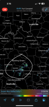
Tor possible tag
klouzek7079
Member
Tor possible tag
Storm north of that just got a tor possible tag as well
Aaron Rider
Member
For the record, it feels vaguely that way even in central Pennsylvania. Sometimes I observe that when tornadoes are active way to the westThe air in central MO definitely has that "feel" to it. Very warm and muggy with a slight unnerving breeze. Will be keeping an eye out as the cold front moves in.
Cyclonic Paracosm
Member
when is main event in like cdt/edt
Kds86z
Member
Definitely here humid in Pa today. Md out for possible severe.For the record, it feels vaguely that way even in central Pennsylvania. Sometimes I observe that when tornadoes are active way to the west
TornadoFan
Member
TOR warning for the storm east of Springfield.


