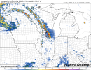
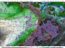
.LONG TERM...
(Thursday night through Tuesday)
Issued at 208 AM EDT Wed May 14 2025
Key Messages:
- Afternoon highs
likely to be above average through the period
- Chances for thunderstorms (some strong to severe) each
afternoon through early next week
The long term forecast picks up on Friday morning with quasi-zonal
flow at the mid-levels and the western fringes of a broad surface
high overspreading much of the Southeast. Our sensible weather late
week and beyond will be governed by a combination of several
shortwaves traversing the benign mid-level
flow, and a frontal
boundary approaching from the northwest beginning early Friday.
Global model guidance suggests the potential for the aforementioned
front to stall out across the midsection of the state, which, in
concert with any reinforcing mid-level perturbations, will serve to
support the development of
convection each afternoon. Beginning late
Friday, a mid-level
closed low will nudge nearly due eastward across
the Great Lakes toward New England. As it does so, a core of
enhanced
flow rounding the base of the broader
trough will support a
surge in bulk
shear for the northern half of the forecast area (on
the order of 40-60kts per
ensembles). Expect strong, unidirectional
shear profiles to linger until the
closed low begins to exit the
Eastern Seaboard Monday into Tuesday, which combined with
instability on the order of 1000-2000
J/kg, may allow for upscale
growth of any patchy
convection into a more organized complex of
storms. Both
GFS and Euro guidance show signals that suggest
multiple waves of semi-organized thunderstorms are possible Friday
through Monday. No areas are currently formally outlooked by
SPC,
but strong to marginally severe storms seem most probable early
Saturday into Sunday when frontal forcing is most potent. Our
primary concern within any lines of thunderstorms will be the
potential for
isolated damaging wind gusts embedded within the
strongest segments of the line.
Thanks to a conveyor belt of warm, moist, southwesterly
fetch off of
the Gulf at the surface, temperatures will soar through the
extended. Highs are
likely to top out in the mid-80s to mid-90s each
day (aside from the terrain of northeast Georgia, which is
progged
to remain in the mid-70s to lower-80s), as much as 8-12 degrees
above average. Will need to keep an eye on the impacts of convective
coverage on temperatures on Friday and Saturday, as Atlanta may
approach record highs both days. Expect lows in the lower 60s to
lower 70s each night.
96


