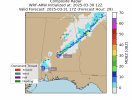
Hot off the presses! I'm going to post as they come in (it's still running), but here's some high-res WRF-ARW output from me, starting at 19z today and going to tonight. I'm overlaying the Threat Potential to show general trends of where it thinks storms may pose a danger. I centered it on Birmingham, AL, but I should've made the window a bit bigger to capture more of TN and MS. Oh well, maybe next time!
At 22Z, it picks up on some hail potential in SE AL.

Then a couple of cells in north AL early Monday overnight AM with some hail potential as well:

Those same couple of cells (it looks like anyway) the next hour have some tornado potential:

Back to hail potential the next hour, same cell looks like:

At 7 AM tomorrow, hail potential north of Birmingham:

The Tornado Risk Index (scaled from 0 to 10 and hatched if significant EF2+ tornadoes are predicted possible by the model) has a max in the overnight hours of 5/10 in NW AL. For the rest of the event (so far, it's run until early afternoon Monday), the risk doesn't get any higher.

So IF this model run is accurate, the tornado risk over AL especially is on the lower end but can't be ignored. Of course, (and I should've put this at the top of my post), this is NOWCAST time, models are just toys during this period. I'm just playing with my model, y'all, chill lol It's really time to watch the observed soundings, the atmosphere, the radar, and make the best decisions in the here and now. Thanks everyone!


