Equus
Member
Makes sense, everything is definitely having trouble with the worked over air mass. Would not let guard down though.
Follow along with the video below to see how to install our site as a web app on your home screen.
Note: This feature may not be available in some browsers.
Storms are struggling but definitely not putting it past them to turn severe on a dime.Makes sense, everything is definitely having trouble with the worked over air mass. Would not let guard down though.
oh my gosh....Do I spy that violent tornado hallmark "matchsticking" and granulation of debris...
oh my gosh....
For sure we are 100’percent not done ywtwow what a day. the widespread showers this morning caused the highest instability to be placed further south than expected, but the shear was just as high there. I am not sure we are 100% done yet.
New SPC update brings us down to an Enhanced.
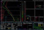
View attachment 7655
I suspected the rain and warm front "moving north" were going to be a problem. Rule of thumb holding true so far.wow what a day. the widespread showers this morning caused the highest instability to be placed further south than expected, but the shear was just as high there. I am not sure we are 100% done yet.
976
WFUS54 KOHX 260113
TOROHX
TNC037-041-149-159-187-189-260145-
/O.NEW.KOHX.TO.W.0004.210326T0113Z-210326T0145Z/
BULLETIN - EAS ACTIVATION REQUESTED
Tornado Warning
National Weather Service Nashville TN
813 PM CDT Thu Mar 25 2021
The National Weather Service in Nashville has issued a
* Tornado Warning for...
Southern Smith County in Middle Tennessee...
Southeastern Davidson County in Middle Tennessee...
Northwestern De Kalb County in Middle Tennessee...
Northwestern Rutherford County in Middle Tennessee...
Northeastern Williamson County in Middle Tennessee...
Central Wilson County in Middle Tennessee...
* Until 845 PM CDT.
* At 813 PM CDT, a severe thunderstorm capable of producing a tornado
was located near La Vergne, or 13 miles southeast of Nashville,
moving east at 45 mph.
HAZARD...Tornado and quarter size hail.
SOURCE...Radar indicated rotation.
IMPACT...Flying debris will be dangerous to those caught without
shelter. Mobile homes will be damaged or destroyed.
Damage to roofs, windows, and vehicles will occur. Tree
damage is likely.
* Locations impacted include...
Lebanon, Carthage, Smyrna, La Vergne, Mount Juliet, Nolensville,
Watertown, Gordonsville, Rural Hill, Antioch, Walterhill, Hickman,
South Carthage, Alexandria, Tuckers Crossroads, Cedars Of Lebanon
State Park, Gladeville and Percy Priest Lake.
This includes the following highways...
Interstate 40 between mile markers 233 and 264.
Interstate 24 between mile markers 56 and 70.
Interstate 840 between mile markers 59 and 76.
PRECAUTIONARY/PREPAREDNESS ACTIONS...
Heavy rainfall may hide this tornado. Do not wait to see or hear the
tornado. TAKE COVER NOW!
Torrential rainfall is occurring with this storm, and may lead to
flash flooding. Do not drive your vehicle through flooded roadways.
&&
LAT...LON 3590 8668 3607 8675 3634 8593 3608 8583
TIME...MOT...LOC 0113Z 248DEG 40KT 3603 8662
TORNADO...RADAR INDICATED
HAIL...1.00IN
$$
Rose
I suspected the rain and warm front "moving north" were going to be a problem. Rule of thumb holding true so far.
Hopefully, this issue gets studied and the issues identified and corrected.And why didn't the warm front "move north"? Not just because of the rain. The dynamic support that was supposed to make that a non-issue did not materialize to the extent expected. The models universally over-amped the upper system, so the surface response was not as potent as anticipated as close in to the event as 12Z this morning.
At least, that's my rudimentary analysis. Experts, please chime in.