
Rocket1
Member
How is the Huntsville/Hazel Green/Fayetteville area looking as far as CAPE & shear?
Follow along with the video below to see how to install our site as a web app on your home screen.
Note: This feature may not be available in some browsers.
I doDoes anyone use radar scope pro tier 2?
I had almost 2.5" at my house in Madison last night. One storm was about 2 a.m., the other around 3:30. Very heavy rain and what comes tomorrow will no doubt cause flooding.Flooding May end up being a big part of this storm as well. There are areas between Montgomery and Hattiesburg have been getting dumped on for about 12hrs now.
I love that movie. 'Some things in here don't react well to bulletzzz'.....Howdy, everyone. We are going to complete a routine clearing of the baffles aka switch out our web servers in a few minutes. TalkWeather may appear down for less than 2 minutes.
Captain Ramius:
Give me a ping, Vasili. One ping only, please.
Capt. Vasili Borodin:
Aye, Captain.
I just have the basic version, not Pro.Does anyone use radar scope pro tier 2?
Oh goodness. I apologize for my middle school self. I don't know if I came up with it first or my friend, but I remember typing it a few times. JO banned me at one point, a story I enjoy telling these days.So you are SEWS? Ha ha.. you really ruffled a lot of feathers. I actually predate that back in the 90s when I got started really from day 1. The forum was managed by JO. Anyways, back to current discussion.

Me too!!Same")
Sorry for the late reply, it can certainly be hard to find, which is why I personally have it bookmarked. https://www.spc.noaa.gov/exper/sref/sref.php?run=latest&id=SREF_prob_combined_sigtor__Where did you get this from? I've looked up SPC's SREF, but the display never looks like this.
Or other MSU grads. 96 Communications/English Double Major. Minor in BBQ and Dudy NobleMarooned, I was going to say the same thing. Many have gone to MSU to become meteorologists. The posters have matured and become more educated. Me - still the same as I was back then, educationally. Just a retired engineer now.
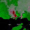
Brandon Clement is on that cell but isn't currently streaming, possibly due to lack of cell serviceThat cell south of Jackson Miss is getting that look to it
Lol, those were so funny!!!Indeed. Sorry for the fake snowcasts from the "SEWS" that me and my old friend made. Makes a funny story to tell the meteorologists I've worked with though.
Dothan City Schools (Houston County in Southeast Alabama) says they'll keep schools on normal schedule Wednesday and evaluate for Thursday.
If it hasn't already been mentioned, Gov. Ivey has declared a state of Emergency for all 67 Alabama counties starting at 6pm.


")