• Welcome to TalkWeather!
    We see you lurking around TalkWeather! Take the extra step and join us today to view attachments, see less ads and maybe even join the discussion.
    CLICK TO JOIN TALKWEATHER

Severe Potential 6/22-6/23

Big ole goose egg on the day. We may get a trace before midnight....boy, how frustrating seeing it all going around. You can see how Tuscaloosa Co, particularly the southern half, has only seen about 0.5-1" in the last 2 weeks. It's approaching one month since our last day with at least 1" of rain.
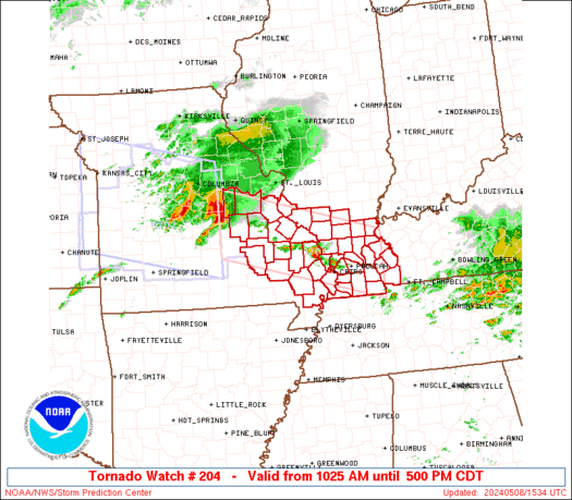
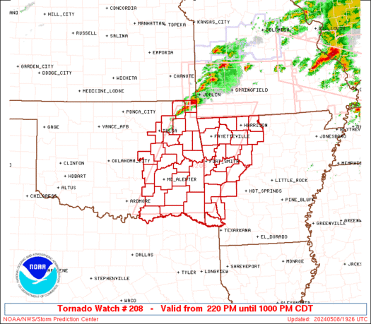
And this morning's complex fell apart as outflow surged out ahead of it, while areas just north and east have received several inches. At this point, I'm just beside myself. Will it ever rain in Tuscaloosa proper again?
 
Not sure if the SPC will issue a severe t-storm watch for north Alabama but there is a nice complex of severe thunderstorms approaching Pickwick Lake. Speaking of lake, I feel bad for organizers of the Hydroboat Race on Lake Guntersville and this weekend’s weather is terrible.
 
ww0204_radar_init_resize.gif
 
TOR for Colbert County and Franklin County, Al. Radar indicated.
 
A Tornado Watch has been issued for N Alabama until 10 PM
 
Goes 16 GLM of the storm that is in NE Alabama.

GLM Goes 16.png
 
 
There is a MCS over western Arkansas this morning. Will these storms make it to north Alabama this evening or will they stay north in Tennessee?
All of the Hi-Res model guidance suggests the MCS dies out in East AR and redevelops convection later on further NE in TN/Kentucky. WRF is the only model to show it lasting even marginally past Arkansas. But given the circumstances and recent model accuracy I would say, maybe? I haven't analyzed the environment in MS/AL/TN so I'm just going off guidance and not mesoscale details.
 
 
Back
Top