champal3003
Member
Also, 10% hatched area for tornadoes in there with a mention of one or two long track tornadoes if discrete cells form ahead of it.
Follow along with the video below to see how to install our site as a web app on your home screen.
Note: This feature may not be available in some browsers.
Good luck and stay safe!!
Not feeling this current setup?I’m going to sleep.
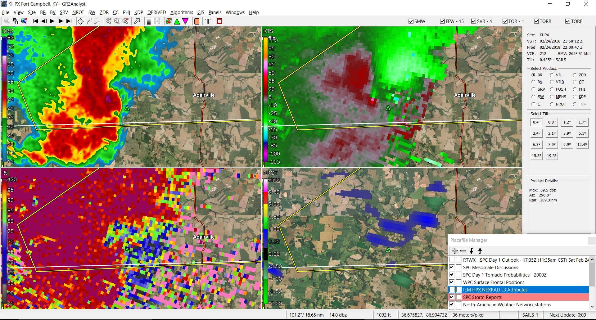
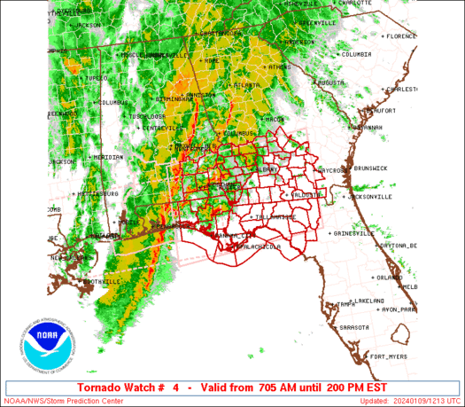
TOR for Logan and Simpson in KY, really impressive isolated cell there. Impressive on radar
Actually quite unhappy w/ the NWS in Louisville, had a couplet and debris signature 15 minutes before the storm was even tornado warned. The cell even got severe warned while it had an obvious tornado on the ground. Pathetic.TOR for Logan and Simpson in KY, really impressive isolated cell there. Impressive on radar