CheeselandSkies
Member
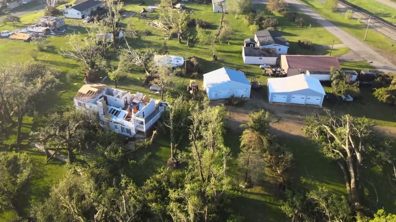
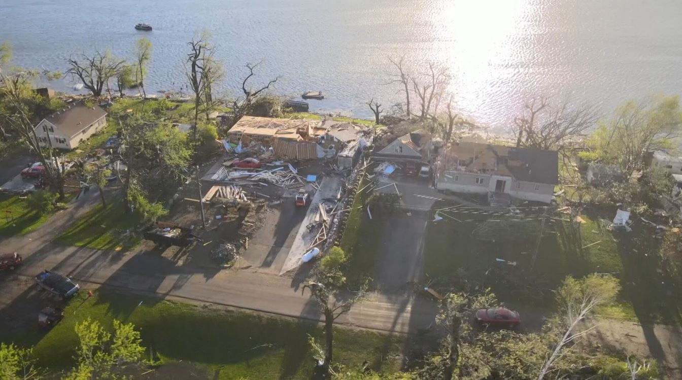
Hmm. I don't want to call it too early, but convective trends look like a large MCS is trying to form, rather than multiple tornadic supercells. Latest discussion from NWS Twin Cities seems to be picking up on this as well. Parameters are still downright scary, but storm mode is still in question here.
"Our "main event" is starting to get going with storms near the MN/SD
border at 3pm. This is a rare, high- end environment that will be
capable of producing a severe weather outbreak across the MPX
forecast area. The first concern is the potential for a few
supercells to develop in the warm sector ahead of the approaching
cold front. The WoFS has picked up a on these supercells forming over
northwest IA/southwest MN and moving northeast into central MN by
21Z. This potential will be monitored closely as they`d be capable of
producing all severe hazards including tornadoes. However, recent
trends from the WoFS has been to back down on the intensity of these
supercells, instead showing a severe QLCS coming out of SD."
It's a neat concept, but I've not been real impressed with WoFS so far. I recall several days over the course of the last month or so that it's portrayed intense supercells in areas that ended up cap busting.