Navigation
Install the app
How to install the app on iOS
Follow along with the video below to see how to install our site as a web app on your home screen.
Note: This feature may not be available in some browsers.
More options
-
Welcome to TalkWeather! We see you lurking around TalkWeather! Take the extra step and join us today to view attachments, see less ads and maybe even join the discussion. CLICK TO JOIN TALKWEATHER
You are using an out of date browser. It may not display this or other websites correctly.
You should upgrade or use an alternative browser.
You should upgrade or use an alternative browser.
Hurricane Melissa
- Thread starter Jacob Aden
- Start date
Just saw that a category 5 was going to hit Jamaica. Less than ideal scenario.
Smokedevil
Member
I work in Healthcare, EMS, so I naturally look at the human element. If this thing makes landfall at 190 mph, even 170, the loss of life will be catastrophic. Thats not hyperbole either. There is no where to hide from it on such a small island.
WeathermanLeprechaun
Member
Seems like Melissa is exhibiting dual outflow channels that should help maintain and further intensify the storm with RI continuing. Sub-900 is VERY likely.
TornadoFan
Member
Here we go again
I saw on twitter earlier someone speculating about how deadly the flash flooding will be with the storm traversing up some mountainous terrainI work in Healthcare, EMS, so I naturally look at the human element. If this thing makes landfall at 190 mph, even 170, the loss of life will be catastrophic. Thats not hyperbole either. There is no where to hide from it on such a small island.
Ozonelayer
Member
Here we go again
This is awe-inspiring and terrifying at the same time. It just won't stop, it's as if it can't stop.
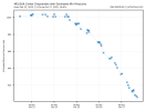
Intensification since yesterday at 200 pm in mph and mb:
2 pm yesterday- 140/946
5 pm yesterday- 145/941
8 pm yesterday- 145/933
11 pm yesterday- 145/933
2 am today- 150/926
5 am today- 160/917
8 am today- 160/913
11 am today- 165/908
2 pm (most recent) - 175/906
That’s a 35 mph increase /40 mb drop in intensity since 24 hours ago at this same time.
2 pm yesterday- 140/946
5 pm yesterday- 145/941
8 pm yesterday- 145/933
11 pm yesterday- 145/933
2 am today- 150/926
5 am today- 160/917
8 am today- 160/913
11 am today- 165/908
2 pm (most recent) - 175/906
That’s a 35 mph increase /40 mb drop in intensity since 24 hours ago at this same time.
N0mz
Member
The intensification overall hasn't been extremely quick, but it has been remarkably consistent and long-lasting.Intensification since yesterday at 200 pm in mph and mb:
2 pm yesterday- 140/946
5 pm yesterday- 145/941
8 pm yesterday- 145/933
11 pm yesterday- 145/933
2 am today- 150/926
5 am today- 160/917
8 am today- 160/913
11 am today- 165/908
2 pm (most recent) - 175/906
That’s a 35 mph increase /40 mb drop in intensity since 24 hours ago at this same time.
Going to be some ridiculous mudslidesI saw on twitter earlier someone speculating about how deadly the flash flooding will be with the storm traversing up some mountainous terrain
Reminds me of Haiyan, unwavering in intensity, just consistent strengthening with no signs of stopping. What's different here is that you simply don't see this in the Atlantic, that tends to be a typhoon thing.The intensification overall hasn't been extremely quick, but it has been remarkably consistent and long-lasting.
N0mz
Member
The NHC key message for Jamaica is appalling, but here is the whole 11 a.m. list:Just saw that a category 5 was going to hit Jamaica. Less than ideal scenario.
Key Messages:
1. Jamaica: Do not venture out of your safe shelter. Catastrophic
and life-threatening flash flooding and numerous landslides are
likely today through Tuesday. Catastrophic winds in the eyewall have
the potential to cause total structural failure especially in higher
elevation areas tonight and early Tuesday. This will result in
extensive infrastructural damage, long-lasting power and
communication outages, and isolated communities. Life-threatening
storm surge and damaging waves are expected along the southern coast
through Tuesday.
2. Haiti and the Dominican Republic: Catastrophic and
life-threatening flash flooding and landslides are expected across
southwestern Haiti and southern portions of the Dominican Republic
through midweek. In Haiti, extensive infrastructural damage and
isolation of communities is likely. Tropical storm conditions are
expected late Tuesday and Wednesday.
3. Eastern Cuba: Heavy rainfall with life-threatening and
potentially catastrophic flash flooding and landslides is expected
beginning today. Life-threatening storm surge and damaging winds are
expected late Tuesday and Tuesday night. Preparations should be
rushed to completion.
4. Southeast Bahamas and the Turks and Caicos: Hurricane conditions,
life-threatening storm surge, and heavy rainfall are possible on
Wednesday. Residents should follow advice given by local officials
and be sure to have preparations complete by Tuesday night.
NorthGaWeather
Member
Be careful with SFMR as it is highly unreliable, especially above 120/130kts. NOAA planes discontinued transmission of the data (AF still does) due to it. It may be dead on sometimes, but it does run hot.I'm hearing from people SFMR got 186 but I'm waiting on CyclonicWX to show it.
Last edited:
N0mz
Member
Where you been? lolJust saw that a category 5 was going to hit Jamaica. Less than ideal scenario.
A few of us discussed this yesterday and the human cost will be immense, unfortunately. Logistically, things will be extremely difficult and supplying aid could be almost impossible for a lot of communities. Only saving grace is that it doesn't look like the strongest winds will impact Kingston directly, but conversely, the mang smaller communities on the southwest part of the island are going to bear the bring and potentially be unreachable for weeks or months.I work in Healthcare, EMS, so I naturally look at the human element. If this thing makes landfall at 190 mph, even 170, the loss of life will be catastrophic. Thats not hyperbole either. There is no where to hide from it on such a small island.
lake.effect
Member
This is the webcam that has my attention:
It's in a deep river valley so it will be sheltered from the highest winds. This location might miss the inner eyewall but it should get solid cat 2/3 winds. But the main reason I'm watching this like a hawk is for flooding. I fully expect everything in this camera's view to be washed away by tomorrow.
It's in a deep river valley so it will be sheltered from the highest winds. This location might miss the inner eyewall but it should get solid cat 2/3 winds. But the main reason I'm watching this like a hawk is for flooding. I fully expect everything in this camera's view to be washed away by tomorrow.
Off topic but -- good, they don't need a Caribbean-wide tsunami right now. Hopefully there won't be much even locally way over in the Leewards. (An aftershock is mentioned, too.)
TSUNAMI INFORMATION STATEMENT NUMBER 1
NWS PACIFIC TSUNAMI WARNING CENTER HONOLULU HI
1246 UTC MON OCT 27 2025
....TSUNAMI INFORMATION STATEMENT...
**** NOTICE **** NOTICE **** NOTICE **** NOTICE **** NOTICE *****
THIS STATEMENT IS ISSUED FOR INFORMATION ONLY IN SUPPORT OF THE
UNESCO/IOC TSUNAMI AND OTHER COASTAL HAZARDS WARNING SYSTEM FOR
THE CARIBBEAN AND ADJACENT REGIONS AND IS MEANT FOR NATIONAL
AUTHORITIES IN EACH COUNTRY OF THAT SYSTEM.
NATIONAL AUTHORITIES WILL DETERMINE THE APPROPRIATE LEVEL OF
ALERT FOR EACH COUNTRY AND MAY ISSUE ADDITIONAL OR MORE REFINED
INFORMATION.
**** NOTICE **** NOTICE **** NOTICE **** NOTICE **** NOTICE *****
PRELIMINARY EARTHQUAKE PARAMETERS
---------------------------------
* MAGNITUDE 6.8
* ORIGIN TIME 1239 UTC OCT 27 2025
* COORDINATES 16.5 NORTH 59.5 WEST
* DEPTH 0 KM / 0 MILES
* LOCATION LEEWARD ISLANDS
EVALUATION
----------
* AN EARTHQUAKE WITH A PRELIMINARY MAGNITUDE OF 6.8 OCCURRED IN
THE LEEWARD ISLANDS AT 1239 UTC ON MONDAY OCTOBER 27 2025.
* BASED ON ALL AVAILABLE DATA... THERE IS NO SIGNIFICANT
TSUNAMI THREAT FROM THIS EARTHQUAKE. HOWEVER... THERE IS A
VERY SMALL POSSIBILITY OF TSUNAMI WAVES ALONG COASTS LOCATED
NEAREST THE EPICENTER.
RECOMMENDED ACTIONS
-------------------
* NO ACTION IS REQUIRED.
NEXT UPDATE AND ADDITIONAL INFORMATION
--------------------------------------
* THIS WILL BE THE ONLY STATEMENT ISSUED FOR THIS EVENT UNLESS
ADDITIONAL DATA ARE RECEIVED OR THE SITUATION CHANGES.
* AUTHORITATIVE INFORMATION ABOUT THE EARTHQUAKE FROM THE U.S.
GEOLOGICAL SURVEY CAN BE FOUND ON THE INTERNET AT
EARTHQUAKE.USGS.GOV.
* FURTHER INFORMATION ABOUT THIS EVENT MAY BE FOUND AT
WWW.TSUNAMI.GOV.
* COASTAL REGIONS OF THE US GULF COAST... US EAST COAST... AND
THE MARITIME PROVINCES OF CANADA SHOULD REFER TO U.S.
NATIONAL TSUNAMI WARNING CENTER MESSAGES THAT CAN BE FOUND
AT WWW.TSUNAMI.GOV.
$$
TSUNAMI INFORMATION STATEMENT NUMBER 1
NWS PACIFIC TSUNAMI WARNING CENTER HONOLULU HI
1316 UTC MON OCT 27 2025
....TSUNAMI INFORMATION STATEMENT...
**** NOTICE **** NOTICE **** NOTICE **** NOTICE **** NOTICE *****
THIS STATEMENT IS ISSUED FOR INFORMATION ONLY IN SUPPORT OF THE
UNESCO/IOC TSUNAMI AND OTHER COASTAL HAZARDS WARNING SYSTEM FOR
THE CARIBBEAN AND ADJACENT REGIONS AND IS MEANT FOR NATIONAL
AUTHORITIES IN EACH COUNTRY OF THAT SYSTEM.
NATIONAL AUTHORITIES WILL DETERMINE THE APPROPRIATE LEVEL OF
ALERT FOR EACH COUNTRY AND MAY ISSUE ADDITIONAL OR MORE REFINED
INFORMATION.
**** NOTICE **** NOTICE **** NOTICE **** NOTICE **** NOTICE *****
PRELIMINARY EARTHQUAKE PARAMETERS
---------------------------------
* MAGNITUDE 6.1
* ORIGIN TIME 1255 UTC OCT 27 2025
* COORDINATES 16.5 NORTH 59.6 WEST
* DEPTH 10 KM / 6 MILES
* LOCATION LEEWARD ISLANDS
EVALUATION
----------
* AN EARTHQUAKE WITH A PRELIMINARY MAGNITUDE OF 6.1 OCCURRED IN
THE LEEWARD ISLANDS AT 1255 UTC ON MONDAY OCTOBER 27 2025.
Show quoted text


