
Lake Martin EF4
Member
According to @JPWX we've got another threat for the South end of this week. Don't quite know where but keep an eye out...
Follow along with the video below to see how to install our site as a web app on your home screen.
Note: This feature may not be available in some browsers.


 \
\
You can say pretty much goodbye to above normal tornado/severe storm activity for traditional tornado alley due to that drought.
You can say pretty much goodbye to above normal tornado/severe storm activity for traditional tornado alley due to that drought.
You can say pretty much goodbye to above normal tornado/severe storm activity for traditional tornado alley due to that drought.
It's hard to say because the drought in most of central OK and parts of southwestern KS is supposed to "remain but improve" per the 3 month drought outlook.I would definitely not say that
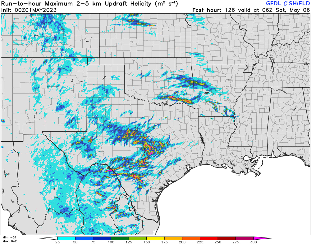
The GFS refuses to back down and now the HRRR wants to play as well. Both of the models agree the environment will be conducive for severe weather, but the window for tornado activity will be rather narrow, primarily between 21z tomorrow and 01z on Friday. Which means the primary tornado threat could be nocturnal...
Thanks. Wish the model runs on Pivotal Weather had the option to display a certain time zone instead of UTC to make it idiot-proof for dumbbells like myself.21Z Thursday - 01Z Friday is 4-8PM CDT Thursday afternoon/evening, so mostly in daylight.
