
xJownage
Member
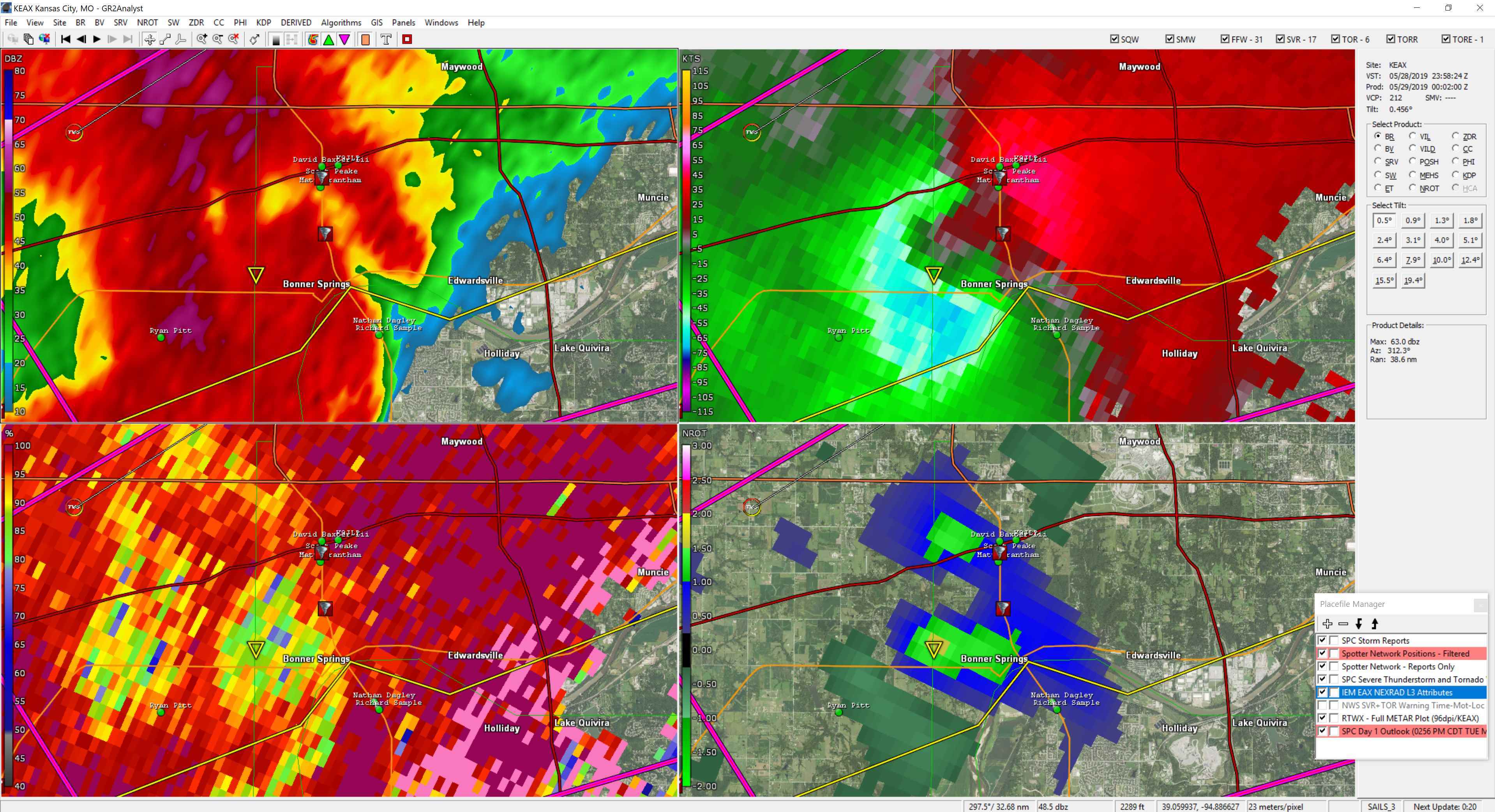
Looks like it may finally be occluding, there was a smaller cell that developed and cut the BWER which would make sense as a cause of occlusion.
EDIT: Debris signature has dissipated on radar. Hopefully it's gone at this point.
Follow along with the video below to see how to install our site as a web app on your home screen.
Note: This feature may not be available in some browsers.
Mets are calling the intensity on TV again, SMH.
My concern is that the HRRR shows an area of higher helicity and shear right over the county that Kansas City is primarily located in.
Velocities are decreasing rapidlyGuys, the broad southern rotation was actually the cycle of this storm. That broad rotation is intensifying currently and is likely to drop another tornado...this one clipping the north side of the KC metro should it drop.
Now they are. Before it was intensifying.Velocities are decreasing rapidly
Unfortunately not surprising to see significant damage already.