
Leeward Islands dodging an artillery round with this storm, geez.I see on the model predictions that there is a very good possibility that Lee becomes an upper echelon category 5, and could find its place on the list of most intense Atlantic hurricanes on record.
06z HAFS-A
View attachment 21604
Navigation
Install the app
How to install the app on iOS
Follow along with the video below to see how to install our site as a web app on your home screen.
Note: This feature may not be available in some browsers.
More options
-
Welcome to TalkWeather! We see you lurking around TalkWeather! Take the extra step and join us today to view attachments, see less ads and maybe even join the discussion. CLICK TO JOIN TALKWEATHER
You are using an out of date browser. It may not display this or other websites correctly.
You should upgrade or use an alternative browser.
You should upgrade or use an alternative browser.
Hurricane LEE
- Thread starter Casuarina Head
- Start date
- Thread starter
- #22
Casuarina Head
Member
The 12Z operational GFS did not shift southward, so it still shows TD #10 missing Hebert Box #1. It also shows the turn northward around 65°W. Confidence increases.^ In my view, the above is essentially certain to transpire—my level of confidence in this solution is 99.9%. But we shall see.
Edit: the 12Z GEFS mean also shifted considerably farther north vs. yesterday’s 12Z by day five, with most members missing Hebert Box #1. Confidence rises further.
Last edited:
The 12Z operational GFS did not shift southward, so it still shows TD #10 missing Hebert Box #1. It also shows the turn northward around 65°W. Confidence increases.
Probably also worth noting that the 12z GFS has it grazing Massachusetts and Maine as well.
- Admin
- #24
- Messages
- 3,618
- Reaction score
- 3,431
- Location
- Fayetteville, AR
- Special Affiliations
- SKYWARN® Volunteer
Is this why we ask people to drop their landfall maps in a new thread? That was always interesting to go back through after the event had passed.
warneagle
Member
NHC said themselves that they’ve never had an initial advisory that forecast 120 kt winds before. Let’s hope it manages to thread the needle and avoid land entirely because having this good of agreement on this strong of a storm this far out is concerning to say the least.As an aside, this is likely to become an extremely intense hurricane. I’ve never seen an initial advisory-package that calls for 120 knots five days out!
- Thread starter
- #26
Casuarina Head
Member
Per the ATCF, we now have Tropical Storm Lee.AL, 13, 2023090518, , BEST, 0, 129N, 411W, 35, 1006, TS
- Admin
- #27
- Messages
- 3,618
- Reaction score
- 3,431
- Location
- Fayetteville, AR
- Special Affiliations
- SKYWARN® Volunteer
I must be missing it... I don't see it. Could you help narrow the scope a little?Per the ATCF, we now have Tropical Storm Lee.
- Thread starter
- #28
Casuarina Head
Member
@WesL https://ftp.nhc.noaa.gov/atcf/btk/bal132023.datI must be missing it... I don't see it. Could you help narrow the scope a little?
Interestingly, the global models continue to trend toward a much slower and more southerly LEE a week ahead. In fact, by next Wednesday the 12Z ECMWF indicates that LEE is still near the latitude of Key West, Florida. Also, the entire pattern is delayed, with the first trough still near the westernmost Great Lakes on the run. Toward the end LEE is even bending north-northwest, as on the latest GFS, while southwest of Bermuda. Nevertheless, the overall pattern is still progressive on both models, which means that if LEE misses Bermuda, it is still very unlikely to hit the U.S. The fact that it is going to miss Hebert Box #1 further makes a hit unlikely. To increase the odds, a) LEE would need to pass through Hebert Box #1 and b) the long-range pattern would need to be much less progressive and “blockier,” i.e., retrogressive, without constant troughs sweeping through over time.
- Admin
- #29
- Messages
- 3,618
- Reaction score
- 3,431
- Location
- Fayetteville, AR
- Special Affiliations
- SKYWARN® Volunteer
Thanks! That is a useful tool!
000
WTNT33 KNHC 052050
TCPAT3
BULLETIN
Tropical Storm Lee Advisory Number 2
NWS National Hurricane Center Miami FL AL132023
500 PM AST Tue Sep 05 2023
...TROPICAL STORM LEE EXPECTED TO RAPIDLY INTENSIFY INTO AN
EXTREMELY DANGEROUS HURRICANE BY THE WEEKEND...
SUMMARY OF 500 PM AST...2100 UTC...INFORMATION
----------------------------------------------
LOCATION...13.2N 41.8W
ABOUT 1315 MI...2115 KM E OF THE LESSER ANTILLES
MAXIMUM SUSTAINED WINDS...45 MPH...75 KM/H
PRESENT MOVEMENT...WNW OR 290 DEGREES AT 16 MPH...26 KM/H
MINIMUM CENTRAL PRESSURE...1005 MB...29.68 INCHES
WATCHES AND WARNINGS
--------------------
None.
Interests in the Leeward Islands should monitor the progress of
this system.
DISCUSSION AND OUTLOOK
----------------------
At 500 PM AST (2100 UTC), the center of Tropical Storm Lee was
located near latitude 13.2 North, longitude 41.8 West. Lee is moving
toward the west-northwest near 16 mph (26 km/h), and this motion is
expected to continue for the next few days with a slight reduction
in forward speed.
Maximum sustained winds have increased to near 45 mph (75 km/h)
with higher gusts. Lee is forecast to be a hurricane within a couple
of days and will likely become a major hurricane by Friday.
Tropical-storm-force winds extend outward up to 70 miles (110 km)
from the center.
The estimated minimum central pressure is 1005 mb (29.68 inches).


Looking back at the start, rather than ahead at possible tracks, I liked this -- too basic for experts, no doubt, but it really helped this beginner see how these systems get started:
- Moderator
- #34
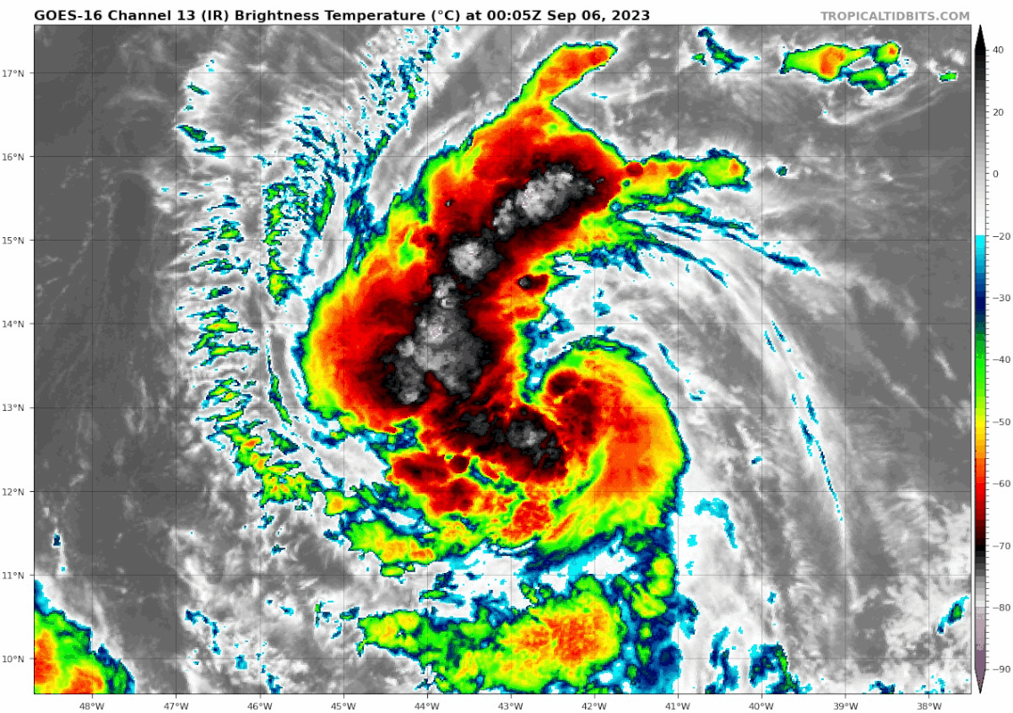
Unique satellite presentation.
If your cyclone lasts longer than 24 hours, please seek immediate medical attention..... LOLUnique satellite presentation.
- Moderator
- #36
If your cyclone lasts longer than 24 hours, please seek immediate medical attention..... LOL
Ha ha, I wasn’t thinking that way, but I am now.
Timhsv
Member

This would be catastrophic at 918 mb which would about equal a CAT5 and winds greater than 155 MPH.
- Moderator
- #38
00z
HAFS-A
Min Pressure: 913mb
Max Wind: 146knts (168mph)
HAFS-B
Min Pressure: 901mb
Max Wind: 157knts (180mph)
HAFS-A
Min Pressure: 913mb
Max Wind: 146knts (168mph)
HAFS-B
Min Pressure: 901mb
Max Wind: 157knts (180mph)
You have to go all the way back to 2005 to find a Atlantic hurricane pressure near or below 900mb. Of course those pressures occurred in the Gulf of Mexico or Caribbean Sea. The only Atlantic hurricane outside of the Caribbean and Gulf to have a pressure at or below 900mb is the 1935 Labor Day Hurricane.00z
HAFS-A
Min Pressure: 913mb
Max Wind: 146knts (168mph)
HAFS-B
Min Pressure: 901mb
Max Wind: 157knts (180mph)
