- Thread starter
- #21
Kory
Member
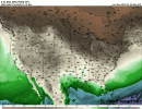
Ummm euro disagrees.Honestly I think that will be the issue for this system. The wind profile s may be there but instability will be lacking further north. I don't see anything major north of the middle of AR, MS, and AL