akt1985
Member
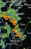
The Tornado Watch has been expanded east in Florida to include areas around Interstate 75 including Lake City, Gainesville and Ocala.
Follow along with the video below to see how to install our site as a web app on your home screen.
Note: This feature may not be available in some browsers.

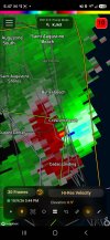
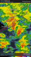
Looking at the radar and observed environment, it’s not hard to see why. These storms look incredibly healthy in a way that we would ordinarily see in a big tornado set-up.Trey is really gungho on ef2+ potential


I'm not sure air over land has properly destabilized yet. These cells keep approaching and really falling apart when they get ~15 miles away from land.


Agree. I think what I've said is still true. Tornado threat is severely limited by lack of any proper SB destabiliziation on land. Wild how robust it's been out to land so far but yeah, i don't think this threat on land really begins yet.I'm not sure air over land has properly destabilized yet. These cells keep approaching and really falling apart when they get ~15 miles away from land.
Regarding this, i know I'm a bit late but he's pretty knowledgeable at times. I agree though, his wording is extremely technical at times and just makes absolutely no sense either. I scroll thru most of his posts lmao, i don't think they need to be posted on here. He may sound like he has a point but most of his tweets are just complete big word, hyphen spam.Ok I'm sorry, but what is this guy talking about? I feel like he just throws out buzzwords and hopes it sticks half the time from what I've seen of his posts. How is this anything like a SE CO cyclone with a Plains environment?
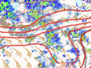
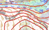
Mesoanalysis SBCAPE shows it pretty well, pretty much no instability at all inland.Agree. I think what I've said is still true. Tornado threat is severely limited by lack of any proper SB destabiliziation on land. Wild how robust it's been out to land so far but yeah, i don't think this threat on land really begins yet.

now gone, lol. been the trendTornado Warning for St. George Island, Florida.