• Welcome to TalkWeather!
    We see you lurking around TalkWeather! Take the extra step and join us today to view attachments, see less ads and maybe even join the discussion.
    CLICK TO JOIN TALKWEATHER
  • Current Tropical Systems
    Erin

Iceland's Fagradalsfjall Fires

This isn't Svartsengi related, but it is geographically close and on the same tectonic feature, the Reykjanes Ridge:


X translation:

A swarm of earthquakes began around 9pm JST on May 24th near the northern end of the Reykjanes Ridge, southwest of the Reykjanes Peninsula in Iceland, and the active state continued until 3am JST on the 25th (updates then appear to have stopped until 7am on the 25th).
● As of 3:00 JST on the 25th, the largest earthquake was a M5.1 earthquake measuring 10km at 23:21 JST on May 24th.
● Reykjanes Ridge epicenter distribution map from IMO website M-T Figure for the past 48 hours as of 3:00 JST on May 25 (18:00 UT on May 24)

RUV just did a news update (autotranslated), noting that the swarm continues, with at least 30 out of 400 temblors thus far being over M3. They report that IMO has not yet seen signs of volcanism.

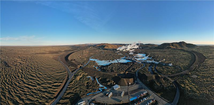
AFAIK, the nearest named submarine volcanic systems are Eldey and the submerged part of the Reykjanes system (which is west of the 2021-to-present eruptions and magmatism at Fagradalsfjall and the Sundhnuk craters).

Ah, the joys of living on a mid-ocean ridge!
 
The Eldey swarm settled down, came back weakly, and has settled down again.

The IMO update today (via GT) has a nice view of the lava berms and the Blue Lagoon complex. Emphasis added.

Svartsengi_Bjarki_November2024_Cropped.png

Continuing land rise in Svartsengi-3.6.2025​


Updated June 3


Landslides and magma accumulation continue beneath Svartsengi. However, the rate of magma accumulation continues to slow steadily compared to the rate in April and the first half of May. If magma accumulation continues at a similar rate to the past few weeks, it can still be assumed that the likelihood of a magma flow or eruption will increase as the autumn progresses. Changes in the rate of landslips, and thus magma accumulation beneath Svartsengi, may, however, affect this assessment.
 
No changes -- they're still expecting eruption chances to rise in autumn, according to today's update (autotranslated), if magma continues to accumulate. Apparently inflow has slowed down in recent weeks.

Regarding the April 1st events, per GT:

Although the eruption on April 1, 2025 was by far the smallest eruption to date on the Sundhnjúk crater chain in terms of lava flow, the sequence of events was extensive. The largest part of the event consisted of a magma intrusion that traveled north and reached as far north as Keilur. The intrusion was comparable to the one that occurred on November 10, 2023, except that the magma intrusion then mostly headed south and reached under Grindavík. The event on April 1 was therefore the second largest on the Sundhnjúk crater chain, with only the intrusion on November 10, 2023 being larger.
 
From the IMO:

"
Updated at 2:11

According to seismic activity and GPS measurements showing deformation in the Sundhnúk crater series, the magma chamber that is forming is expanding more to the south than to the north."
 
Thankfully, IMO reports that no infrastructure appears threatened.

That's amazing, how fast it happened! Yesterday they did their regular update, noting the sill was about 2/3 full (compared to past pre-eruption volumes) and accumulation seemed to be slowing, though seismicity over the April dike had increased slightly. If things kept up, an eruption could be expected some time in the fall.

Then, just a few hours ago, badda-BING, badda-BOOM, but in a small way (thus far, anyway). :cool:
 
MBL.IS has a classic headline (autotranslated) first published an hour after seismicity picked up and about three hours before lava broke through the ground.:

 
This ongoing but much diminished eruption has been a real polluter:


As of an X tweet about an hour ago, pollution in Reykjavik is less but still noticeable.

Per other sources, conditions closer to the crater are still dangerous and masks are mandatory for responders.

I wonder how this lava chemistry compares to earlier eruptions...
 
From today's IMO update (autotranslated):

...Wind directions are variable in the country, making it difficult to predict accurately, but the Icelandic Meteorological Office's gas distribution forecast shows that SO₂ pollution is moving east today and could cover much of South and East Iceland by evening. Tomorrow, the volcanic haze is expected to spread across much of the country, covering South, East and West Iceland.


Screenshot-2025-07-22-115047

The image above shows the Icelandic Meteorological Office's eruption distribution forecast for Wednesday, July 23 at 6 a.m.

It can also be assumed that pollution from the eruption could spread to the British Isles in the coming days. The image below shows a new forecast for the distribution of sulfur dioxide (SO₂) from the eruption on the Reykjanes Peninsula. The map on the left shows the situation at 06:01 on July 22 and the map on the right shows the predicted situation at 00:00 on July 23, 2025. The forecast covers a larger area than before and shows that the pollution could spread to the British Isles...

Thankfully, this is a very small eruption, but it certainly shows the powerful effects that some Icelandic eruptions can have.

The Skafta Fires (Laki) in 1783 was a big (flood lava) eruption in the southeastern/ south central highlands near the coast, as well as a big polluter, and everything in the Northern Hemisphere north of around 30° N got hazed, sometimes very badly, sometimes lasting for months.

Things are busy right now but I'm keeping an eye out for knowledgeable discussions of:
  • Why this current eruption happened
  • Why its gas emission is so high
 
Okay, on looking into it, both the Southern Volcanoes group on Facebook and Dr. Thorvaldur Thordarson say that the haze is mostly from initial SO2 releases. There hasn't been much regional ventilation since then.

Thorvaldur knows a lot about this sort of thing.

It definitely is "stinky" lava, though. Thorvaldur told mbl.is (autotranslated) that more than 300,000 tonnes of SO2 have been released thus far. =8-O
 
 
It's so nice to be having an eruption in Iceland and not be worried about infrastructure, businesses, and settlements!

IMO said Friday that the eruption slowed but then stabilized.

Isak (the drone pilot) posted this about 15 hours ago:

 
Welcome to Iceland!

524183053_1246730087482983_3218317360097257541_n


That's from the IMO update -- thoughtless visitors are indeed walking on fresh lava with a very thin crust.

That's so dangerous. Yes, experts have built roads on fresh lava, squeezed a sluggishly flowing lava tongue to stop it from breaching the barriers, and so forth, but need drove them; they brought a lot of expertise into things before they acted; and then, as professionals in a challenging situation, they took a few calculated risks that, thus far, have paid off.

Sightseeing is a whole 'nother thing, and while basalt is a good insulator, no one can know how thin the crust might be on their next step.

Anyway, also in the update, the sill has begun to inflate again. The current eruption keeps going. It's an interesting situation.
 
Back
Top