@TH2002
I recently located
the following report in relation to Ian. It is very detailed and, interestingly enough, seems to confirm my suspicions:
The
attached PDF includes links to a modelled wind-swath that
is available here (p. 14). The last link mentions the following re: MSW:
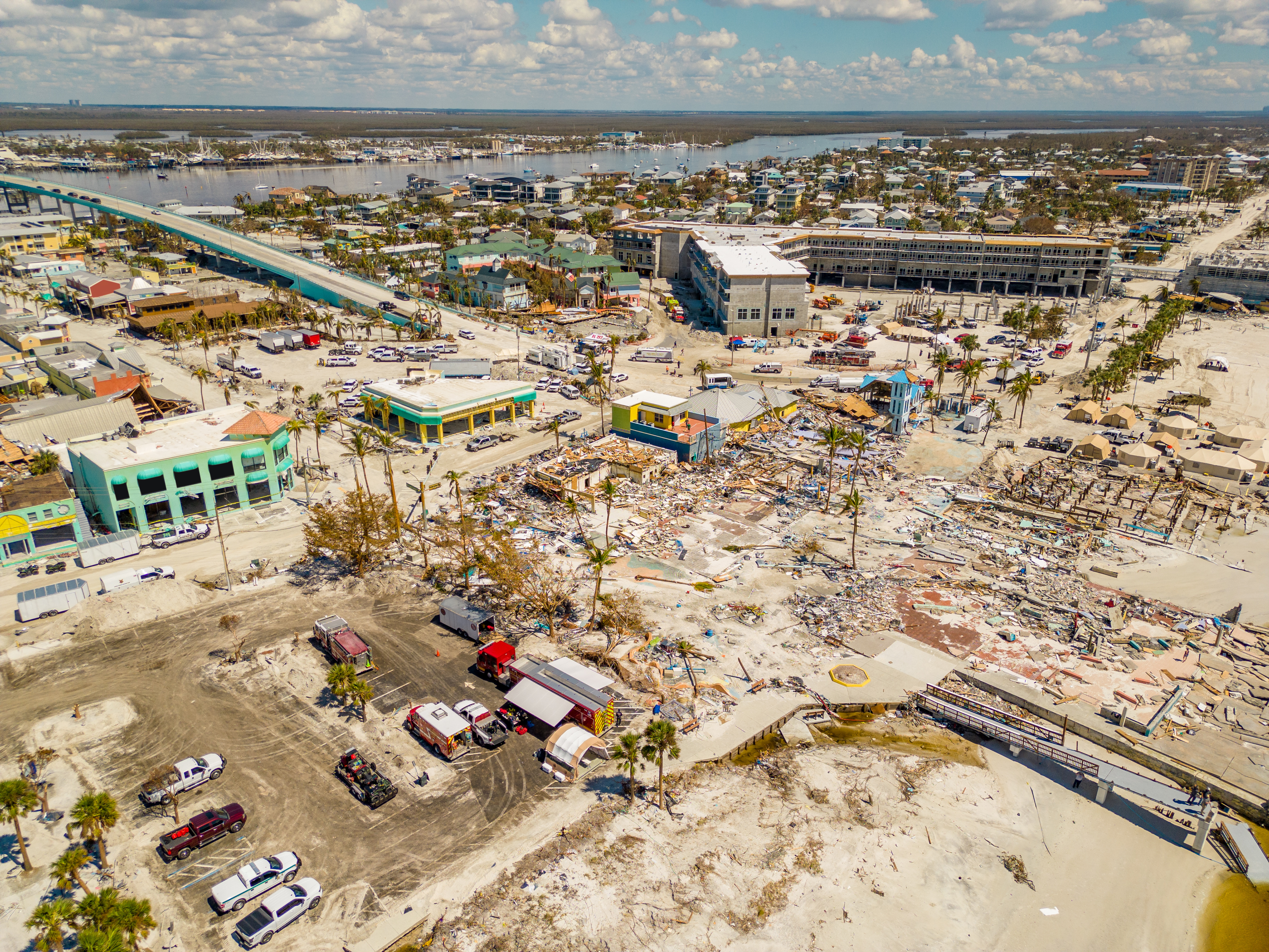
Furthermore, the wind-swath map indicates that the peak gusts occurred along and to the right of the centre-line,
not to the west.
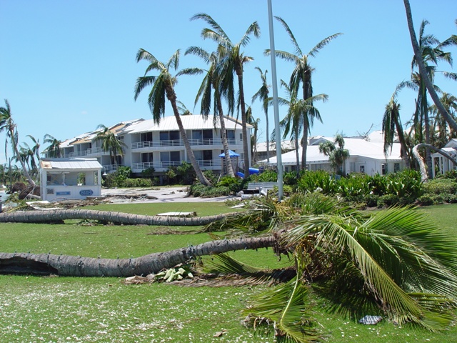
Regarding coconut palms: Ian apparently did not strip waterfront, unobstructed coconut palms of their fronds, despite the latter’s crowns being above the peak waves and surge. (Only some coconuts behind condominiums were badly affected, likely due to wind-tunnelling; palms on the waterfront were much less damaged.) By contrast, in Hurricane Andrew’s core virtually all exposed coconut palms were completely stripped or their fronds, badly sheared, and/or snapped. So Category-3 winds, if not weaker, should be more than sufficient to produce much more severe damage to coconut palms in the absence of surge/wave than was evident after Ian.
As noted above, the StEER survey is very thorough and covers many different aspects, so I it seems credible to me.