• Welcome to TalkWeather!
    We see you lurking around TalkWeather! Take the extra step and join us today to view attachments, see less ads and maybe even join the discussion.
    CLICK TO JOIN TALKWEATHER

Hurricane Hurricane IDALIA: threat to the northeastern Gulf Coast

Messages
511
Reaction score
433
Location
Northern Europe
Another thing: why are sources indicating that the surge at Cedar Key was 8.9’? Based on video the peak heights near the waterfront do not appear to have been much more than three and a half to four feet. These include the storm tide and added waves, so the surge would have been even lower. The forecasts called for a surge of 12–16’ in the hardest-hit area. Peak sustained winds and gusts observed on land do not appear to have supported anything much stronger than a Category 1 in the Big Bend. Of course, somewhat stronger winds likely went unrecorded, but prior to weakening data from sondes offshore suggested only a mid-range-to-upper-end Category 2, with surface-based winds being much lower than flight-level (the observation of 78 knots in the western quadrant would seemingly support 90–95 knots elsewhere). So Idalia’s peak was likely just below Category-3 status wind-wise, with a MSLP in the low 940s mb. But the storm then weakened afterward and likely came in as a strong Category 1, which would explain the lacklustre surge vs. forecasts. So I am really worried about storms such as Idalia, Ian, et al. being badly overestimated.
 

JBishopwx

Member
Sustaining Member
Messages
907
Reaction score
2,036
Location
Ackerman, MS
Special Affiliations
  1. SKYWARN® Volunteer
Another thing: why are sources indicating that the surge at Cedar Key was 8.9’? Based on video the peak heights near the waterfront do not appear to have been much more than three and a half to four feet. These include the storm tide and added waves, so the surge would have been even lower. The forecasts called for a surge of 12–16’ in the hardest-hit area. Peak sustained winds and gusts observed on land do not appear to have supported anything much stronger than a Category 1 in the Big Bend. Of course, somewhat stronger winds likely went unrecorded, but prior to weakening data from sondes offshore suggested only a mid-range-to-upper-end Category 2, with surface-based winds being much lower than flight-level (the observation of 78 knots in the western quadrant would seemingly support 90–95 knots elsewhere). So Idalia’s peak was likely just below Category-3 status wind-wise, with a MSLP in the low 940s mb. But the storm then weakened afterward and likely came in as a strong Category 1, which would explain the lacklustre surge vs. forecasts. So I am really worried about storms such as Idalia, Ian, et al. being badly overestimated.
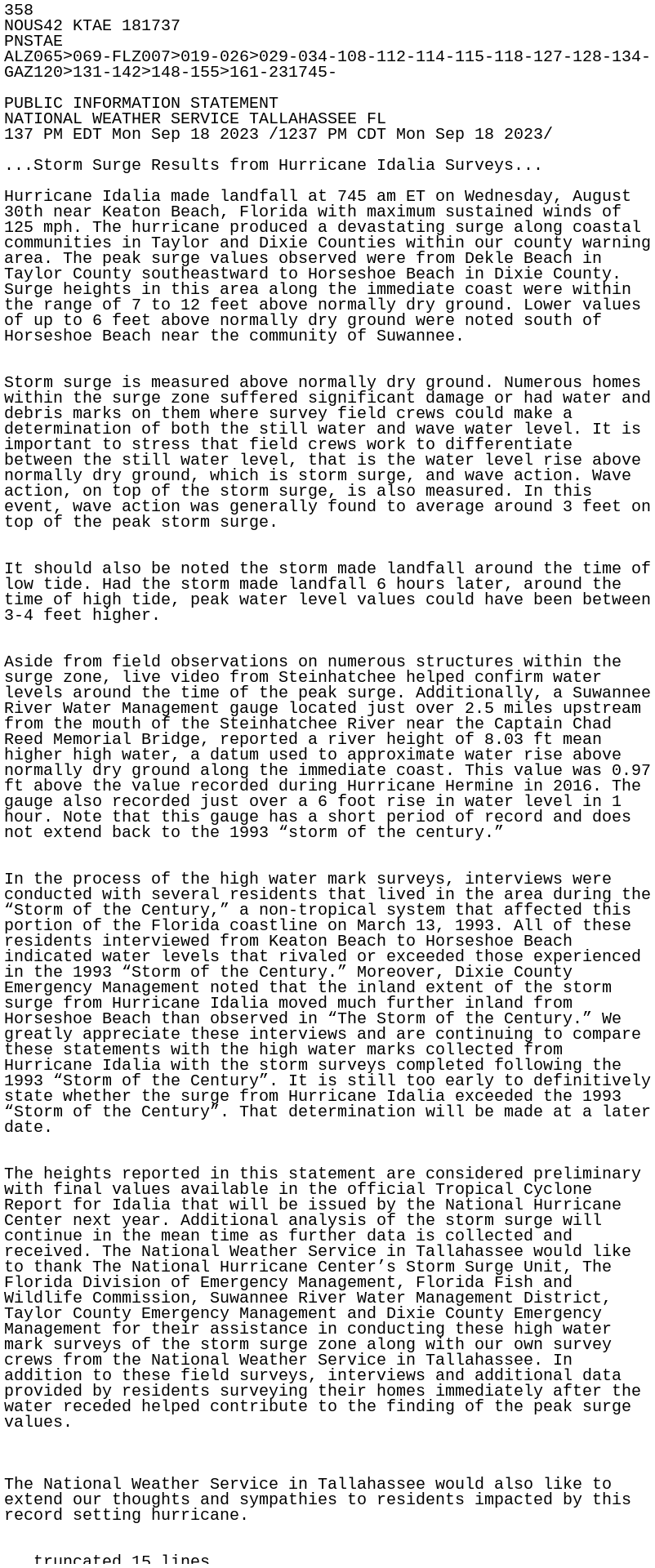
For what it's worth, they started surveying and looking at data today. From NWS Tampa:
We are currently compiling data and just started surveying damaged areas today of impacted locations. This process will continue through next week to get to all counties, especially the N Nature coast, where local officials are still conducting recovery operations that we need to stay out of their way. We sent a few preliminary reports of winds and rainfall yesterday totals under the PNSTBW header. We can not confirm storm surge values at this time, as with Ian last year, those values may take awhile before becoming official.
Highest wind speed at 83 mph in Tallahassee CWA.
 
Last edited:

Clancy

Member
Messages
2,621
Reaction score
4,723
Location
Macland, Georgia
The dead horse is just never dead enough for some, eh?

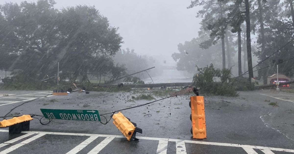
Anywho, seems like Valdosta and surrounding environs may have gotten some of the more extensive wind damage from Idalia, interestingly enough. Thankfully my folks down there said people were generally aware of the storm and were prepared. Michael did similar damage to parts of far SW GA back in 2018. Also, props to NHC for excellent forecasting and lead time on Idalia.

 
Messages
511
Reaction score
433
Location
Northern Europe
The dead horse is just never dead enough for some, eh?
@Clancy Where is the evidence to support anything stronger than a Category-1 (or maybe low-end Category-2) cyclone at landfall? The surge was clearly much lower than forecast and even the listed totals do not seem to match the observed effects. I have been following meteorologists on other sites and one or more of them has even stated that Idalia was likely only of Category-1 status at landfall, based on the fact that several land-based stations in the path of the core survived and did not even record sustained hurricane-force winds. Based on available reports and imagery the observed wind-caused damage to frame homes, mobile homes, etc. also more closely matches the Category-1 than the Category-2 description on the Saffir-Simpson scale. This matters because a) climatological records must be accurate, b) the official records influence stakeholders’ risk-perceptions and readiness, and c) policymakers act accordingly. (A fourth factor is d), is the role of profiteers, which I have already mentioned.) Unfortunately, ever since the mid-2000s there have been several U.S. landfalls whose intensities seem to have been overestimated, in some cases significantly. I don’t want to go too far off topic, I already mentioned Ian in this thread and another, as well as a few others. Storms are clearly complex entities whose intensities must evaluated holistically, not solely on the basis of flight-level winds, SFMR, or radar. Data from land-based stations, sondes, and marine stations are just as invaluable. In this case I am worried that people will think that they survived a high-end Cat-3 rather than a rather middling Cat-1. (I experienced low-end sustained Cat-1 winds in South Florida during Hurricane Wilma in 2005 and wind-caused damages seemed greater than in the footage from Idalia.)
 

TH2002

Member
Sustaining Member
Messages
3,188
Reaction score
4,831
Location
California, United States
Special Affiliations
  1. SKYWARN® Volunteer
@TH2002 It is my informed theory. The fact that a large swath of the media regularly attribute events such as Idalia to AGW and rely without qualification on incomplete, often-inaccurate, and/or decontextualised historical records. (For example, the reported surge of 5.7’ feet at East Tampa Bay, along with a value of 3.82’ at St. Pete Beach, is being reported as a record, even though the 1921 Tampa Bay hurricane yielded a tide of 10.5’, the highest since the hurricane of 1848 [~15’], which would likely imply a surge of at least 6’.) The first link also implies that AGW is influencing insurers’ decisions to calculate rates. So while I have no hard proof that this is the case, there seems to be evidence that it is likely.

I think that the data from the StEER survey indicate that this is not only possible, but also likely. If anything Ian may have even been a bit weaker than a low-end Cat-3.
Insurers using AGW as a justification to raise rates, and a large swath of the MSM attributing events like Idalia to climate change are problems separate from NOAA overestimating the landfall intensity of hurricanes. Even if you're 100% right about events like Idalia and Ian being significantly weaker at landfall than their official intensities, the fact that insurers and media outlets attribute singular weather events to climate change isn't NOAA's fault.

I can’t answer this, but I feel that the trend is definitely ongoing in regard to Atlantic hurricanes.
Appreciate your honesty there, but it just makes no sense to me that insurers would lobby Congress to have NOAA artificially inflate the number of landfalling high-end hurricanes, but not do anything similar with tornadoes.
 
Messages
511
Reaction score
433
Location
Northern Europe
The dead horse is just never dead enough for some.
@Clancy To be clear: this isn’t to imply that Cat-1 conditions are not damaging. I was speaking strictly from a scientific perspective. In your view, what about this storm made it most damaging? What would be your estimate of its intensity? (Incidentally, post-Idalia aerial photography is now available for communities such as Dekle Beach, Keaton Beach, Steinhatchee, Horseshoe Beach, Cedar Key, and environs.) I will admit that I am not so familiar with the region to begin with, though I did reside in the Tampa Bay area for several years.
 

JBishopwx

Member
Sustaining Member
Messages
907
Reaction score
2,036
Location
Ackerman, MS
Special Affiliations
  1. SKYWARN® Volunteer
Messages
511
Reaction score
433
Location
Northern Europe
This basically proves my point. The strongest sustained wind speed was 55 knots at Horseshoe Beach, with a gust to 61 knots. The reported gust appears rather low proportionately to sustained winds, especially when compared to the other observations listed. Typically a gust-factor of 1.3 applies to reports on land, which would imply sustained winds of 47 knots at Horseshoe Beach. The report also leniently fails to convert the winds to reflect standard 10-m elevation, assuming instead that the anemometers were sited at < 20 m AGL (even though standard elevation is relative to MSL). So there are no credible indicators of winds stronger than low-end Category-1 status anywhere near the centre, if at all, even when sparseness of observational coverage is taken into account. The peak storm tide was 8’, at Steinhatchee, implying an even lower storm surge. The tide was expected to range from 12–18’ in this area. So neither surge nor wind implies that IDALIA was much stronger than a Category-1 hurricane at landfall.
 

JBishopwx

Member
Sustaining Member
Messages
907
Reaction score
2,036
Location
Ackerman, MS
Special Affiliations
  1. SKYWARN® Volunteer

JBishopwx

Member
Sustaining Member
Messages
907
Reaction score
2,036
Location
Ackerman, MS
Special Affiliations
  1. SKYWARN® Volunteer
Last edited:
Back
Top