
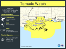
5% tornado risk for most of Alabama tomorrow
Navigation
Install the app
How to install the app on iOS
Follow along with the video below to see how to install our site as a web app on your home screen.
Note: This feature may not be available in some browsers.
More options
-
Welcome to TalkWeather! We see you lurking around TalkWeather! Take the extra step and join us today to view attachments, see less ads and maybe even join the discussion. CLICK TO JOIN TALKWEATHER
You are using an out of date browser. It may not display this or other websites correctly.
You should upgrade or use an alternative browser.
You should upgrade or use an alternative browser.
Hurricane Hurricane Francine
- Thread starter KoD
- Start date
Can't exactly call Francine's CoC small, huh?

Rather lopsided - west side dominant as drier air wraps in from the south. The supercell-maker scenario seems plausible. She's going to pack some unexpected punches I'm afraid.


Water rising at the barriers in New Orleans. So far nothing worse than a slightly higher than normal high tide - peaked at 9:45 am so far.
https://waterdata.usgs.gov/monitori...eriod=P7D&showMedian=false&timeSeriesId=62836

2pm edit - starting back up, even as the tide rolls out. Wind driven surge - still well below levels of concern, have had higher tides in the last week.

https://waterdata.usgs.gov/monitori...eriod=P7D&showMedian=false&timeSeriesId=62836
2pm edit - starting back up, even as the tide rolls out. Wind driven surge - still well below levels of concern, have had higher tides in the last week.
Last edited:
lake.effect
Member
Lots of rotation offshore heading into the Gulfport/Biloxi region in the next hour.
Laissez les bon temps rouler - Looks to me like Francine wants to go to Bourbon Street. ")
Yeesh. Yep. Lake Pontchartrain, Slidell, even West Bank as they wrap around as well. Definitely worth keeping an eye on.Lots of rotation offshore heading into the Gulfport/Biloxi region in the next hour.

Now it's getting close to that time we all love - trying to figure out the actual time of a "landfall" on the Louisiana coast, where land... well... it isn't really where the map says it is.
warneagle
Member
lake.effect
Member
That isolated cell just south of new orleans needs a warning soon.
Francine seems to have wrapped up some as it approaches. I hate when they do that. Can't get over the size of that eye. Looks like it's trying to clear out.

lake.effect
Member
^the large eye means New Orleans will likely see a part of the eyewall if not actual eye itself. Could be a rough night.
Still a big slug of mid level dry air impacting the east side. Mixing out though. Out of time for it to be very meaningful, thankfully. She's not petite, huh?

BayouWeatherGeek
Member
WDBU in New Orleans is livestreaming coverage
lake.effect
Member
Radar velocities do not indicate this is a weakening storm at all. Impressive 115-120mph gusts aloft in the NE eyewall.
No, sadly I think we're seeing one that tightens up as it makes landfall. I much prefer storms winding down as they approach - these tend to catch folks off guard, and also seem to me to translate effects to ground level more. I wonder if there is data to back up that impression or if it's just my impression?Radar velocities do not indicate this is a weakening storm at all. Impressive 115-120mph gusts aloft in the NE eyewall.
slenker
Member
It most certainly is supported by imagery of damage, that actively intensifying cyclones making landfall tend to be more intense at ground level.No, sadly I think we're seeing one that tightens up as it makes landfall. I much prefer storms winding down as they approach - these tend to catch folks off guard, and also seem to me to translate effects to ground level more. I wonder if there is data to back up that impression or if it's just my impression?
I'm hopeful looking at IR that Francine isn't actually intensifying very much - IR is a mess, but it wrapping itself up right now and trying to clear the eye was not on my expectations list. Hoping there isn't a resulting convection burst.It most certainly is supported by imagery of damage, that actively intensifying cyclones making landfall tend to be more intense at ground level.
The shape of the coastline combined with friction from the land helps the storm tighten up more (example of that was Sally). That's one of the things I've learned over the last few years. Also the angle of the storm approach and a trough of low pressure system can actually help ventilate the system more (example of that was Michael).