• Welcome to TalkWeather!
    We see you lurking around TalkWeather! Take the extra step and join us today to view attachments, see less ads and maybe even join the discussion.
    CLICK TO JOIN TALKWEATHER

Archive Historic Harvey (Tropical Depression)

Status
Not open for further replies.

TWBot

TalkWeather Bot
Don't Feed The Bots
Messages
542
Reaction score
2
Location
On a server
000
WTNT34 KNHC 260547
TCPAT4

BULLETIN
Hurricane Harvey Intermediate Advisory Number 23A
NWS National Hurricane Center Miami FL AL092017
100 AM CDT Sat Aug 26 2017

...HARVEY MAKES A SECOND LANDFALL ON THE NORTHEASTERN SHORE OF
COPANO BAY...


SUMMARY OF 100 AM CDT...0600 UTC...INFORMATION
----------------------------------------------
LOCATION...28.2N 97.0W
ABOUT 5 MI...10 KM N OF ROCKPORT TEXAS
ABOUT 45 MI...75 KM S OF VICTORIA TEXAS
MAXIMUM SUSTAINED WINDS...125 MPH...205 KM/H
PRESENT MOVEMENT...NW OR 325 DEGREES AT 6 MPH...9 KM/H
MINIMUM CENTRAL PRESSURE...942 MB...27.82 INCHES


WATCHES AND WARNINGS
--------------------
CHANGES WITH THIS ADVISORY:

None.

SUMMARY OF WATCHES AND WARNINGS IN EFFECT:

A Storm Surge Warning is in effect for...
* Port Mansfield to High Island Texas

A Hurricane Warning is in effect for...
* Port Mansfield to Sargent Texas

A Tropical Storm Warning is in effect for...
* North of Sargent to High Island Texas

A Storm Surge Warning means there is a danger of life-threatening
inundation from rising water moving inland from the coastline in the
indicated locations. For a depiction of areas at risk, please see
the National Weather Service Storm Surge Watch/Warning Graphic,
available at hurricanes.gov. This is a life-threatening situation.

A Hurricane Warning means that hurricane conditions are expected
somewhere within the warning area. Preparations to protect life and
property should already be complete.

Interests in southwestern Louisiana should continue to monitor the
progress of this system.

For storm information specific to your area, including possible
inland watches and warnings, please monitor products issued by your
local National Weather Service forecast office.


DISCUSSION AND 48-HOUR OUTLOOK
------------------------------
At 100 AM CDT (0600 UTC), the eye of Hurricane Harvey was located
near latitude 28.2 North, longitude 97.0 West. Harvey has made a
second landfall along the northeastern shore of Copano Bay, Texas.
Harvey is moving toward the northwest near 6 mph (9 km/h). The
hurricane is expected to slow down further during the next day or
so, and it will meander over southeastern Texas through the middle
of next week.

Maximum sustained winds have decreased to near 125 mph (205 km/h)
with higher gusts. Harvey is a category 3 hurricane on the
Saffir-Simpson Hurricane Wind Scale. Additional weakening is
forecast during the next 48 hours while the center of Harvey is over
southeastern Texas.

Hurricane-force winds extend outward up to 40 miles (65 km) from
the center, and tropical-storm-force winds extend outward up to 140
miles (220 km). A Texas Coastal Ocean Observing Network station at
the Aransas Wildlife Refuge recently measured sustained hurricane-
force winds of 74 mph (119 km/h) and a wind gust to 98 mph (157
km/h).

A National Ocean Service tide gauge at Port Lavaca, Texas, recently
reported a water level of 5.9 ft above Mean Higher High Water.

The estimated minimum central pressure is 942 mb (27.82 inches).


HAZARDS AFFECTING LAND
----------------------
RAINFALL: Harvey is expected to produce total rain accumulations of
15 to 30 inches and isolated maximum amounts of 40 inches over the
middle and upper Texas coast through next Wednesday. During the same
time period Harvey is expected to produce total rain accumulations
of 5 to 15 inches in far south Texas and the Texas Hill Country over
through southwest and central Louisiana. Rainfall of this magnitude
will cause catastrophic and life-threatening flooding.

STORM SURGE: The combination of a dangerous storm surge and the
tide will cause normally dry areas near the coast to be flooded by
rising waters moving inland from the shoreline. The water is
expected to reach the following heights above ground if the peak
surge occurs at the time of high tide...

Port Aransas to Port O'Connor...9 to 13 ft
Port O'Connor to Sargent...6 to 9 ft
N Entrance Padre Island Natl Seashore to Port Aransas...5 to 8 ft
Sargent to Jamaica Beach...4 to 6 ft
Port Mansfield to N Entrance Padre Island Natl Seashore...3 to 5 ft
Jamaica Beach to High Island...2 to 4 ft
Mouth of the Rio Grande to Port Mansfield...1 to 3 ft
High Island to Morgan City...1 to 3 ft

The deepest water will occur along the immediate coast near and to
the northeast of the landfall location, where the surge will be
accompanied by large and destructive waves. Surge-related flooding
depends on the relative timing of the surge and the tidal cycle, and
can vary greatly over short distances. For information specific to
your area, please see products issued by your local National Weather
Service forecast office.

WIND: Hurricane conditions are occuring along portions of the
middle Texas coast within the hurricane warning area and are
spreading inland as the eye continues to move farther onshore.
Tropical storm conditions are occurring in other portions of the
hurricane and tropical storm warning areas. Tropical storm
conditions are likely to persist along portions of the coast through
at least Sunday.

SURF: Swells generated by Harvey are affecting the Texas,
Louisiana, and northeast Mexico coasts. These swells are likely to
cause life-threatening surf and rip current conditions. Please
consult products from your local weather office.

TORNADOES: Tornadoes are possible through Saturday near the middle
and upper Texas coast into far southwest Louisiana.


NEXT ADVISORY
-------------
Next complete advisory at 400 AM CDT.

$$
Forecaster Berg

Continue reading...
 

Tyler Penland

Mountain Snow Miser
Staff member
Moderator
Messages
254
Reaction score
154
Location
Blowing Rock, NC; Elevation 3,575ft
Looks like he's barely moving, if at all, now. Last 20 frames on radar he looks stalled.

Sent from my SM-G930R7 using Tapatalk
 

TWBot

TalkWeather Bot
Don't Feed The Bots
Messages
542
Reaction score
2
Location
On a server
000
WTNT34 KNHC 260854
TCPAT4

BULLETIN
Hurricane Harvey Advisory Number 24
NWS National Hurricane Center Miami FL AL092017
400 AM CDT Sat Aug 26 2017

...HARVEY MOVING SLOWLY INLAND OVER SOUTH TEXAS...
...CATASTROPHIC FLOODING EXPECTED OVER THE NEXT FEW DAYS DUE TO
HEAVY RAINFALL...


SUMMARY OF 400 AM CDT...0900 UTC...INFORMATION
----------------------------------------------
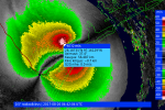
LOCATION...28.5N 97.2W
ABOUT 30 MI...50 KM SW OF VICTORIA TEXAS
ABOUT 105 MI...170 KM SE OF SAN ANTONIO TEXAS
MAXIMUM SUSTAINED WINDS...100 MPH...155 KM/H
PRESENT MOVEMENT...NW OR 325 DEGREES AT 6 MPH...9 KM/H
MINIMUM CENTRAL PRESSURE...963 MB...28.44 INCHES


WATCHES AND WARNINGS
--------------------
CHANGES WITH THIS ADVISORY:

The Hurricane Warning and Storm Surge Warning have been
discontinued south of Baffin Bay. The Hurricane Warning north of
Port O'Connor to Sargent has been changed to a Tropical Storm
Warning.

SUMMARY OF WATCHES AND WARNINGS IN EFFECT:

A Storm Surge Warning is in effect for...
* Baffin Bay to High Island Texas

A Hurricane Warning is in effect for...
* Baffin Bay to Port O'Connor Texas

A Tropical Storm Warning is in effect for...
* North of Port O'Connor to High Island Texas

A Storm Surge Warning means there is a danger of life-threatening
inundation from rising water moving inland from the coastline in the
indicated locations. For a depiction of areas at risk, please see
the National Weather Service Storm Surge Watch/Warning Graphic,
available at hurricanes.gov. This is a life-threatening situation.

A Hurricane Warning means that hurricane conditions are expected
somewhere within the warning area. Preparations to protect life and
property should already be complete.

A Tropical Storm Warning means that tropical storm conditions are
expected somewhere within the warning.

Interests in southwestern Louisiana should continue to monitor the
progress of this system.

For storm information specific to your area, including possible
inland watches and warnings, please monitor products issued by your
local National Weather Service forecast office.


DISCUSSION AND 48-HOUR OUTLOOK
------------------------------
At 400 AM CDT (0900 UTC), the eye of Hurricane Harvey was located
by NOAA Doppler radar near latitude 28.5 North, longitude 97.2 West.
Harvey is moving toward the northwest near 6 mph (9 km/h). Harvey
is expected to slow down through the day and meander over
southeastern Texas through the middle of next week.

Doppler radar data indicate that maximum sustained winds have
decreased to near 100 mph (155 km/h) with higher gusts. Additional
weakening is forecast, and Harvey is likely to become a tropical
storm later today.

Hurricane-force winds extend outward up to 35 miles (55 km) from the
center, and tropical-storm-force winds extend outward up to 140
miles (220 km).

The estimated minimum central pressure is 963 mb (28.44 inches).

Almost 10 inches of rain have already been reported at a few
locations in southeastern Texas.

HAZARDS AFFECTING LAND
----------------------
RAINFALL: Harvey is expected to produce total rain accumulations of
15 to 30 inches and isolated maximum amounts of 40 inches over the
middle and upper Texas coast through next Wednesday. During the same
time period Harvey is expected to produce total rain accumulations
of 5 to 15 inches in far south Texas and the Texas Hill Country over
through southwest and central Louisiana. Rainfall of this magnitude
will cause catastrophic and life-threatening flooding.

STORM SURGE: The combination of a dangerous storm surge and the
tide will cause normally dry areas near the coast to be flooded by
rising waters moving inland from the shoreline. The water is
expected to reach the following heights above ground if the peak
surge occurs at the time of high tide...

Port Aransas to Port O'Connor...6 to 12 ft
Port O'Connor to Sargent...6 to 9 ft
Sargent to Jamaica Beach...4 to 6 ft
Baffin Bay to Port Aransas...3 to 6 ft
Jamaica Beach to High Island...2 to 4 ft
Mouth of the Rio Grande to Port Mansfield...1 to 3 ft
High Island to Morgan City...1 to 3 ft

The deepest water will occur along the immediate coast near and to
the northeast of the landfall location, where the surge will be
accompanied by large and destructive waves. Surge-related flooding
depends on the relative timing of the surge and the tidal cycle, and
can vary greatly over short distances. For information specific to
your area, please see products issued by your local National Weather
Service forecast office.

WIND: Hurricane conditions are occuring inland from the coast
within Harvey's eyewall, and hurricane-force winds, especially in
gusts, are still possible near the middle Texas coast for the next
several hours. Tropical storm conditions are occurring in other
portions of the hurricane and tropical storm warning areas.
Tropical storm conditions are likely to persist along portions of
the coast through at least Sunday.

SURF: Swells generated by Harvey are affecting the Texas,
Louisiana, and northeast Mexico coasts. These swells are likely to
cause life-threatening surf and rip current conditions. Please
consult products from your local weather office.

TORNADOES: Tornadoes are possible today and tonight near the middle
and upper Texas coast into far southwest Louisiana.


NEXT ADVISORY
-------------
Next intermediate advisory at 700 AM CDT.
Next complete advisory at 1000 AM CDT.

$$
Forecaster Berg

Continue reading...
 

TWBot

TalkWeather Bot
Don't Feed The Bots
Messages
542
Reaction score
2
Location
On a server
000
WTNT34 KNHC 261152
TCPAT4

BULLETIN
Hurricane Harvey Intermediate Advisory Number 24A
NWS National Hurricane Center Miami FL AL092017
700 AM CDT Sat Aug 26 2017

...HARVEY MOVING SLOWLY OVER TEXAS PRODUCING TORRENTIAL RAINS...
...CATASTROPHIC FLOODING EXPECTED OVER THE NEXT FEW DAYS...


SUMMARY OF 700 AM CDT...1200 UTC...INFORMATION
----------------------------------------------
LOCATION...28.7N 97.2W
ABOUT 20 MI...30 KM WSW OF VICTORIA TEXAS
ABOUT 95 MI...150 KM SE OF SAN ANTONIO TEXAS
MAXIMUM SUSTAINED WINDS...80 MPH...130 KM/H
PRESENT MOVEMENT...NNW OR 340 DEGREES AT 6 MPH...9 KM/H
MINIMUM CENTRAL PRESSURE...975 MB...28.79 INCHES


WATCHES AND WARNINGS
--------------------
CHANGES WITH THIS ADVISORY:

None.

SUMMARY OF WATCHES AND WARNINGS IN EFFECT:

A Storm Surge Warning is in effect for...
* Baffin Bay to High Island Texas

A Hurricane Warning is in effect for...
* Baffin Bay to Port O'Connor Texas

A Tropical Storm Warning is in effect for...
* North of Port O'Connor to High Island Texas

A Storm Surge Warning means there is a danger of life-threatening
inundation from rising water moving inland from the coastline in the
indicated locations. For a depiction of areas at risk, please see
the National Weather Service Storm Surge Watch/Warning Graphic,
available at hurricanes.gov. This is a life-threatening situation.

A Hurricane Warning means that hurricane conditions are expected
somewhere within the warning area.

A Tropical Storm Warning means that tropical storm conditions are
expected somewhere within the warning.

Interests in southwestern Louisiana should continue to monitor the
progress of this system.

For storm information specific to your area, including possible
inland watches and warnings, please monitor products issued by your
local National Weather Service forecast office.


DISCUSSION AND 48-HOUR OUTLOOK
------------------------------
At 700 AM CDT (1200 UTC), the eye of Hurricane Harvey was located by
NOAA Doppler radar near latitude 28.7 North, longitude 97.2 West.
Harvey is moving toward the north-northwest near 6 mph (9 km/h).
Harvey is expected to slow down through the day and meander over
southeastern Texas through the middle of next week.

Doppler radar data indicate that maximum sustained winds have
decreased to near 80 mph (130 km/h) with higher gusts. These winds
are confined to a small area near the eye of the hurricane.
Additional weakening is forecast, and Harvey is likely to become a
tropical storm later today.

Hurricane-force winds extend outward up to 35 miles (55 km) from
the center, and tropical-storm-force winds extend outward up to 140
miles (220 km).

The estimated minimum central pressure is 975 mb (28.79 inches).


HAZARDS AFFECTING LAND
----------------------
RAINFALL: Harvey is expected to produce total rain accumulations of
15 to 30 inches and isolated maximum amounts of 40 inches over the
middle and upper Texas coast through next Wednesday. During the same
time period Harvey is expected to produce total rain accumulations
of 5 to 15 inches in far south Texas, the Texas Hill Country
and southwest and central Louisiana. Rainfall of this magnitude
will cause catastrophic and life-threatening flooding. A list of
rainfall observations compiled by the NOAA Weather Prediction Center
can be found at: www.wpc.ncep.noaa.gov/discussions/nfdscc1.html

STORM SURGE: The combination of a dangerous storm surge and the
tide will cause normally dry areas near the coast to be flooded by
rising waters moving inland from the shoreline. The water is
expected to reach the following heights above ground if the peak
surge occurs at the time of high tide...

Port Aransas to Port O'Connor...6 to 12 ft
Port O'Connor to Sargent...6 to 9 ft
Sargent to Jamaica Beach...4 to 6 ft
Baffin Bay to Port Aransas...3 to 6 ft
Jamaica Beach to High Island...2 to 4 ft
Mouth of the Rio Grande to Port Mansfield...1 to 3 ft
High Island to Morgan City...1 to 3 ft

The deepest water will occur along the immediate coast near the
area of onshore winds, where the surge will be accompanied by large
and destructive waves. Surge-related flooding depends on the
relative timing of the surge and the tidal cycle, and can vary
greatly over short distances. For information specific to your
area, please see products issued by your local National Weather
Service forecast office.

WIND: Hurricane conditions are occuring inland from the coast
within Harvey's eyewall, and hurricane-force winds, especially in
gusts, are still possible near the middle Texas coast for the next
several hours. Tropical storm conditions are occurring in other
portions of the hurricane and tropical storm warning areas.
Tropical storm conditions are likely to persist along portions of
the coast through at least Sunday.

SURF: Swells generated by Harvey are affecting the Texas,
Louisiana, and northeast Mexico coasts. These swells are likely to
cause life-threatening surf and rip current conditions. Please
consult products from your local weather office.

TORNADOES: Tornadoes are possible today and tonight near the middle
and upper Texas coast into far southwest Louisiana.


NEXT ADVISORY
-------------
Next complete advisory at 1000 AM CDT.

$$
Forecaster Avila

Continue reading...
 

Mike S

Administrator
Staff member
Administrator
Moderator
PerryW Project Supporter
Messages
1,991
Reaction score
1,115
Location
Meridianville, Al
Special Affiliations
  1. SKYWARN® Volunteer
View from the ISS
 

TWBot

TalkWeather Bot
Don't Feed The Bots
Messages
542
Reaction score
2
Location
On a server
000
WTNT34 KNHC 261451
TCPAT4

BULLETIN
Hurricane Harvey Advisory Number 25
NWS National Hurricane Center Miami FL AL092017
1000 AM CDT Sat Aug 26 2017

...HARVEY DRENCHING TEXAS...
...TORRENTIAL RAINS WILL CONTINUE FOR A FEW MORE DAYS...


SUMMARY OF 1000 AM CDT...1500 UTC...INFORMATION
-----------------------------------------------
LOCATION...28.9N 97.3W
ABOUT 25 MI...35 KM W OF VICTORIA TEXAS
ABOUT 80 MI...130 KM ESE OF SAN ANTONIO TEXAS
MAXIMUM SUSTAINED WINDS...75 MPH...120 KM/H
PRESENT MOVEMENT...N OR 350 DEGREES AT 2 MPH...4 KM/H
MINIMUM CENTRAL PRESSURE...984 MB...29.06 INCHES


WATCHES AND WARNINGS
--------------------
CHANGES WITH THIS ADVISORY:

The Storm Surge Warning for the Texas coast south of Port Aransas
has been discontinued.

The Hurricane Warning for the Texas coast has been replaced with a
Tropical Storm Warning.

SUMMARY OF WATCHES AND WARNINGS IN EFFECT:

A Storm Surge Warning is in effect for...
* Port Aransas to High Island Texas

A Tropical Storm Warning is in effect for...
* Baffin Bay to High Island Texas

Hurricane warnings continue for inland areas near the center of
Harvey. Please see products from your local National Weather
Service office.

A Storm Surge Warning means there is a danger of life-threatening
inundation from rising water moving inland from the coastline in the
indicated locations. For a depiction of areas at risk, please see
the National Weather Service Storm Surge Watch/Warning Graphic,
available at hurricanes.gov. This is a life-threatening situation.

A Tropical Storm Warning means that tropical storm conditions are
expected somewhere within the warning.

For storm information specific to your area, including possible
inland watches and warnings, please monitor products issued by your
local National Weather Service forecast office.


DISCUSSION AND 48-HOUR OUTLOOK
------------------------------
At 1000 AM CDT (1500 UTC), the center of Hurricane Harvey was
located near latitude 28.9 North, longitude 97.3 West. Harvey is
moving slowly toward the north near 2 mph (4 km/h), and little
motion is anticipated during the next several days.

Maximum sustained winds have decreased to near 75 mph (120 km/h)
with higher gusts. These winds are confined to a small area near the
center. Weakening is forecast during the next 48 hours, and Harvey
is expected to become a tropical storm this afternoon.

Hurricane-force winds extend outward up to 25 miles (35 km) from the
center and tropical-storm-force winds extend outward up to 140 miles
(220 km).

The estimated minimum central pressure is 984 mb (29.06 inches).


HAZARDS AFFECTING LAND
----------------------
RAINFALL: Harvey is expected to produce total rain accumulations of
15 to 30 inches and isolated maximum amounts of 40 inches over the
middle and upper Texas coast through Thursday. During the same
time period Harvey is expected to produce total rain accumulations
of 5 to 15 inches in far south Texas, the Texas Hill Country
and southwest and central Louisiana. Rainfall of this magnitude
will cause catastrophic and life-threatening flooding. A list of
rainfall observations compiled by the NOAA Weather Prediction Center
can be found at: www.wpc.ncep.noaa.gov/discussions/nfdscc1.html

STORM SURGE: The combination of a dangerous storm surge and the
tide will cause normally dry areas near the coast to be flooded by
rising waters moving inland from the shoreline. The water is
expected to reach the following heights above ground if the peak
surge occurs at the time of high tide...

Port Aransas to Sargent...4 to 7 ft
Sargent to High Island including Galveston Bay...2 to 4 ft
High Island to Morgan City...1 to 3 ft

The deepest water will occur along the immediate coast near the
area of onshore winds, where the surge will be accompanied by large
and destructive waves. Surge-related flooding depends on the
relative timing of the surge and the tidal cycle, and can vary
greatly over short distances. For information specific to your
area, please see products issued by your local National Weather
Service forecast office.

WIND: Hurricane conditions are occuring inland near the core
of Harvey. Tropical storm conditions are occurring in portions of
the tropical storm warning area, and are likely to persist along
portions of the coast through at least Sunday.

SURF: Swells generated by Harvey are affecting the Texas,
Louisiana, and northeast Mexico coasts. These swells are likely to
cause life-threatening surf and rip current conditions. Please
consult products from your local weather office.

TORNADOES: Tornadoes are possible today and tonight near the middle
and upper Texas coast into far southwest Louisiana.


NEXT ADVISORY
-------------
Next intermediate advisory at 100 PM CDT.
Next complete advisory at 400 PM CDT.

$$
Forecaster Avila/Lapenta

Continue reading...
 

Mike S

Administrator
Staff member
Administrator
Moderator
PerryW Project Supporter
Messages
1,991
Reaction score
1,115
Location
Meridianville, Al
Special Affiliations
  1. SKYWARN® Volunteer
Incredible

Harvey is
moving slowly toward the north near 2 mph (4 km/h), and little
motion is anticipated during the next several days.
 

TWBot

TalkWeather Bot
Don't Feed The Bots
Messages
542
Reaction score
2
Location
On a server
000
WTNT34 KNHC 261748
TCPAT4

BULLETIN
Tropical Storm Harvey Intermediate Advisory Number 25A
NWS National Hurricane Center Miami FL AL092017
100 PM CDT Sat Aug 26 2017

...HARVEY BECOMES A TROPICAL STORM INLAND OVER TEXAS...
...EXTREMELY SERIOUS FLOODING EVENT UNFOLDING...


SUMMARY OF 100 PM CDT...1800 UTC...INFORMATION
----------------------------------------------
LOCATION...29.1N 97.6W
ABOUT 45 MI...70 KM WNW OF VICTORIA TEXAS
ABOUT 60 MI...95 KM ESE OF SAN ANTONIO TEXAS
MAXIMUM SUSTAINED WINDS...70 MPH...110 KM/H
PRESENT MOVEMENT...NNW OR 340 DEGREES AT 2 MPH...4 KM/H
MINIMUM CENTRAL PRESSURE...987 MB...29.15 INCHES


WATCHES AND WARNINGS
--------------------
CHANGES WITH THIS ADVISORY:

None.

SUMMARY OF WATCHES AND WARNINGS IN EFFECT:

A Storm Surge Warning is in effect for...
* Port Aransas to High Island Texas

A Tropical Storm Warning is in effect for...
* Baffin Bay to High Island Texas

A Storm Surge Warning means there is a danger of life-threatening
inundation from rising water moving inland from the coastline in the
indicated locations. For a depiction of areas at risk, please see
the National Weather Service Storm Surge Watch/Warning Graphic,
available at hurricanes.gov. This is a life-threatening situation.

For storm information specific to your area, including possible
inland watches and warnings, please monitor products issued by your
local National Weather Service forecast office.


DISCUSSION AND 48-HOUR OUTLOOK
------------------------------
At 100 PM CDT (1800 UTC), the center of Tropical Storm Harvey was
located by National Weather Service Doppler radar near latitude 29.1
North, longitude 97.6 West. Harvey is moving slowly toward the
north-northwest near 2 mph (4 km/h), and little motion is
anticipated during the next several days.

Maximum sustained winds have decreased to near 70 mph (110 km/h)
with higher gusts. Additional weakening is forecast during the next
48 hours.

Tropical-storm-force winds extend outward up to 140 miles (220 km).

The estimated minimum central pressure is 987 mb (29.15 inches).


HAZARDS AFFECTING LAND
----------------------
RAINFALL: Harvey is expected to produce total rain accumulations of
15 to 30 inches and isolated maximum amounts of 40 inches over the
middle and upper Texas coast through Thursday. During the same
time period Harvey is expected to produce total rain accumulations
of 5 to 15 inches in far south Texas, the Texas Hill Country
and southwest and central Louisiana. Rainfall of this magnitude
will cause catastrophic and life-threatening flooding. A list of
rainfall observations compiled by the NOAA Weather Prediction Center
can be found at: www.wpc.ncep.noaa.gov/discussions/nfdscc1.html

STORM SURGE: The combination of a dangerous storm surge and the
tide will cause normally dry areas near the coast to be flooded by
rising waters moving inland from the shoreline. The water is
expected to reach the following heights above ground if the peak
surge occurs at the time of high tide...

Port Aransas to Sargent...4 to 7 ft
Sargent to High Island including Galveston Bay...2 to 4 ft
High Island to Morgan City...1 to 3 ft

The deepest water will occur along the immediate coast near the
area of onshore winds, where the surge will be accompanied by large
and destructive waves. Surge-related flooding depends on the
relative timing of the surge and the tidal cycle, and can vary
greatly over short distances. For information specific to your
area, please see products issued by your local National Weather
Service forecast office.

WIND: Tropical storm conditions are occurring in portions of
the tropical storm warning area, and are likely to persist along
portions of the coast through at least Sunday.

SURF: Swells generated by Harvey are affecting the Texas,
Louisiana, and northeast Mexico coasts. These swells are likely to
cause life-threatening surf and rip current conditions. Please
consult products from your local weather office.

TORNADOES: Tornadoes are possible today and tonight near the middle
and upper Texas coast into far southwest Louisiana.


NEXT ADVISORY
-------------
Next complete advisory at 400 PM CDT.

$$
Forecaster Avila

Continue reading...
 

TWBot

TalkWeather Bot
Don't Feed The Bots
Messages
542
Reaction score
2
Location
On a server
000
WTNT34 KNHC 262036
TCPAT4

BULLETIN
Tropical Storm Harvey Advisory Number 26
NWS National Hurricane Center Miami FL AL092017
400 PM CDT Sat Aug 26 2017

...TROPICAL STORM HARVEY BARELY MOVING...
...TORRENTIAL RAINS WILL CONTINUE...


SUMMARY OF 400 PM CDT...2100 UTC...INFORMATION
----------------------------------------------
LOCATION...29.1N 97.6W
ABOUT 45 MI...70 KM WNW OF VICTORIA TEXAS
ABOUT 60 MI...95 KM ESE OF SAN ANTONIO TEXAS
MAXIMUM SUSTAINED WINDS...65 MPH...100 KM/H
PRESENT MOVEMENT...STATIONARY
MINIMUM CENTRAL PRESSURE...990 MB...29.24 INCHES


WATCHES AND WARNINGS
--------------------
CHANGES WITH THIS ADVISORY:

None.

SUMMARY OF WATCHES AND WARNINGS IN EFFECT:

A Storm Surge Warning is in effect for...
* Port Aransas to High Island Texas

A Tropical Storm Warning is in effect for...
* Baffin Bay to High Island Texas

A Storm Surge Warning means there is a danger of life-threatening
inundation from rising water moving inland from the coastline in the
indicated locations. For a depiction of areas at risk, please see
the National Weather Service Storm Surge Watch/Warning Graphic,
available at hurricanes.gov. This is a life-threatening situation.

For storm information specific to your area, including possible
inland watches and warnings, please monitor products issued by your
local National Weather Service forecast office.


DISCUSSION AND 48-HOUR OUTLOOK
------------------------------
At 400 PM CDT (2100 UTC), the center of Tropical Storm Harvey was
located by Doppler radar near latitude 29.1 North, longitude 97.6
West. Harvey has been nearly stationary and little motion is
anticipated during the next few days.

Maximum sustained winds have decreased to near 65 mph (100 km/h)
with higher gusts. Additional weakening is expected during the
next day or two.

Tropical-storm-force winds extend outward up to 115 miles (185 km)
from the center.

The estimated minimum central pressure is 990 mb (29.24 inches).


HAZARDS AFFECTING LAND
----------------------
RAINFALL: Harvey is expected to produce additional rain
accumulations of 15 to 25 inches over the middle and upper Texas
coast through Thursday. Isolated storm totals may reach around 40
inches in this area. Elsewhere during the same period, Harvey is
expected to produce total rain accumulations of 5 to 15 inches
farther south toward the lower Texas coast, farther west toward the
Texas Hill Country and southwest and central Louisiana. Rainfall of
this magnitude will cause catastrophic and life-threatening
flooding. A list of rainfall observations compiled by the NOAA
Weather Prediction Center can be found at:
www.wpc.ncep.noaa.gov/discussions/nfdscc1.html

STORM SURGE: The combination of a dangerous storm surge and the
tide will cause normally dry areas near the coast to be flooded by
rising waters moving inland from the shoreline. The water is
expected to reach the following heights above ground if the peak
surge occurs at the time of high tide...

Port Aransas to Sargent...4 to 7 ft
Sargent to High Island including Galveston Bay...2 to 4 ft
High Island to Morgan City...1 to 2 ft

The deepest water will occur along the immediate coast near the
area of onshore winds, where the surge will be accompanied by large
and destructive waves. Surge-related flooding depends on the
relative timing of the surge and the tidal cycle, and can vary
greatly over short distances. For information specific to your
area, please see products issued by your local National Weather
Service forecast office.

WIND: Tropical storm conditions are occurring in portions of
the tropical storm warning area, and are likely to persist along
portions of the coast through at least Sunday.

SURF: Swells generated by Harvey are affecting the Texas,
Louisiana, and northeast Mexico coasts. These swells are likely to
cause life-threatening surf and rip current conditions. Please
consult products from your local weather office.

TORNADOES: A few tornadoes are possible through Monday near the
middle and upper Texas coast into far southwest Louisiana.


NEXT ADVISORY
-------------
Next intermediate advisory at 700 PM CDT.
Next complete advisory at 1000 PM CDT.

$$
Forecaster Avila

Continue reading...
 

TWBot

TalkWeather Bot
Don't Feed The Bots
Messages
542
Reaction score
2
Location
On a server
000
WTNT34 KNHC 262339
TCPAT4

BULLETIN
Tropical Storm Harvey Intermediate Advisory Number 26A
NWS National Hurricane Center Miami FL AL092017
700 PM CDT Sat Aug 26 2017

...TROPICAL STORM HARVEY DRIFTING EAST-NORTHEASTWARD...
...TORRENTIAL RAINS WILL CONTINUE...


SUMMARY OF 700 PM CDT...0000 UTC...INFORMATION
----------------------------------------------
LOCATION...29.2N 97.4W
ABOUT 40 MI...65 KM NW OF VICTORIA TEXAS
ABOUT 70 MI...115 KM ESE OF SAN ANTONIO TEXAS
MAXIMUM SUSTAINED WINDS...60 MPH...95 KM/H
PRESENT MOVEMENT...ENE OR 060 DEGREES AT 2 MPH
MINIMUM CENTRAL PRESSURE...992 MB...29.29 INCHES


WATCHES AND WARNINGS
--------------------
CHANGES WITH THIS ADVISORY:

None.

SUMMARY OF WATCHES AND WARNINGS IN EFFECT:

A Storm Surge Warning is in effect for...
* Port Aransas to High Island Texas

A Tropical Storm Warning is in effect for...
* Baffin Bay to High Island Texas

A Storm Surge Warning means there is a danger of life-threatening
inundation from rising water moving inland from the coastline in the
indicated locations. For a depiction of areas at risk, please see
the National Weather Service Storm Surge Watch/Warning Graphic,
available at hurricanes.gov. This is a life-threatening situation.

For storm information specific to your area, including possible
inland watches and warnings, please monitor products issued by your
local National Weather Service forecast office.


DISCUSSION AND 48-HOUR OUTLOOK
------------------------------
At 700 PM CDT (0000 UTC), the center of Tropical Storm Harvey was
located by Doppler radar near latitude 29.2 North, longitude 97.4
West. Harvey has been drifting east-northeastward for the past few
hours. Little additional motion is anticipated during the next few
days.

Maximum sustained winds have decreased to near 60 mph (95 km/h)
with higher gusts. Additional weakening is expected during the next
day or two.

Tropical-storm-force winds extend outward up to 115 miles (185 km)
from the center. San Marcos Regional Airport recently reported
sustained winds of 40 mph (65 km/h) and a wind gust of 53 mph
(85 km/h).

The estimated minimum central pressure is 992 mb (29.29 inches).


HAZARDS AFFECTING LAND
----------------------
RAINFALL: Harvey is expected to produce additional rain
accumulations of 15 to 25 inches over the middle and upper Texas
coast through Thursday. Isolated storm totals may reach around 40
inches in this area. Elsewhere during the same period, Harvey is
expected to produce total rain accumulations of 5 to 15 inches
farther south toward the lower Texas coast, farther west toward the
Texas Hill Country and southwest and central Louisiana. Rainfall of
this magnitude will cause catastrophic and life-threatening
flooding. A list of rainfall observations compiled by the NOAA
Weather Prediction Center can be found at:
www.wpc.ncep.noaa.gov/discussions/nfdscc1.html

STORM SURGE: The combination of a dangerous storm surge and the
tide will cause normally dry areas near the coast to be flooded by
rising waters moving inland from the shoreline. The water is
expected to reach the following heights above ground if the peak
surge occurs at the time of high tide...

Port Aransas to Sargent...4 to 7 ft
Sargent to High Island including Galveston Bay...2 to 4 ft
High Island to Morgan City...1 to 2 ft

The deepest water will occur along the immediate coast near the
area of onshore winds, where the surge will be accompanied by large
and destructive waves. Surge-related flooding depends on the
relative timing of the surge and the tidal cycle, and can vary
greatly over short distances. For information specific to your
area, please see products issued by your local National Weather
Service forecast office.

WIND: Tropical storm conditions are occurring in portions of
the tropical storm warning area, and are likely to persist along
portions of the coast through at least Sunday.

SURF: Swells generated by Harvey are affecting the Texas,
Louisiana, and northeast Mexico coasts. These swells are likely to
cause life-threatening surf and rip current conditions. Please
consult products from your local weather office.

TORNADOES: A few tornadoes are possible through Monday near the
middle and upper Texas coast into far southwest Louisiana.


NEXT ADVISORY
-------------
Next complete advisory at 1000 PM CDT.

$$
Forecaster Beven

Continue reading...
 

TWBot

TalkWeather Bot
Don't Feed The Bots
Messages
542
Reaction score
2
Location
On a server
000
WTNT34 KNHC 270245
TCPAT4

BULLETIN
Tropical Storm Harvey Advisory Number 27
NWS National Hurricane Center Miami FL AL092017
1000 PM CDT Sat Aug 26 2017

...HARVEY WEAKENING AS IT DRIFTS OVER SOUTHEASTERN TEXAS...
...TORRENTIAL RAINS WILL CONTINUE...


SUMMARY OF 1000 PM CDT...0300 UTC...INFORMATION
-----------------------------------------------
LOCATION...29.3N 97.3W
ABOUT 40 MI...65 KM NW OF VICTORIA TEXAS
ABOUT 75 MI...115 KM E OF SAN ANTONIO TEXAS
MAXIMUM SUSTAINED WINDS...50 MPH...85 KM/H
PRESENT MOVEMENT...ENE OR 60 DEGREES AT 1 MPH...2 KM/H
MINIMUM CENTRAL PRESSURE...994 MB...29.36 INCHES


WATCHES AND WARNINGS
--------------------
CHANGES WITH THIS ADVISORY:

The Storm Surge Warning and the Tropical Storm Warning
are discontinued north of Sargent Texas.

SUMMARY OF WATCHES AND WARNINGS IN EFFECT:

A Storm Surge Warning is in effect for...
* Port Aransas to Sargent Texas

A Tropical Storm Warning is in effect for...
* Baffin Bay to Sargent Texas

A Storm Surge Warning means there is a danger of life-threatening
inundation from rising water moving inland from the coastline in the
indicated locations. For a depiction of areas at risk, please see
the National Weather Service Storm Surge Watch/Warning Graphic,
available at hurricanes.gov. This is a life-threatening situation.

For storm information specific to your area, including possible
inland watches and warnings, please monitor products issued by your
local National Weather Service forecast office.


DISCUSSION AND 48-HOUR OUTLOOK
------------------------------
At 1000 PM CDT (0300 UTC), the center of Tropical Storm Harvey was
located near latitude 29.3 North, longitude 97.3 West. Harvey is
drifting east-northeastward. A drift toward the south or southeast
is expected during the next couple of days. On the forecast track,
the center of Harvey is expected to remain inland over southeastern
Texas.

Maximum sustained winds have decreased to near 50 mph (85 km/h) with
higher gusts. Additional weakening is forecast during the next
48 hours, and Harvey is likely to weaken to a tropical depression on
Sunday.

Tropical-storm-force winds extend outward up to 115 miles (185 km)
from the center. During the past few hours, the airport at New
Braunfels, Texas has reported sustained winds of 41 mph (67 km/h)
and a gust of 58 mph (93 km/h).

The estimated minimum central pressure is 994 mb (29.36 inches).


HAZARDS AFFECTING LAND
----------------------
RAINFALL: Harvey is expected to produce additional rain
accumulations of 15 to 25 inches over the middle and upper Texas
coast through Thursday. Isolated storm totals may reach around
40 inches in this area. Rainfall of this magnitude will cause
catastrophic and life-threatening flooding. Elsewhere during the
same time period, Harvey is expected to produce total rain
accumulations of 5 to 15 inches farther south toward the lower Texas
coast, farther west toward the the Texas Hill Country, and farther
east through southwest and central Louisiana. A list of rainfall
observations compiled by the NOAA Weather Prediction Center can be
found at: www.wpc.ncep.noaa.gov/discussions/nfdscc1.html

STORM SURGE: The combination of a dangerous storm surge and the
tide will cause normally dry areas near the coast to be flooded by
rising waters moving inland from the shoreline. The water is
expected to reach the following heights above ground if the peak
surge occurs at the time of high tide...

Port Aransas to Sargent...3 to 6 ft
Sargent to High Island including Galveston Bay...1 to 3 ft
High Island to Morgan City...1 to 2 ft

The deepest water will occur along the immediate coast near the
area of onshore winds, where the surge will be accompanied by large
and destructive waves. Surge-related flooding depends on the
relative timing of the surge and the tidal cycle, and can vary
greatly over short distances. For information specific to your
area, please see products issued by your local National Weather
Service forecast office.

WIND: Tropical storm conditions are occurring in an area near the
center and over portions of the tropical storm warning area along
the coast. These conditions are likely to persist through Sunday
morning.

SURF: Swells generated by Harvey affecting the coasts of Texas
and Louisiana should subside through Sunday morning. These swells
are likely to cause life-threatening surf and rip current
conditions. Please consult products from your local weather office.

TORNADOES: A few tornadoes are possible through Monday near the
middle and upper Texas coast into far southwest Louisiana.


NEXT ADVISORY
-------------
Next intermediate advisory at 100 AM CDT.
Next complete advisory at 400 AM CDT.

$$
Forecaster Beven

Continue reading...
 

KoD

Moderator
Staff member
Moderator
PerryW Project Supporter
Messages
1,380
Reaction score
697
Location
Huntsville, AL
An absolutely ridiculous amount of rainfall has occurred, as feared, and is progged to continue. The Houston area is receiving the most intense rain bands at this time, and more look to be swinging around soon coming in at 40-50+ decibels.
 

TWBot

TalkWeather Bot
Don't Feed The Bots
Messages
542
Reaction score
2
Location
On a server
000
WTNT34 KNHC 270544
TCPAT4

BULLETIN
Tropical Storm Harvey Intermediate Advisory Number 27A
NWS National Hurricane Center Miami FL AL092017
100 AM CDT Sun Aug 27 2017

...HARVEY SLOWLY WEAKENING AS IT MOVES LITTLE...
...CONTINUES TO PRODUCE EXTREMELY HEAVY RAINS...


SUMMARY OF 100 AM CDT...0600 UTC...INFORMATION
----------------------------------------------
LOCATION...29.3N 97.4W
ABOUT 45 MI...75 KM NW OF VICTORIA TEXAS
ABOUT 70 MI...110 KM ESE OF SAN ANTONIO TEXAS
MAXIMUM SUSTAINED WINDS...45 MPH...75 KM/H
PRESENT MOVEMENT...STATIONARY
MINIMUM CENTRAL PRESSURE...998 MB...29.47 INCHES


WATCHES AND WARNINGS
--------------------
CHANGES WITH THIS ADVISORY:

None.

SUMMARY OF WATCHES AND WARNINGS IN EFFECT:

A Storm Surge Warning is in effect for...
* Port Aransas to Sargent Texas

A Tropical Storm Warning is in effect for...
* Baffin Bay to Sargent Texas

A Storm Surge Warning means there is a danger of life-threatening
inundation from rising water moving inland from the coastline in the
indicated locations. For a depiction of areas at risk, please see
the National Weather Service Storm Surge Watch/Warning Graphic,
available at hurricanes.gov. This is a life-threatening situation.

For storm information specific to your area, including possible
inland watches and warnings, please monitor products issued by your
local National Weather Service forecast office.


DISCUSSION AND 48-HOUR OUTLOOK
------------------------------
At 100 AM CDT (0600 UTC), the center of Tropical Storm Harvey was
located near latitude 29.3 North, longitude 97.4 West. Harvey is
nearly stationary. A drift toward the south or southeast is
expected during the next couple of days. On the forecast track,
the center of Harvey is expected to remain inland over southeastern
Texas through Monday.

Maximum sustained winds have decreased to near 45 mph (75 km/h)
with higher gusts. Additional weakening is forecast during the next
48 hours, and Harvey is likely to weaken to a tropical depression
later today.

Tropical-storm-force winds extend outward up to 115 miles (185 km)
from the center. During the past couple of hours, the airport at
Austin, Texas has reported sustained winds of 38 mph (61 km/h)
and a gust of 49 mph (80 km/h).

The estimated minimum central pressure is 998 mb (29.47 inches).


HAZARDS AFFECTING LAND
----------------------
RAINFALL: Harvey is expected to produce additional rain
accumulations of 15 to 25 inches over the middle and upper Texas
coast through Thursday. Isolated storm totals may reach around
40 inches in this area. Rainfall of this magnitude will cause
catastrophic and life-threatening flooding. Elsewhere during the
same time period, Harvey is expected to produce total rain
accumulations of 5 to 15 inches farther south toward the lower Texas
coast, farther west toward the the Texas Hill Country, and farther
east through southwest and central Louisiana. A list of rainfall
observations compiled by the NOAA Weather Prediction Center can be
found at: www.wpc.ncep.noaa.gov/discussions/nfdscc1.html

STORM SURGE: The combination of a dangerous storm surge and the
tide will cause normally dry areas near the coast to be flooded by
rising waters moving inland from the shoreline. The water is
expected to reach the following heights above ground if the peak
surge occurs at the time of high tide...

Port Aransas to Sargent...3 to 6 ft
Sargent to High Island including Galveston Bay...1 to 3 ft
High Island to Morgan City...1 to 2 ft

The deepest water will occur along the immediate coast near the
area of onshore winds, where the surge will be accompanied by large
and destructive waves. Surge-related flooding depends on the
relative timing of the surge and the tidal cycle, and can vary
greatly over short distances. For information specific to your
area, please see products issued by your local National Weather
Service forecast office.

WIND: Tropical storm conditions are occurring in an area near the
center and over portions of the tropical storm warning area along
the coast. These conditions are likely to persist through this
morning.

SURF: Swells generated by Harvey affecting the coasts of Texas
and Louisiana should subside through this morning. These swells
are likely to cause life-threatening surf and rip current
conditions. Please consult products from your local weather office.

TORNADOES: A few tornadoes are possible through Monday near the
middle and upper Texas coast into far southwest Louisiana.


NEXT ADVISORY
-------------
Next complete advisory at 400 AM CDT.

$$
Forecaster Pasch

Continue reading...
 
Status
Not open for further replies.
Logo 468x120
Back
Top