• Welcome to TalkWeather!
    We see you lurking around TalkWeather! Take the extra step and join us today to view attachments, see less ads and maybe even join the discussion.
    CLICK TO JOIN TALKWEATHER

Severe WX December 16-17 2019 Severe Weather Outbreak

Equus

Member
Messages
3,290
Reaction score
3,368
Location
Jasper, AL
Special Affiliations
  1. SKYWARN® Volunteer
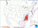
Back to the subject at hand... NAM definitely the outlier on timing, GFS and Euro are both agreeing on storms arriving earlier. Lots of questions, then, still on storm mode and timing. These cold season events can go sooo many different ways.
 

warneagle

Member
Messages
3,729
Reaction score
3,208
Location
Arlington, VA
Special Affiliations
  1. SKYWARN® Volunteer
I guess it'll be interesting to see where the other CAMs fall in terms of timing once we get into their range. The GFS has been pretty consistent on the timing and the VBV.
 

rolltide_130

Member
Messages
828
Reaction score
378
Location
Harvest, Alabama
Special Affiliations
I think models are overdoing things to be honest

Synoptically, it makes sense why they're doing what they're doing so my concern is definitely piqued.

Surface thermos aren't crazy, but it is ICE cold at 300mb with this being a very polar-jet driven system and this is gonna aid in vertical updraft stretching if any storms get going.

The uncertainty lies in whether or not any supercells can get going. If they can establish themselves, there will be problems. It's just a question of whether the forcing will be there.
 

Equus

Member
Messages
3,290
Reaction score
3,368
Location
Jasper, AL
Special Affiliations
  1. SKYWARN® Volunteer
Day 2 Enhanced for central portion of D3 Slight, for wind probs

day2otlk_0700asdf.gif

Starting to get within CAM range 48 hours out, though most still have the storms west of us at 00z Tuesday... 00z HRW WRF-NSSL has the most interesting look for us here in AL so far with a couple of discrete cells in the northernmost extent of the ~400 CAPE in central AL by Monday afternoon while the others keep everything to MS through 00z, wanting to take a line in here after dark. GFS still not buying shear/instability lining up correctly and the NAM is getting closer in timing to the GFS/Euro, buuuut also backs down on the parameters on the 00z run though still showing isolated tor probs. VBV a lot less obvious on the NAM but still see a little bit here by 03z Tuesday. Slight is probably a good call until day one this far east imo.
 
Last edited:

Equus

Member
Messages
3,290
Reaction score
3,368
Location
Jasper, AL
Special Affiliations
  1. SKYWARN® Volunteer
Now within RAP range wheeere it's painting a bit of a more volatile look than most of the other models have on recent runs but I honestly question the rather impressive tongue of instability (>1000 j/kg) it's showing tomorrow night
 

Richardjacks

Member
Meteorologist
Messages
1,155
Reaction score
1,308
Location
Atop Red Mountain Birmingham, Al
Now within RAP range wheeere it's painting a bit of a more volatile look than most of the other models have on recent runs but I honestly question the rather impressive tongue of instability (>1000 j/kg) it's showing tomorrow night
True...it is an outlier. I am suprised at the amount of sun we are seeing today.
 

Austin Dawg

Member
Sustaining Member
Messages
852
Reaction score
1,299
Location
Leander, Texas
Huge plume of moisture in South Central Texas this morning. Dewpoint 63 but everything is covered in moisture with fog. Didn't see any sun till almost noon.
 

Kory

Member
Messages
4,928
Reaction score
2,119
Location
Tuscaloosa, Alabama
A lot of the mesoscale models are indicating a very active afternoon into the evening starting over LA and moving into MS and AL as the afternoon and evening progresses. Lapse rates are going to be ridiculous so these storms will have deep updrafts.
 

Equus

Member
Messages
3,290
Reaction score
3,368
Location
Jasper, AL
Special Affiliations
  1. SKYWARN® Volunteer
Gonna be honest the CAMs and regionals today got me a lot more interested in the setup, I wasn't really confident in cellular development locally but now... WAA might be enough to offset marginal CAPE which honestly is looking more than just marginal. Could get a hatch on tor probs and I easily see at least a 10% coming for someone.
 

Richardjacks

Member
Meteorologist
Messages
1,155
Reaction score
1,308
Location
Atop Red Mountain Birmingham, Al
I do believe tornadoes are likely, anytime capes go over 500 plus helicity 300 =/+ this time of the year is concerning....Also, the cape is not as "skinny" on the soundings as we usually see in cold season events.
 

Equus

Member
Messages
3,290
Reaction score
3,368
Location
Jasper, AL
Special Affiliations
  1. SKYWARN® Volunteer
HRRRV4 says Armageddon for Louisiana, but we know the CAMs tend to do that a lot
 
Back
Top