• Welcome to TalkWeather!
    We see you lurking around TalkWeather! Take the extra step and join us today to view attachments, see less ads and maybe even join the discussion.
    CLICK TO JOIN TALKWEATHER
Logo 468x120

Severe WX April 3rd-5th, 2023 (South, Southeast, Ohio Valley)

Messages
1,071
Reaction score
1,313
Location
jackson tennessee
Special Affiliations
  1. SKYWARN® Volunteer
This event has me more worried than the one this friday.

With potentially widespread extreme instability and a accompanying faborable dynamic situation.

Although it does needs more agreement between models
Enough agreement to have a 7 day highlighted already … so there that euro and gfs both were dangerous setup
 

Timhsv

Member
Messages
427
Reaction score
764
Location
Meridianville, AL.
Special Affiliations
  1. SKYWARN® Volunteer
Just wow.....
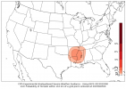
sbcape-prob0500.us_ov.png
 

andyhb

Member
Messages
1,094
Reaction score
3,010
Location
Norman, OK
Obvious slowing/amplifying trend on the 00z models in so far. Wonder if that might lead to capping problems if the trough remains too far west on Tuesday, although it could just make it a big Plains threat instead.
 

andyhb

Member
Messages
1,094
Reaction score
3,010
Location
Norman, OK
30% risk on the D6 issued.

spccoday6.severe.latest.png

AS THE WESTERN TROUGH EJECTS ON DAY 6/TUESDAY, POTENTIAL SIGNIFICANT
SEVERE THUNDERSTORMS WILL BE POSSIBLE FAR EASTERN OK TOWARD
SOUTHEAST MO AND VICINITY. RICH BOUNDARY-LAYER MOISTURE WILL BE IN
PLACE AMID STEEP MIDLEVEL LAPSE RATES COURTESY OF AN EML ADVECTING
ACROSS THE REGION FROM THE MEXICAN PLATEAU. THIS WILL SUPPLY PLENTY
OF INSTABILITY WITH STRONGER VERTICAL SHEAR ACCOMPANYING THE
EJECTING TROUGH. THERE IS SOME UNCERTAINTY AMONG MEDIUM RANGE
GUIDANCE ON THE NORTHERN EXTENT OF BETTER MOISTURE RETURN AND HENCE
SEVERE POTENTIAL. THIS IS MOSTLY DRIVEN BY DIFFERENCES IN SURFACE
LOW, DRYLINE AND WARM FRONT POSITIONS RELATED TO SOMEWHAT DIFFERENT
EJECTION OF THE UPPER TROUGH. HOWEVER, GUIDANCE IS IN VERY GOOD
AGREEMENT WITH RESPECT TO THE SOUTHERN PORTION OF THE RISK AREA.
SUPERCELLS CAPABLE OF ALL SEVERE HAZARDS, SOME POTENTIALLY
SIGNIFICANT, WILL BE POSSIBLE.
 

JBishopwx

Member
Sustaining Member
Messages
894
Reaction score
2,011
Location
Ackerman, MS
Special Affiliations
  1. SKYWARN® Volunteer
Messages
681
Reaction score
1,035
Location
Oakland, Tennessee
Still a decent spread between the GFS and Euro in terms of placement of the surface low but either way there are going to be some potent parameters in place. I pulled this from near Topeka and there are some uh, red flags in that analog box.

gfs_2023032918_150_38.0--95.75.png
How am I supposed to read those supercell analogs? Is it random number/month/day/year? Because if so it's showing an event on 8/9/2023 which uhhhhh sorry chief
 
Messages
2,851
Reaction score
4,625
Location
Madison, WI
How am I supposed to read those supercell analogs? Is it random number/month/day/year? Because if so it's showing an event on 8/9/2023 which uhhhhh sorry chief

Are you talking about the second-to-last in the list? That would be 8/9/1999 at 23Z, at ASOS site KMKT (Mankato, MN).

I wouldn't worry too much about a "weak" August analog for an April setup, lol.

So the top one is 5/5/03 at 00Z (7 PM CDT May 4, 2003) at KJBR (Jonesboro, AR). May 4, 2003 was a high risk day with quite a few long-track and deadly F3+ across SE KS/SW MO, and western TN.
 
Last edited:

warneagle

Member
Messages
3,797
Reaction score
3,399
Location
Arlington, VA
Special Affiliations
  1. SKYWARN® Volunteer
How am I supposed to read those supercell analogs? Is it random number/month/day/year? Because if so it's showing an event on 8/9/2023 which uhhhhh sorry chief
It's in YYMMDDTT format, where the TT is the hour in Zulu time (GMT), followed by the location. So, for example, the last SIG match in the supercell column, 66060900 TOP, means 0z on 9 June 1966 (7 pm on 8 June local time) at Topeka, which is about one hour before the Topeka F5 tornado occurred.
 

Richardjacks

Member
Meteorologist
Messages
1,161
Reaction score
1,331
Location
Atop Red Mountain Birmingham, Al
2023-4-Apr-00-Z.png

1974-4-Apr-00-Z.gif


Uhh...the 00Z EPS is basically a more-amplified, farther-northwest carbon copy of 3 Apr 1974, at least at H5...

This run would literally place the tornadoes over AR/MO/IA instead of AL/TN/KY/IN...
While the euro is pointing to those northern areas, i would be watching for a change...given the way the subtropical ridge has been flattening recently, climatology, plus the way the lower heights are still weighted toward the southwest, a southern trend could be coming.
 
Back
Top