• Welcome to TalkWeather!
    We see you lurking around TalkWeather! Take the extra step and join us today to view attachments, see less ads and maybe even join the discussion.
    CLICK TO JOIN TALKWEATHER

2025 Global Tropical Cyclone Season Discussion

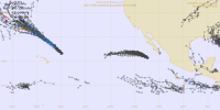
Tropical Cyclone 02S became Moderate Tropical Storm Awo just a few days ago. This was the first time since 1969, yes you read that right, 1969 that a storm formed in the SWIO and was named in the month of August too.

16W became Tropical Storm Podul and it seems to be improving it’s structure by night and getting it’s circulation exposed by day.
 
Last edited:
Henriette may become a hurricane north of Hawaii, and if it does it would be the first time since Ignacio 2015 (which has previously peaked as a Category 4, weakened to a TS and then went north of Hawaii and reintensifies to a Category 1)
 
Henriette may become a hurricane north of Hawaii, and if it does it would be the first time since Ignacio 2015 (which has previously peaked as a Category 4, weakened to a TS and then went north of Hawaii and reintensifies to a Category 1)
1754839885307.png
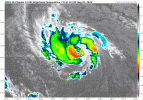
The NHC expects a 65 kt (75 mph) peak from this system, but the way it’s looking right now tell me it could get as high as 75-80 kts if it plays its cards right.
goes18_ir_08E_202508101225.gif
 
View attachment 45811
The NHC expects a 65 kt (75 mph) peak from this system, but the way it’s looking right now tell me it could get as high as 75-80 kts if it plays its cards right.
View attachment 45812
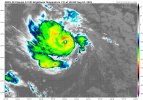
Henriette has done it! She’s become a hurricane! First time since Ignacio 2015 that a TC became a hurricane north of Hawaii
IMG_4528.jpeg
 
Henriette has done it! She’s become a hurricane! First time since Ignacio 2015 that a TC became a hurricane north of Hawaii
View attachment 45854
Here is a loop of what appears to be an eye clearing out in Henriette:

Edit: saved it as a loop, but for some reason it doesn’t appear in downloads.
 
Last edited:
Here is a loop of what appears to be an eye clearing out in Henriette:

Edit: saved it as a loop, but for some reason it doesn’t appear in downloads.
Let’s try again for a loop

(Downloads out right just aren’t working right now )
 
One thing I have noticed about the Eastern Pacific is that it loves its Category 4s.
 
Let's bring up the Western Pacific for a moment. Only one Category 3 major typhoon thus far this season.

There's 12 other years going back to 1960 where this has occurred prior to August 15th:
1977
1981
1985
1995
1998
2009
2010
2016
2017
2020
2022
2024
 
Let's bring up the Western Pacific for a moment. Only one Category 3 major typhoon thus far this season.

There's 12 other years going back to 1960 where this has occurred prior to August 15th:
1977
1981
1985
1995
1998
2009
2010
2016
2017
2020
2022
2024
It’s reminding me of the Eastern Pacific in 2013 (several hurricanes, but only one borderline Category 3 in Hurricane Raymond)
 
Let's bring up the Western Pacific for a moment. Only one Category 3 major typhoon thus far this season.

There's 12 other years going back to 1960 where this has occurred prior to August 15th:
1977
1981
1985
1995
1998
2009
2010
2016
2017
2020
2022
2024
2017 is on the list? That ain’t good.

Especially since 97L in the Atlantic is looking like it could try to pull an Irma-style track in the future if all goes right according to the models.
 
2017 is on the list? That ain’t good.

Especially since 97L in the Atlantic is looking like it could try to pull an Irma-style track in the future if all goes right according to the models.
A meteorologist friend of mine and I were talking about how the pattern coming up is similar to that of 2017 just a couple days ago.
 
A meteorologist friend of mine and I were talking about how the pattern coming up is similar to that of 2017 just a couple days ago.
Especially since 97L is starting to look like a TD over the CV islands, and Irma originated just west of the islands as a TD.

Irma’s invest portion track was very similar to the track 97L has been taking up to now as well
(hooking left around the CV islands after initially moving just north of due west before. After the hook, pre-Irma turned west again, but this time at a higher latitude)

This thing has my full attention right now.
 
A meteorologist friend of mine and I were talking about how the pattern coming up is similar to that of 2017 just a couple days ago.
You know another coincidence with pre-Irma? The NHC tracked a wave in front of it by several hundred miles that also failed to produce a TC.
 
You know another coincidence with pre-Irma? The NHC tracked a wave in front of it by several hundred miles that also failed to produce a TC.
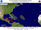
Here it is (was off by a few days but it is similar)
IMG_4579.png
The one in the MDR is the one

IMG_4211.png
Pre-Irma here
 
That's crazy. I wish they still had the NHC outlooks prior to 2010 available to look at.
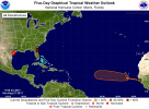
I am still trying to find them, so I feel you.
 
I am still trying to find them, so I feel you.
The NHC has the archive from June 2009 thru June 2014, but that's as far back as they go.
 
The NHC has the archive from June 2009 thru June 2014, but that's as far back as they go.
Ike is a year too early for the archive unfortunately.
 
Last edited:
what exactly are you trying to look for with a hurricane archive there are places like wikipedia if that can help hopefully its not a whole lot but at least maybe some info about say hurricane andrew for example and that was from 1992 who knows maybe people or someone posts about tropical systems from the past on x or social media but im not sure if its every single one maybe also youtube hopefully all that helps :)
 
Back
Top