WTPN31 PGTW 110300
MSGID/GENADMIN/JOINT TYPHOON WRNCEN PEARL HARBOR HI//
SUBJ/TROPICAL DEPRESSION 06W (SIX) WARNING NR 001//
REF/A/MSG/JOINT TYPHOON WRNCEN PEARL HARBOR HI/102021ZJUL2025//
AMPN/REF A IS A TROPICAL CYCLONE FORMATION ALERT.//
RMKS/
1. TROPICAL DEPRESSION 06W (SIX) WARNING NR 001
01 ACTIVE TROPICAL CYCLONE IN NORTHWESTPAC
MAX SUSTAINED WINDS BASED ON ONE-MINUTE AVERAGE
WIND RADII VALID OVER OPEN WATER ONLY
---
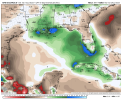
WARNING POSITION:
110000Z --- NEAR 25.0N 140.4E
MOVEMENT PAST SIX HOURS - 315 DEGREES AT 09 KTS
POSITION ACCURATE TO WITHIN 030 NM
POSITION BASED ON CENTER LOCATED BY SATELLITE
PRESENT WIND DISTRIBUTION:
MAX SUSTAINED WINDS - 030 KT, GUSTS 040 KT
WIND RADII VALID OVER OPEN WATER ONLY
REPEAT POSIT: 25.0N 140.4E
---
FORECASTS:
12 HRS, VALID AT:
111200Z --- 26.0N 140.5E
MAX SUSTAINED WINDS - 035 KT, GUSTS 045 KT
WIND RADII VALID OVER OPEN WATER ONLY
RADIUS OF 034 KT WINDS - 030 NM NORTHEAST QUADRANT
050 NM SOUTHEAST QUADRANT
030 NM SOUTHWEST QUADRANT
000 NM NORTHWEST QUADRANT
VECTOR TO 24 HR POSIT: 020 DEG/ 04 KTS
---
24 HRS, VALID AT:
120000Z --- 26.8N 140.8E
MAX SUSTAINED WINDS - 035 KT, GUSTS 045 KT
WIND RADII VALID OVER OPEN WATER ONLY
RADIUS OF 034 KT WINDS - 040 NM NORTHEAST QUADRANT
120 NM SOUTHEAST QUADRANT
050 NM SOUTHWEST QUADRANT
000 NM NORTHWEST QUADRANT
VECTOR TO 36 HR POSIT: 040 DEG/ 05 KTS
---
36 HRS, VALID AT:
121200Z --- 27.6N 141.5E
MAX SUSTAINED WINDS - 040 KT, GUSTS 050 KT
WIND RADII VALID OVER OPEN WATER ONLY
RADIUS OF 034 KT WINDS - 070 NM NORTHEAST QUADRANT
120 NM SOUTHEAST QUADRANT
060 NM SOUTHWEST QUADRANT
020 NM NORTHWEST QUADRANT
VECTOR TO 48 HR POSIT: 035 DEG/ 07 KTS
---
EXTENDED OUTLOOK:
48 HRS, VALID AT:
130000Z --- 28.8N 142.5E
MAX SUSTAINED WINDS - 045 KT, GUSTS 055 KT
WIND RADII VALID OVER OPEN WATER ONLY
RADIUS OF 034 KT WINDS - 100 NM NORTHEAST QUADRANT
150 NM SOUTHEAST QUADRANT
070 NM SOUTHWEST QUADRANT
040 NM NORTHWEST QUADRANT
VECTOR TO 72 HR POSIT: 005 DEG/ 13 KTS
---
72 HRS, VALID AT:
140000Z --- 33.8N 143.1E
MAX SUSTAINED WINDS - 045 KT, GUSTS 055 KT
WIND RADII VALID OVER OPEN WATER ONLY
BECOMING EXTRATROPICAL
RADIUS OF 034 KT WINDS - 170 NM NORTHEAST QUADRANT
200 NM SOUTHEAST QUADRANT
040 NM SOUTHWEST QUADRANT
040 NM NORTHWEST QUADRANT
VECTOR TO 96 HR POSIT: 020 DEG/ 29 KTS
---
LONG RANGE OUTLOOK:
---
96 HRS, VALID AT:
150000Z --- 44.7N 148.0E
MAX SUSTAINED WINDS - 045 KT, GUSTS 055 KT
WIND RADII VALID OVER OPEN WATER ONLY
EXTRATROPICAL
RADIUS OF 034 KT WINDS - 120 NM NORTHEAST QUADRANT
180 NM SOUTHEAST QUADRANT
090 NM SOUTHWEST QUADRANT
030 NM NORTHWEST QUADRANT
---
REMARKS:
110300Z POSITION NEAR 25.3N 140.4E.
11JUL25. TROPICAL DEPRESSION 06W (SIX), LOCATED APPROXIMATELY 50
NM WEST-NORTHWEST OF IWO TO, HAS TRACKED NORTHWESTWARD AT 09
KNOTS OVER THE PAST SIX HOURS.
MINIMUM CENTRAL PRESSURE AT 110000Z IS 1004 MB. MAXIMUM
SIGNIFICANT WAVE HEIGHT AT 110000Z IS 12 FEET.
NEXT WARNINGS AT 110900Z, 111500Z, 112100Z AND 120300Z.
2. THIS CANCELS AND SUPERSEDES REF A (WTPN21 PGTW 102030).//
NNNN