Here are interesting recent articles discussing the accuracy of AI models in tropical cyclones.
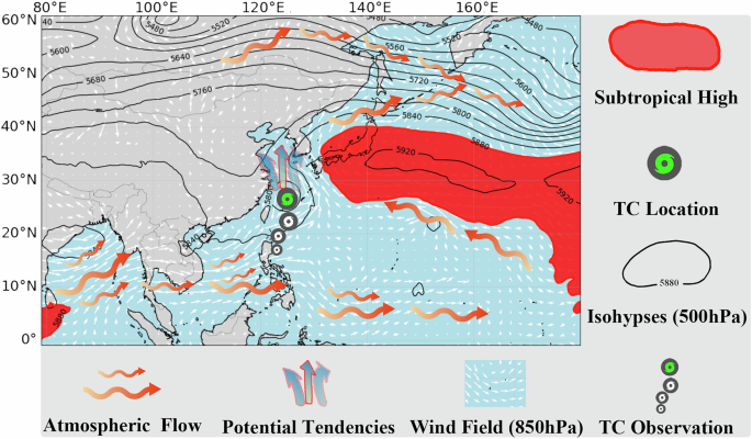
The authors present TropiCycloneNet, a framework that combines a multimodal tropical cyclone dataset spanning 70 years and a machine learning forecast model. The approach improves forecast skill of tropical cyclone track and intensity compared to other methods, advancing data-driven weather...

www.nature.com
It seems that the AI models are a significant improvement on track forecasting over the traditional NWP deterministic models. This is great, of course, but the "big unknown" and the "holy grail" of TC forecasting -- rapid intensification prediction -- still eludes us. At least for now. The AI models so far have seen to significantly *under forecast* TC intensity and are much less accurate at intensity forecasting than NWP deterministic models so far. This makes sense, structurally, as the AI models (deep learning neural networks) have a very hard time extrapolating beyond the observed patterns in their datasets. RI might represent 3%-7% of actual TC activity, so that rarity makes it difficult to explicitly forecast in the statistical AI modeling that occurs. I think the push over the next few years will be to incorporate rare-event modeling into them to try and capture these rare events, but it's a very difficult problem to accurately fix from a statistical standpoint. It might well be that advances in NWP deterministic models and tools like SHIPS advancing in the future becomes the "intensity" forecast component while AI modeling focuses on the track. In any case, it'll be an interesting next few. years as we meld together traditional and new approaches in the field.