Good morning Johnny. Thanks for posting. I'll add the 8am TWOAT in text form in case there are any issues with the attachments.
000
ABNT20 KNHC 011145
TWOAT
Tropical Weather Outlook
NWS National Hurricane Center Miami FL
800 AM EDT Thu Jun 1 2023
For the North Atlantic...Caribbean Sea and the Gulf of Mexico:
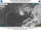
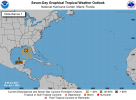
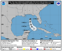
Northeastern Gulf of Mexico (AL91):
Showers and thunderstorms associated with an area of low pressure over the northeastern Gulf of Mexico have increased and become better organized during the overnight hours. Environmental conditions appear marginally favorable for additional development over the next day or so, and a short-lived tropical depression or storm could form over that time span as the system meanders over the northeastern Gulf of Mexico. However, by this weekend environmental conditions are forecast to become unfavorable for additional development as the system drifts southward, likely remaining offshore over the Gulf of Mexico. An Air Force Reserve Hurricane Hunter aircraft is scheduled to investigate the system later today, if necessary.
Regardless of development, locally heavy rainfall could occur over portions of the Florida Peninsula through this weekend. Additional information on the rainfall and flooding potential can be found in products issued by your local National Weather Service forecast office and Excessive Rainfall Outlooks issued by the Weather Prediction Center.
* Formation chance through 48 hours...medium...50 percent.
* Formation chance through 7 days...medium...50 percent.
Today marks the first day of the Atlantic hurricane season, which will run until November 30. The long-term averages for the number of named storms, hurricanes, and major hurricanes are 14, 7, and 3, respectively.
The list of names for 2023 is as follows:
Name Pronunciation
--------------------------
Arlene ar-LEEN
Bret bret
Cindy SIN-dee
Don dahn
Emily EH-mih-lee
Franklin FRANK-lin
Gert ger
[should this be "gert" or is it French? Followup w/NOAA?]
Harold HAIR-uld
Idalia ee-DAL-ya
Jose ho-Zay
Katia KAH-tya
Lee lee
Margot MAR-go
Nigel NY-juhl
Ophelia o-FEEL-ya
Philippe fee-LEEP
Sean shawn
Tammy TAM-ee
Vince vinss
Whitney WHIT-nee
This product, the Tropical Weather Outlook, briefly describes significant areas of disturbed weather and their potential for tropical cyclone formation during the next seven days. The issuance times of this product are 2 AM, 8 AM, 2 PM, and 8 PM EDT. After the change to standard time in November, the issuance times are 1 AM, 7 AM, 1 PM, and 7 PM EST.
A Special Tropical Weather Outlook will be issued to provide updates, as necessary, in between the regularly scheduled issuances of the Tropical Weather Outlook. Special Tropical Weather Outlooks will be issued under the same WMO and AWIPS headers as the regular Tropical Weather Outlooks.
A standard package of products, consisting of the tropical cyclone public advisory, the forecast/advisory, the cyclone discussion, and a wind speed probability product, is issued every six hours for all ongoing tropical cyclones. In addition, a special advisory package may be issued at any time to advise of significant unexpected changes or to modify watches or warnings.
NHC has the option to issue advisories, watches, and warnings for disturbances that are not yet a tropical cyclone, but which pose the threat of bringing tropical storm or hurricane conditions to land areas within 48 hours. For these land-threatening "potential tropical cyclones", NHC will issue the full suite of advisory and watch/warning products. Potential tropical cyclones share the naming conventions currently in place for tropical depressions, being numbered from a single list (e.g., "One", "Two", "Three", etc.).
The Tropical Cyclone Update is a brief statement to inform of significant changes in a tropical cyclone, to post or cancel watches or warnings, or to provide hourly position updates between intermediate advisories when the storm center is easily followed by radar. It is used in lieu of or to precede the issuance of a special advisory package. Tropical Cyclone Updates, which can be issued at any time, can be found under WMO header WTNT61-65 KNHC, and under AWIPS header MIATCUAT1-5.
All NHC text and graphical products are available on the web at
www.hurricanes.gov. More information on NHC text and graphical products can be found at
www.nhc.noaa.gov/pdf/NHC_Product_Description.pdf. New and updated products for the 2023 season can be found at
www.nhc.noaa.gov/pdf/NHC_New_Products_Updates_2023.pdf.
You can also interact with NHC on Facebook at
https://www.facebook.com/NWSNHC. Notifications are available via Twitter when select National Hurricane Center products are issued. Information about our Atlantic Twitter feed (@NHC_Atlantic) is available at
www.hurricanes.gov/twitter.php.
$$
Forecaster Papin/Cangialosi/Brown