• Welcome to TalkWeather!
    We see you lurking around TalkWeather! Take the extra step and join us today to view attachments, see less ads and maybe even join the discussion.
    CLICK TO JOIN TALKWEATHER

Severe Weather 2026

The f#ck?
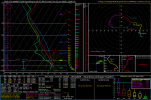
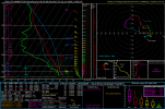
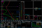
Helicity values of 700+ with 6000+SB cape? I can’t recall/remember ever seeing that on a modeled sounding.
View attachment 53883
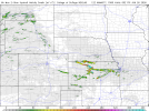
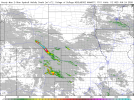
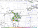
I'm skeptical based purely on how small the area is. It seems quite conditional based on that alone. However, I definitely don't think i've ever seen UD helicity swaths quite like these. Looks like ground scraping mesos with 10-mile-wide embedded wedges lmao. Sounding 1 is from directly in front of the N KS blue, 2 is in front of the central KS blue. interestingly, Stormnet has the tornado risk much further SE than these tracks (more into Oklahoma). Also worth mentioning the track screenshot is from the last frame of the most recent NAM run so who knows how it progresses in the hours after that. These shear vectors are wild.

1782230084373.png

1782229942352.png1782229983861.png
 
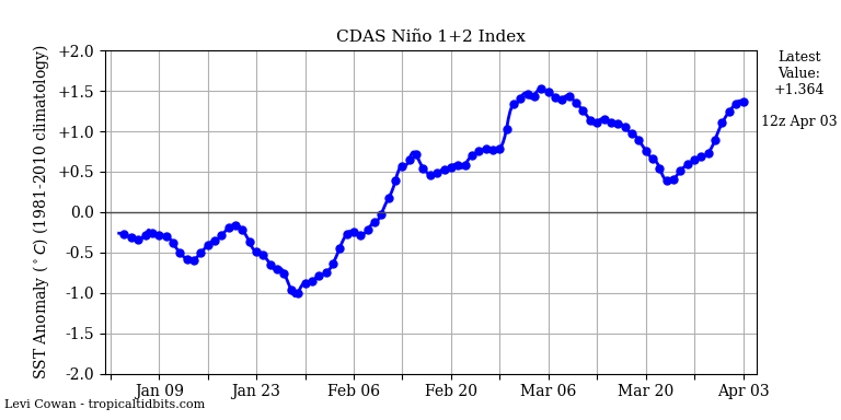
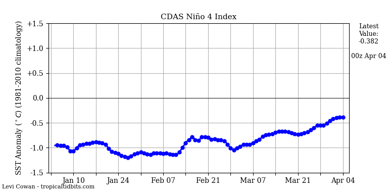
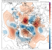
TNI values (Nino 1+2 minus Nino 4) have also gone up by .7 to 1.67, which is very high. Remember, that anything over 1 is positively correlated to tornado outbreaks. Looking at the GFS for the Northern hemisphere reveals a ridiculously chaotic pattern above the polar vortex, and all sorts of Rossby wave mayhem. I'm a firm believer in the Kara Sea Ridge theories now. Basically, it looks like rapidly melting arctic ice is going to keep things extremely active for the foreseeable future.

nino12.png
nino4.png


1782231304884.png
 
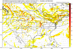
RRFS A, FV3, and MPAS are all not showing anything even remotely similar to what the NAM 3km is. Not even the regular NAM agrees with it, but it does show a decent environment further East. I'm chalking this up as a fluke run until there's more supporting evidence.
 
RRFS A, FV3, and MPAS are all not showing anything even remotely similar to what the NAM 3km is. Not even the regular NAM agrees with it, but it does show a decent environment further East. I'm chalking this up as a fluke run until there's more supporting evidence.
Erm, not exactly.
There’s substantial disagreement because the trough responsible is extremely low amplitude, diffuse, and honestly barely a trough at all.
1782234505798.png
This leads to massive uncertainty on where the surface low will be from the height falls caused by this trough.
A rule of thumb (and is why I put more stock in the 3kmNam for this specific instance) is that surface lows tend to develop at the triple point junction of their boundaries.
The warm front will be in northern central Ks, so where that front connects to the dryline is where the surface low likely will develop. This will put the bulk of the activity in central KS/northern OK; “coincidentally” where storm net has the highest probs.
 
Btw, hope you're not stalking me or anything. Keeping track of when I post sounds a little creepy.
DM’s…..

Anyways… The fact that there’s still this much disagreement on Friday despite being only Tuesday probably says more about predictability than it does about the actual threat level. If the wave is as diffuse as it appears, it wouldn’t take much for the surface low and associated boundaries to shift considerably over the next few cycles. I’d be more interested in where the ensemble clustering starts converging than in any individual CAM solution right now.
 
give this sounding 7.2+ 0-3 km LR make it be in a large enough area and make it at least last 1+ hour. then i would say a super outbreak would be made out of this.
A super outbreak doesn't happen simply by just giving it lapse rates and a large, spatial area, 4/27/11 had boundaries and all sorts of etc. It's just not that easy like that to define a super outbreak environment.
 
A late June svr weather sequence appears likely. But what do we KNOW currently about these days?

Thursday

MI/OH: Sneaky mini supercells may be able to produce a brief tornado threat given enough low level curvature and SRH.

OK/KS: morning convection will leave huge questions with this one. Potential and uncertainty over subsidence in general, but the potential for svr hazards is on the table. Most likely corridor is S KS/N OK progressing eastward from there.

FRIDAY

IL/IN: heavy questions and heavy disagreements. This day can't be for certain as sporadic morning convection and mesoscale features may mess things up or enhance it. Models aren't handling the progression well but StormNet is adamant some sort of notable tornado threat may exist with this one.

SATURDAY

SE ND/E NE/W IA

Both corridors should feature a tornad threat. Down south is more conditional given CINH and forcing in NE/IA but strong support from StormNet on this area increases my confidence for a mention here.

SE ND could favor a isolated corridor for a all hazards event

Saturday doesn't appear to be particularly potent at this time.

Monday

MN/WI

Forcing is the question but StormNet also supporting a strong signal for this day so we must see the progression of this late period. Not much else to say as models do have disagreement on this period.
 
A late June svr weather sequence appears likely. But what do we KNOW currently about these days?

Thursday

MI/OH: Sneaky mini supercells may be able to produce a brief tornado threat given enough low level curvature and SRH.

OK/KS: morning convection will leave huge questions with this one. Potential and uncertainty over subsidence in general, but the potential for svr hazards is on the table. Most likely corridor is S KS/N OK progressing eastward from there.

FRIDAY

IL/IN: heavy questions and heavy disagreements. This day can't be for certain as sporadic morning convection and mesoscale features may mess things up or enhance it. Models aren't handling the progression well but StormNet is adamant some sort of notable tornado threat may exist with this one.

SATURDAY

SE ND/E NE/W IA

Both corridors should feature a tornad threat. Down south is more conditional given CINH and forcing in NE/IA but strong support from StormNet on this area increases my confidence for a mention here.

SE ND could favor a isolated corridor for a all hazards event

Saturday doesn't appear to be particularly potent at this time.

Monday

MN/WI

Forcing is the question but StormNet also supporting a strong signal for this day so we must see the progression of this late period. Not much else to say as models do have disagreement on this period.
Thank you! I have a feeling something big is coming before July.
 
A late June svr weather sequence appears likely. But what do we KNOW currently about these days?

Thursday

MI/OH: Sneaky mini supercells may be able to produce a brief tornado threat given enough low level curvature and SRH.

OK/KS: morning convection will leave huge questions with this one. Potential and uncertainty over subsidence in general, but the potential for svr hazards is on the table. Most likely corridor is S KS/N OK progressing eastward from there.

FRIDAY

IL/IN: heavy questions and heavy disagreements. This day can't be for certain as sporadic morning convection and mesoscale features may mess things up or enhance it. Models aren't handling the progression well but StormNet is adamant some sort of notable tornado threat may exist with this one.

SATURDAY

SE ND/E NE/W IA

Both corridors should feature a tornad threat. Down south is more conditional given CINH and forcing in NE/IA but strong support from StormNet on this area increases my confidence for a mention here.

SE ND could favor a isolated corridor for a all hazards event

Saturday doesn't appear to be particularly potent at this time.

Monday

MN/WI

Forcing is the question but StormNet also supporting a strong signal for this day so we must see the progression of this late period. Not much else to say as models do have disagreement on this period.

18Z Euro does look slightly better for Sunday than GFS. Suggests SD would be a viable target as opposed to far NW MN/NE ND. However still has the LLJ displaced off to the east of the exit region of the 500mb trough. However Monday looks decent on the 12Z in SE MN/NE IA with solid hodographs and not-unbreakable capping.

I took Monday off initially to chase Sunday when it looked better. However now I might end up chasing Monday, driving home and working Tuesday on no sleep.
 
Day 2:

NORTHERN OKLAHOMA/SOUTHERN KANSAS INTO THE OZARKS


A MORNING MCS IS EXPECTED TO MOVE ALONG/NORTH OF A FRONTAL ZONE
ACROSS KANSAS DURING THE MORNING ON THURSDAY. IN THE WAKE OF THIS
MORNING MCS, STRONG DESTABILIZATION IS FORECAST WITH MODERATE
MID-LEVEL FLOW ALOFT. THEREFORE, SUPERCELLS ARE EXPECTED TO DEVELOP
ON THE REMNANT OUTFLOW/FRONTAL ZONE THURSDAY AFTERNOON AND EVENING
FROM SOUTHERN KANSAS AND NORTHERN OKLAHOMA POTENTIALLY INTO THE
OZARKS. GIVEN STORM MOTION THAT SHOULD BE PARALLEL TO THE BOUNDARY,
THE ENHANCED VORTICITY ALONG THIS ZONE COULD RESULT IN A LOCALLY
GREATER TORNADO THREAT. IN ADDITION, MOST GUIDANCE SHOWS A
STRENGTHENING LOW-LEVEL JET ACROSS OKLAHOMA AND INTO SOUTHERN
KANSAS. THIS MAY SUPPORT A STRONG TORNADO THREAT, PARTICULARLY
DURING THE EVENING.
 
Last edited:
I think we need to watch this evening in southern Wisconsin for a sneaky 2% event. Trends would suggests the ongoing clouds/rain clear out by midday, and the HRRR has scattered cells this evening amidst an area of high 0-3KM MLCAPE and steep lapse rates. The only thing preventing higher confidence IMO is fairly weak low-level SRH (straight-line hodographs), but that 3CAPE could help compensate.

hrrr_2026062412_011_43.06--89.40.png
 
I think we need to watch this evening in southern Wisconsin for a sneaky 2% event. Trends would suggests the ongoing clouds/rain clear out by midday, and the HRRR has scattered cells this evening amidst an area of high 0-3KM MLCAPE and steep lapse rates. The only thing preventing higher confidence IMO is fairly weak low-level SRH (straight-line hodographs), but that 3CAPE could help compensate.

View attachment 53903
Extended my thread for the enhanced today so that’ll do too :) thanks
 
Saturday looks like the first day I've seen that has no morning convection at all. But we could see that change. The warm sector has a stout EML and areas of NE/IA an SD will need to watch out. StormNet thinking robust probs for NE/IA too. Strong LLJ response could make for long lived supercells with all hazards risk in both sectors.
 
I think we need to watch this evening in southern Wisconsin for a sneaky 2% event. Trends would suggests the ongoing clouds/rain clear out by midday, and the HRRR has scattered cells this evening amidst an area of high 0-3KM MLCAPE and steep lapse rates. The only thing preventing higher confidence IMO is fairly weak low-level SRH (straight-line hodographs), but that 3CAPE could help compensate.

View attachment 53903
That dry slot and warm nose aloft at 500mb always seems to be a common feature in these setups. Sometimes they don't work and other times they do. Will have to see.
 
Back
Top