A late June svr weather sequence appears likely. But what do we KNOW currently about these days?
Thursday
MI/OH: Sneaky mini supercells may be able to produce a brief tornado threat given enough low level curvature and SRH.
OK/KS: morning convection will leave huge questions with this one. Potential and uncertainty over subsidence in general, but the potential for svr hazards is on the table. Most likely corridor is S KS/N OK progressing eastward from there.
FRIDAY
IL/IN: heavy questions and heavy disagreements. This day can't be for certain as sporadic morning convection and mesoscale features may mess things up or enhance it. Models aren't handling the progression well but StormNet is adamant some sort of notable tornado threat may exist with this one.
SATURDAY
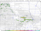
SE ND/E NE/W IA
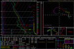
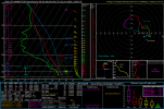
Both corridors should feature a tornad threat. Down south is more conditional given CINH and forcing in NE/IA but strong support from StormNet on this area increases my confidence for a mention here.
SE ND could favor a isolated corridor for a all hazards event
Saturday doesn't appear to be particularly potent at this time.
Monday
MN/WI
Forcing is the question but StormNet also supporting a strong signal for this day so we must see the progression of this late period. Not much else to say as models do have disagreement on this period.








 thanks