warneagle
Member
Yeah, I was kidding. Gotta have some fun since we're stuck in this incredibly boring pattern right now.Yea, I don't think one tornado in one place is any kind of "pattern" to go off.
Follow along with the video below to see how to install our site as a web app on your home screen.

Note: this_feature_currently_requires_accessing_site_using_safari
Yeah, I was kidding. Gotta have some fun since we're stuck in this incredibly boring pattern right now.Yea, I don't think one tornado in one place is any kind of "pattern" to go off.
Euro/UKMET would probably be a marginal severe weather event. Another high shear/low cape kind of event Saturday into Saturday night. But yes, we'll probably go from mid 60s Saturday during the day to near or below freezing for most of Sunday across Dixie.Brad Travis mentioning may need to watch next Saturday in North Alabama. Huge temp swing from near 70 to near freezing for highs in 24hrs. What are the models showing?
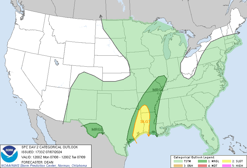
Fairly sizable slight risk with 5% TOR (although I'd be kind of surprised if any serious tornado activity takes place that far north).
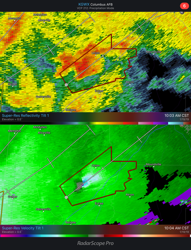
Warning now for Greene County with that storm. Tornado watch probably needs to be extended further north.Tornado warning for Sumter County, AL. That storm has some decent rotation with it. It's riding I-20/59 NE. May need to keep an eye on it here in Tuscaloosa.
Troublesome pattern potentially downstream 7-10 days out. Euro may be signaling a potentially active severe period.