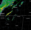
• Welcome to TalkWeather!
    We see you lurking around TalkWeather! Take the extra step and join us today to view attachments, see less ads and maybe even join the discussion.
    CLICK TO JOIN TALKWEATHER
  • April 2024 Weather Video of the Month
    Post your nominations now!

Severe WX Severe Weather Threat - February 15-16, 2023

atrainguy

Member
Messages
865
Reaction score
1,211
Location
Linden, MI
I apologize if I've somehow missed this somewhere, but if this event verifies, roughly what time can we expect things to fire off?
 

UK_EF4

Member
Messages
570
Reaction score
1,315
Location
NW London
In my opinion any supercells further north (N MS & AL, S TM) will have the potential to produce EF2-3 tornadoes, further south I think weak tornadoes are more likely (maybe a low end EF2) - yet if the southern mode grows upscale then in a sense the northern mode is 'cut-off' (we saw something similar in 25/3/2021 event) and northern mode may not even exist. This is mainly based of HRRR. I am eager to see hodographs on observed soundings because a couple CAMS are showing stornger shear than the HRRR which would obviously worsen the event.
 

UncleJuJu98

Member
100,000th Post
Messages
3,928
Reaction score
5,102
Location
Birmingham
I'd imagine some of the lower shear today if there is that. may be offset by high low level lapse rates if we can get those. With the sun being out I'd say it's a good possibility. Don't need a whole lot of shear to get tornadoes.
 

JayF

Technical Administrator
Staff member
Administrator
Moderator
Sustaining Member
Technical Admin
Messages
1,626
Reaction score
883
Location
Hartselle, al
HAM Callsign
KB4JCS
You all may notice that images, when attached, are being edited to be smaller. I know we haven't been really enforcing it, but please, if you include a picture, do not make it full-size in the post. You can attach files and if you do not click the insert button the image will be there but it will not take up the entire screen. If people are interested in the image they can click on it to enlarge it. See the attachment of the incoming weather for today.
 

Attachments

  • Screen Shot 2023-02-16 at 10.10.58 AM.png
    Screen Shot 2023-02-16 at 10.10.58 AM.png
    122.5 KB · Views: 0
F

Former Member 1430

Guest
I completely
In my opinion any supercells further north (N MS & AL, S TM) will have the potential to produce EF2-3 tornadoes, further south I think weak tornadoes are more likely (maybe a low end EF2) - yet if the southern mode grows upscale then in a sense the northern mode is 'cut-off' (we saw something similar in 25/3/2021 event) and northern mode may not even exist. This is mainly based of HRRR. I am eager to see hodographs on observed soundings because a couple CAMS are showing stornger shear than the HRRR which would obviously worsen the event.
I completely agree with your assessment. I will be curious to see which way this event goes
 

Gail

Member
Messages
406
Reaction score
591
Location
Caledonia, MS
You all may notice that images, when attached, are being edited to be smaller. I know we haven't been really enforcing it, but please, if you include a picture, do not make it full-size in the post. You can attach files and if you do not click the insert button the image will be there but it will not take up the entire screen. If people are interested in the image they can click on it to enlarge it. See the attachment of the incoming weather for today.
I’m sorry! I’m on my phone so everything looks small already. I’ll try to be more careful in the future.
 
Logo 468x120
Back
Top